Séris
Séris is a commune in the Loir-et-Cher department in central France.
Séris | |
|---|---|
Commune | |
Location of Séris 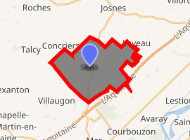
| |
 Séris  Séris | |
| Coordinates: 47°45′28″N 1°30′10″E | |
| Country | France |
| Region | Centre-Val de Loire |
| Department | Loir-et-Cher |
| Arrondissement | Blois |
| Canton | La Beauce |
| Intercommunality | Beauce et Forêt |
| Government | |
| • Mayor (2014–2020) | Jean-Yves Peschard |
| Area 1 | 17.52 km2 (6.76 sq mi) |
| Population (2017-01-01)[1] | 376 |
| • Density | 21/km2 (56/sq mi) |
| Time zone | UTC+01:00 (CET) |
| • Summer (DST) | UTC+02:00 (CEST) |
| INSEE/Postal code | 41245 /41500 |
| Elevation | 103–119 m (338–390 ft) (avg. 120 m or 390 ft) |
| 1 French Land Register data, which excludes lakes, ponds, glaciers > 1 km2 (0.386 sq mi or 247 acres) and river estuaries. | |
Population
| Year | Pop. | ±% |
|---|---|---|
| 1793 | 826 | — |
| 1806 | 791 | −4.2% |
| 1821 | 721 | −8.8% |
| 1831 | 742 | +2.9% |
| 1841 | 738 | −0.5% |
| 1851 | 774 | +4.9% |
| 1861 | 741 | −4.3% |
| 1872 | 738 | −0.4% |
| 1881 | 741 | +0.4% |
| 1891 | 677 | −8.6% |
| 1901 | 566 | −16.4% |
| 1911 | 532 | −6.0% |
| 1921 | 469 | −11.8% |
| 1931 | 445 | −5.1% |
| 1946 | 396 | −11.0% |
| 1954 | 374 | −5.6% |
| 1962 | 406 | +8.6% |
| 1968 | 366 | −9.9% |
| 1975 | 297 | −18.9% |
| 1982 | 255 | −14.1% |
| 1990 | 265 | +3.9% |
| 1999 | 287 | +8.3% |
| 2009 | 371 | +29.3% |
| 2015 | 375 | +1.1% |
gollark: <@341618941317349376> What 2253 hours?
gollark: > mining manually
gollark: https://wiki.archlinux.org/index.php/Backlight#Backlight_utilities
gollark: ArchWiki has a page of brightness control programs.
gollark: Ah yes, you are correct.
See also
| Wikimedia Commons has media related to Séris. |
- "Populations légales 2017". INSEE. Retrieved 6 January 2020.
This article is issued from Wikipedia. The text is licensed under Creative Commons - Attribution - Sharealike. Additional terms may apply for the media files.