La Ferté-Saint-Cyr
La Ferté-Saint-Cyr is a commune in the Loir-et-Cher department of central France.
La Ferté-Saint-Cyr | |
|---|---|
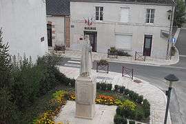 Statue and town hall | |
Location of La Ferté-Saint-Cyr 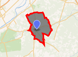
| |
 La Ferté-Saint-Cyr  La Ferté-Saint-Cyr | |
| Coordinates: 47°39′24″N 1°40′30″E | |
| Country | France |
| Region | Centre-Val de Loire |
| Department | Loir-et-Cher |
| Arrondissement | Blois |
| Canton | Chambord |
| Intercommunality | Pays de Chambord |
| Government | |
| • Mayor (20143–2020) | Jean-Paul Prince |
| Area 1 | 57.93 km2 (22.37 sq mi) |
| Population (2017-01-01)[1] | 1,056 |
| • Density | 18/km2 (47/sq mi) |
| Time zone | UTC+01:00 (CET) |
| • Summer (DST) | UTC+02:00 (CEST) |
| INSEE/Postal code | 41085 /41220 |
| Elevation | 78–131 m (256–430 ft) (avg. 86 m or 282 ft) |
| 1 French Land Register data, which excludes lakes, ponds, glaciers > 1 km2 (0.386 sq mi or 247 acres) and river estuaries. | |
Geography
The commune is traversed by the Cosson river.
Population
| Year | Pop. | ±% |
|---|---|---|
| 1793 | 209 | — |
| 1806 | 244 | +16.7% |
| 1821 | 869 | +256.1% |
| 1831 | 888 | +2.2% |
| 1841 | 880 | −0.9% |
| 1851 | 990 | +12.5% |
| 1861 | 1,086 | +9.7% |
| 1872 | 1,165 | +7.3% |
| 1881 | 1,033 | −11.3% |
| 1891 | 1,066 | +3.2% |
| 1901 | 1,039 | −2.5% |
| 1911 | 1,092 | +5.1% |
| 1921 | 921 | −15.7% |
| 1931 | 806 | −12.5% |
| 1946 | 860 | +6.7% |
| 1954 | 720 | −16.3% |
| 1962 | 707 | −1.8% |
| 1968 | 737 | +4.2% |
| 1975 | 745 | +1.1% |
| 1982 | 774 | +3.9% |
| 1990 | 809 | +4.5% |
| 1999 | 894 | +10.5% |
| 2008 | 975 | +9.1% |
| 2013 | 1,053 | +8.0% |
gollark: Muahahaha. I have HELPED write a WEBAPP in NODE DOT JS to ANNOY THE HASKELLERS.
gollark: Oh, cool.
gollark: <@!341618941317349376> <@!341618941317349376> <@!341618941317349376> <@!341618941317349376> <@!341618941317349376> <@!341618941317349376> NAP specification‽
gollark: Arbitrary ones.
gollark: For arbitrary reasons.
References
- "Populations légales 2017". INSEE. Retrieved 6 January 2020.
| Wikimedia Commons has media related to La Ferté-Saint-Cyr. |
| Authority control |
|
|---|
This article is issued from Wikipedia. The text is licensed under Creative Commons - Attribution - Sharealike. Additional terms may apply for the media files.