Angé
Angé is a commune in the Loir-et-Cher department in central France.
Angé | |
|---|---|
.jpg) | |
Location of Angé 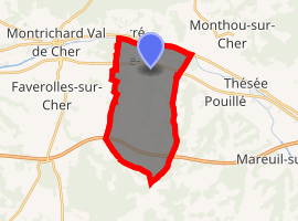
| |
 Angé  Angé | |
| Coordinates: 47°19′55″N 1°14′38″E | |
| Country | France |
| Region | Centre-Val de Loire |
| Department | Loir-et-Cher |
| Arrondissement | Romorantin-Lanthenay |
| Canton | Saint-Aignan |
| Intercommunality | Val de Cher - Controis |
| Government | |
| • Mayor (2014-2020) | Jacky Desforges |
| Area 1 | 17.36 km2 (6.70 sq mi) |
| Population (2017-01-01)[1] | 882 |
| • Density | 51/km2 (130/sq mi) |
| Time zone | UTC+01:00 (CET) |
| • Summer (DST) | UTC+02:00 (CEST) |
| INSEE/Postal code | 41002 /41400 |
| Elevation | 59–172 m (194–564 ft) (avg. 68 m or 223 ft) |
| 1 French Land Register data, which excludes lakes, ponds, glaciers > 1 km2 (0.386 sq mi or 247 acres) and river estuaries. | |
Population
| Year | Pop. | ±% |
|---|---|---|
| 1793 | 539 | — |
| 1800 | 616 | +14.3% |
| 1806 | 604 | −1.9% |
| 1821 | 668 | +10.6% |
| 1831 | 650 | −2.7% |
| 1836 | 662 | +1.8% |
| 1841 | 656 | −0.9% |
| 1846 | 705 | +7.5% |
| 1851 | 725 | +2.8% |
| 1856 | 737 | +1.7% |
| 1861 | 755 | +2.4% |
| 1866 | 807 | +6.9% |
| 1872 | 780 | −3.3% |
| 1876 | 851 | +9.1% |
| 1881 | 865 | +1.6% |
| 1886 | 914 | +5.7% |
| 1891 | 839 | −8.2% |
| 1896 | 853 | +1.7% |
| 1901 | 831 | −2.6% |
| 1906 | 762 | −8.3% |
| 1911 | 722 | −5.2% |
| 1921 | 674 | −6.6% |
| 1926 | 696 | +3.3% |
| 1931 | 653 | −6.2% |
| 1936 | 653 | +0.0% |
| 1946 | 645 | −1.2% |
| 1954 | 608 | −5.7% |
| 1962 | 615 | +1.2% |
| 1968 | 638 | +3.7% |
| 1975 | 646 | +1.3% |
| 1982 | 664 | +2.8% |
| 1990 | 751 | +13.1% |
| 1999 | 793 | +5.6% |
| 2006 | 761 | −4.0% |
| 2009 | 818 | +7.5% |
gollark: You might have to do things like, I don't even know, gradient descent.
gollark: Just assume the nonlinear things are linear. Nobody will notice.
gollark: Poorly!
gollark: Just write your macronutrient requirements down as linear inequalities and use linear programming to minimize total cost? Trivial.
gollark: GTech™ Communistic Site-282 works perfectly. I don't see what there is to be worried about.
References
- "Populations légales 2017". INSEE. Retrieved 6 January 2020.
| Wikimedia Commons has media related to Angé. |
| Authority control |
|
|---|
This article is issued from Wikipedia. The text is licensed under Creative Commons - Attribution - Sharealike. Additional terms may apply for the media files.