La Chapelle-Enchérie
La Chapelle-Enchérie is a commune in the Loir-et-Cher department in central France.
La Chapelle-Enchérie | |
|---|---|
 Coat of arms | |
Location of La Chapelle-Enchérie 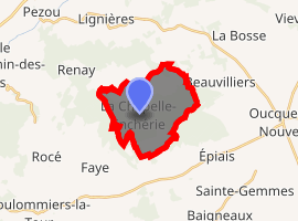
| |
 La Chapelle-Enchérie  La Chapelle-Enchérie | |
| Coordinates: 47°49′31″N 1°12′18″E | |
| Country | France |
| Region | Centre-Val de Loire |
| Department | Loir-et-Cher |
| Arrondissement | Vendôme |
| Canton | Le Perche |
| Intercommunality | Haut Vendômois |
| Government | |
| • Mayor (2014–2020) | Christiane Larue |
| Area 1 | 10.76 km2 (4.15 sq mi) |
| Population (2017-01-01)[1] | 211 |
| • Density | 20/km2 (51/sq mi) |
| Time zone | UTC+01:00 (CET) |
| • Summer (DST) | UTC+02:00 (CEST) |
| INSEE/Postal code | 41037 /41290 |
| Elevation | 98–144 m (322–472 ft) (avg. 120 m or 390 ft) |
| 1 French Land Register data, which excludes lakes, ponds, glaciers > 1 km2 (0.386 sq mi or 247 acres) and river estuaries. | |
Population
| Year | Pop. | ±% |
|---|---|---|
| 1793 | 242 | — |
| 1806 | 309 | +27.7% |
| 1821 | 270 | −12.6% |
| 1831 | 294 | +8.9% |
| 1841 | 362 | +23.1% |
| 1851 | 460 | +27.1% |
| 1861 | 441 | −4.1% |
| 1872 | 410 | −7.0% |
| 1881 | 419 | +2.2% |
| 1891 | 455 | +8.6% |
| 1901 | 414 | −9.0% |
| 1911 | 348 | −15.9% |
| 1921 | 351 | +0.9% |
| 1931 | 256 | −27.1% |
| 1946 | 259 | +1.2% |
| 1954 | 223 | −13.9% |
| 1962 | 213 | −4.5% |
| 1968 | 167 | −21.6% |
| 1975 | 139 | −16.8% |
| 1982 | 129 | −7.2% |
| 1990 | 134 | +3.9% |
| 1999 | 146 | +9.0% |
| 2008 | 165 | +13.0% |
| 2013 | 197 | +19.4% |
gollark: Also how they have their own assembly language which is like AMD64 but slightly different, uses ALL CAPS to "emphasise that assembly is dangerous" or something, and uses ·s in symbol names for horrible reasons.
gollark: Peak golang: https://www.reddit.com/r/rust/comments/5penft/parallelizing_enjarify_in_go_and_rust/dcsgk7n/
gollark: Oh BEE, not me.
gollark: <@!160279332454006795> Utterly compute log_9(243).
gollark: As planned.
References
- "Populations légales 2017". INSEE. Retrieved 6 January 2020.
| Wikimedia Commons has media related to La Chapelle-Enchérie. |
| Authority control |
|
|---|
This article is issued from Wikipedia. The text is licensed under Creative Commons - Attribution - Sharealike. Additional terms may apply for the media files.