Montrouveau
Montrouveau is a commune in the Loir-et-Cher department of central France.
Montrouveau | |
|---|---|
.svg.png) Coat of arms | |
Location of Montrouveau 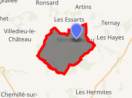
| |
 Montrouveau  Montrouveau | |
| Coordinates: 47°42′55″N 0°43′47″E | |
| Country | France |
| Region | Centre-Val de Loire |
| Department | Loir-et-Cher |
| Arrondissement | Vendôme |
| Canton | Montoire-sur-le-Loir |
| Intercommunality | Pays de Ronsard |
| Government | |
| • Mayor (2014–2020) | Yves Dolbeau |
| Area 1 | 17.7 km2 (6.8 sq mi) |
| Population (2017-01-01)[1] | 154 |
| • Density | 8.7/km2 (23/sq mi) |
| Time zone | UTC+01:00 (CET) |
| • Summer (DST) | UTC+02:00 (CEST) |
| INSEE/Postal code | 41153 /41800 |
| Elevation | 94–141 m (308–463 ft) (avg. 140 m or 460 ft) |
| 1 French Land Register data, which excludes lakes, ponds, glaciers > 1 km2 (0.386 sq mi or 247 acres) and river estuaries. | |
Population
| Year | Pop. | ±% |
|---|---|---|
| 1793 | 273 | — |
| 1806 | 280 | +2.6% |
| 1821 | 438 | +56.4% |
| 1831 | 490 | +11.9% |
| 1841 | 492 | +0.4% |
| 1851 | 456 | −7.3% |
| 1861 | 415 | −9.0% |
| 1872 | 354 | −14.7% |
| 1881 | 357 | +0.8% |
| 1891 | 370 | +3.6% |
| 1901 | 363 | −1.9% |
| 1911 | 316 | −12.9% |
| 1921 | 307 | −2.8% |
| 1931 | 316 | +2.9% |
| 1946 | 335 | +6.0% |
| 1954 | 302 | −9.9% |
| 1962 | 248 | −17.9% |
| 1968 | 217 | −12.5% |
| 1975 | 171 | −21.2% |
| 1982 | 139 | −18.7% |
| 1990 | 113 | −18.7% |
| 1999 | 110 | −2.7% |
| 2006 | 126 | +14.5% |
| 2014 | 146 | +15.9% |
gollark: <@259981416928903168> The answer to that is persistent data structures.
gollark: Or deep copying.
gollark: ^
gollark: Like much of lua, it's kind of analogous to other things and kind of a bodged mess.
gollark: Well, it's not.
References
- "Populations légales 2017". INSEE. Retrieved 6 January 2020.
| Wikimedia Commons has media related to Montrouveau. |
| Authority control |
|
|---|
This article is issued from Wikipedia. The text is licensed under Creative Commons - Attribution - Sharealike. Additional terms may apply for the media files.