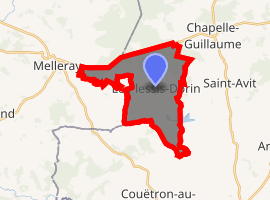
Le Plessis-Dorin
Le Plessis-Dorin is a commune in the Loir-et-Cher department of central France.
Le Plessis-Dorin | |
|---|---|
Town hall | |
.svg.png) Coat of arms | |
Location of Le Plessis-Dorin 
| |
 Le Plessis-Dorin  Le Plessis-Dorin | |
| Coordinates: 48°05′25″N 0°51′55″E | |
| Country | France |
| Region | Centre-Val de Loire |
| Department | Loir-et-Cher |
| Arrondissement | Vendôme |
| Canton | Le Perche |
| Government | |
| • Mayor (2014–2020) | Marinette Hoyeau |
| Area 1 | 14.19 km2 (5.48 sq mi) |
| Population (2017-01-01)[1] | 167 |
| • Density | 12/km2 (30/sq mi) |
| Time zone | UTC+01:00 (CET) |
| • Summer (DST) | UTC+02:00 (CEST) |
| INSEE/Postal code | 41177 /41170 |
| Elevation | 131–249 m (430–817 ft) (avg. 245 m or 804 ft) |
| 1 French Land Register data, which excludes lakes, ponds, glaciers > 1 km2 (0.386 sq mi or 247 acres) and river estuaries. | |
Population
| Year | Pop. | ±% |
|---|---|---|
| 1793 | 659 | — |
| 1806 | 764 | +15.9% |
| 1821 | 836 | +9.4% |
| 1831 | 895 | +7.1% |
| 1841 | 842 | −5.9% |
| 1851 | 801 | −4.9% |
| 1861 | 806 | +0.6% |
| 1872 | 802 | −0.5% |
| 1881 | 781 | −2.6% |
| 1891 | 827 | +5.9% |
| 1901 | 694 | −16.1% |
| 1911 | 785 | +13.1% |
| 1921 | 703 | −10.4% |
| 1931 | 718 | +2.1% |
| 1946 | 596 | −17.0% |
| 1954 | 529 | −11.2% |
| 1962 | 465 | −12.1% |
| 1968 | 361 | −22.4% |
| 1975 | 298 | −17.5% |
| 1982 | 292 | −2.0% |
| 1990 | 218 | −25.3% |
| 1999 | 202 | −7.3% |
| 2008 | 187 | −7.4% |
| 2014 | 175 | −6.4% |
gollark: I always enjoy receiving these friendly emails.
gollark: <@!160279332454006795> Please harbinge appropriately.
gollark: Your users probably fall into the groups of: would never pirate even if given the option (I doubt there are many of these given the context); will pirate it if it's easy enough (you may be able to stop these people, but they could also just track down a "cracked" build); never going to buy it legitimately (probably many).
gollark: 🐝
gollark: Just offer hosted cloud™ geometry dash instances which you are FORCED to use.
This article is issued from Wikipedia. The text is licensed under Creative Commons - Attribution - Sharealike. Additional terms may apply for the media files.