Nova Scotia Route 201
Route 201 is a collector road in the Canadian province of Nova Scotia.
| ||||
|---|---|---|---|---|
| Route information | ||||
| Maintained by Nova Scotia Department of Transportation and Infrastructure Renewal | ||||
| Length | 38 km[1] (24 mi) | |||
| Major junctions | ||||
| West end | ||||
| East end | ||||
| Location | ||||
| Counties | Annapolis | |||
| Highway system | ||||
| Provincial highways in Nova Scotia 100-series
| ||||
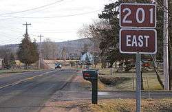
View of Route 201 outside Bridgetown.
It is located in the Annapolis Valley and runs from Annapolis Royal to Kingston. Heading west from its junction with Trunk 1 the route follows the southern banks of the Annapolis River through the communities of Nictaux, Lawrencetown, and Paradise before crossing over Highway 101 into the town Bridgetown. After exiting the town the route continues west where it terminates at a junction with Route 8 in the town of Annapolis Royal.
The highway is designated as a bicycle route.
Communities
- Lequille
- Moschelle
- Round Hill
- Tupperville
- Centrelea
- Carleton Corner
- West Paradise
- Paradise
- Lawrencetown
- South Williamston
- Nictaux West
- Nictaux
- South Farmington
- Meadowvale
- Greenwood
- South Greenwood
- Greenwood Square
- East Kingston
Roads
Parks
gollark: What if Macron logic literally WASM?
gollark: Package manager: `map`.
gollark: Compiler: `mac`.
gollark: `TheThingCannotActuallyBeThisThing`
gollark: `AntimemeticBeeoid`
References
- Atlantic Canada Back Road Atlas ISBN 978-1-55368-618-7 Pages 65, 77-78
This article is issued from Wikipedia. The text is licensed under Creative Commons - Attribution - Sharealike. Additional terms may apply for the media files.