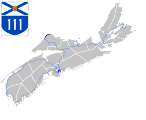
Nova Scotia Highway 111
Highway 111 is a 13-kilometre (8 mi) controlled-access freeway in Halifax Regional Municipality, Nova Scotia, Canada.
| ||||
|---|---|---|---|---|
| Highway of Heroes[1] Circumferential Highway | ||||
 | ||||
| Route information | ||||
| Maintained by Nova Scotia Department of Transportation and Infrastructure Renewal | ||||
| Length | 13 km[2] (8 mi) | |||
| Existed | 1960–present | |||
| Major junctions | ||||
| West end | ||||
| East end | ||||
| Highway system | ||||
| Provincial highways in Nova Scotia 100-series
| ||||
Highway 111 varies from 4-12 lanes and is known colloquially as the Circumferential Highway, or, more recently, "the Circ", because it forms a partial orbital road around Dartmouth. The highway runs from Pleasant Street in the neighbourhood of Woodside in the south to the A. Murray MacKay Bridge in the north.
It serves as a key transportation link for Dartmouth and Halifax. The section from Highway 118 (Woodland Avenue) to the MacKay Bridge was constructed at the same time as the bridge, opening in 1970. The portion from Pleasant Street to Woodland Avenue was built in 1960 and was twinned in 1977.
Access to Highways 102 and 103
The MacKay Bridge, as maintained by the Halifax-Dartmouth Bridge Commission, is officially part of Highway 111, and is considered as an extension of it. A truck route through the former city of Halifax, from the MacKay Bridge along Connaught Avenue to Bayers Road near Highway 102, is signed with directional markers, but is not officially a part of the route.
Micmac Rotary
The Micmac (or Mic Mac) Rotary was a traffic circle located at the intersection of Hwy 111 with Route 318 (Braemar Drive) and Trunk 7 (Main Street/Prince Albert Road/Grahams Grove). It was named after nearby Lake Micmac, which was partially in-filled to accommodate it. The Micmac Rotary was notorious for rush hour congestion, even resulting in the recording of a song entitled "Mic Mac Rotary Blues".[3]
The rotary was removed during a redesign of the intersection in the late 1980s which saw it replaced by the "Micmac Parclo", which consists of a series of overpasses and controlled access lanes. The resulting roadway through the Parclo and across Lake Micmac to the interchange with Highway 118 is the widest in Atlantic Canada at 10-12 lanes.
Highway of Heroes
On May 22, 2013 Highway 111 was officially named "Highway of Heroes" by Premier Darrell Dexter.
Exit list
The entire route is located in Halifax Regional Municipality.
| Location | km[2] | mi | Exit | Destinations | Notes | ||
|---|---|---|---|---|---|---|---|
| Continues as | |||||||
| Halifax Peninsula | 0.0 | 0.0 | At-grade | ||||
| 0.5 | 0.31 | — | Robie Street | Access via Massachusetts Avenue | |||
| 0.8 | 0.50 | — | Barrington Street | ||||
| Halifax Harbour | 1.4– 2.6 | 0.87– 1.6 | A. Murray MacKay Bridge | ||||
| Dartmouth | 3.2 | 2.0 | Toll booth | ||||
| 3.3 | 2.1 | (1) | Princess Margaret Boulevard | ||||
| 3.9 | 2.4 | 2 | Signed as exits 2E (Route 322) and 2W (To Trunk 7 / Hwy 101) | ||||
| 5.1 | 3.2 | 3 | Highfield Park Drive – Burnside Industrial Park | ||||
| 6.6 | 4.1 | 4 | Signed as exits 4S (south) and 4N (north) northbound; no northbound entrance from Hwy 118 north (Woodland Avenue) | ||||
| 7.5 | 4.7 | 5 | Micmac Boulevard | ||||
| 8.3 | 5.2 | 6 | Signed as exits 6A (west) and 6B (east) southbound | ||||
| 9.0 | 5.6 | — | Gordon Avenue | Northbound exit only; no signage | |||
| 9.9 | 6.2 | 7 | Signed as exits 7W (west) and 7E (east) southbound | ||||
| 11.6 | 7.2 | 8 | Mount Hope Avenue – Woodside Industrial Park | ||||
| 12.9 | 8.0 | At-grade | |||||
1.000 mi = 1.609 km; 1.000 km = 0.621 mi
| |||||||
See also
- List of highways named Circumferential Highway
- List of highways named Highway of Heroes
References
- "Archived copy". Archived from the original on 2016-03-03. Retrieved 2013-05-22.CS1 maint: archived copy as title (link)
- Google (July 17, 2017). "Highway 111 in Nova Scotia" (Map). Google Maps. Google.
- "NS Classic Rock Discography - 45 rpm". Retrieved 2009-05-30.
