Nova Scotia Route 344
Route 344 is a collector road in the Canadian province of Nova Scotia.
| ||||
|---|---|---|---|---|
| Route information | ||||
| Maintained by Nova Scotia Department of Transportation and Infrastructure Renewal | ||||
| Length | 47 km[1] (29 mi) | |||
| Major junctions | ||||
| South end | ||||
| North end | ||||
| Highway system | ||||
| Provincial highways in Nova Scotia 100-series
| ||||
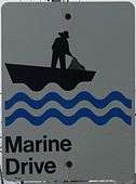
Part of Marine Drive
It is located in Guysborough County and connects Auld's Cove at Trunk 4 with Boylston at Trunk 16.
Communities
- Auld's Cove
- Mulgrave
- Pirate Harbour
- Steep Creek
- Middle Melford
- Sand Point
- Hadleyville-(formerly Oyster Ponds)
- St. Francis Harbour - (formerly Goose Harbour)
- Manassette Lake
- Port Shoreham
- Manchester
- Boylston
Parks
- Port Shoreham Beach Provincial Park
History
The section of the Collector Highway 344 from Auld's Cove and Mulgrave was designated as Trunk Highway 44.
gollark: I can read 5.3GB.
gollark: I'll check.
gollark: Fine, I can compress the outbound data.
gollark: I see.
gollark: Well, you have 49GB of storage used, so I can probably download that to osmarks.net's servers over only a few days.
References
- Atlantic Canada Back Road Atlas ISBN 978-1-55368-618-7 Pages 56, 72
This article is issued from Wikipedia. The text is licensed under Creative Commons - Attribution - Sharealike. Additional terms may apply for the media files.