Nova Scotia Route 316
Route 316 is a collector road in the Canadian province of Nova Scotia. It is located in Antigonish County and Guysborough County, connecting Lower South River at Highway 104 with Half Island Cove at Trunk 16.
| ||||
|---|---|---|---|---|
| Route information | ||||
| Maintained by Nova Scotia Department of Transportation and Infrastructure Renewal | ||||
| Length | 132 km[1] (82 mi) | |||
| Major junctions | ||||
| South end | ||||
| North end | ||||
| Location | ||||
| Counties | Antigonish / Guysborough County | |||
| Highway system | ||||
| Provincial highways in Nova Scotia 100-series
| ||||
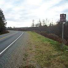
Route sign in Goshen, Guysborough County, Nova Scotia
Communities
- Half Island Cove
- Upper Whitehead
- Port Felix East
- Port Felix
- Charlos Cove
- Larry's River
- New Harbour West
- Coddle's Harbour
- Drumhead
- Seal Harbour
- Goldboro
- Isaac's Harbour North
- Stormont
- Middle Country Harbour
- Country Harbour Mines
- Cross Roads Country Harbour
- Country Harbour Lake
- Fisher Mills
- Eight Island Lake
- Goshen
- Argyle
- Loch Katrine
- Upper South River
- Frasers Mills
- St. Andrews
- Lower South River
gollark: Expedient retroactive trilateration.
gollark: Just make more alts?
gollark: Actually, bees.
gollark: I do not. It sounds bad.
gollark: Someone should fix my roles. I cannot seem to access "#polls", nor do I have total administrative control of the entire server.
References
- Atlantic Canada Back Road Atlas ISBN 978-1-55368-618-7 Pages 55, 71-73
This article is issued from Wikipedia. The text is licensed under Creative Commons - Attribution - Sharealike. Additional terms may apply for the media files.