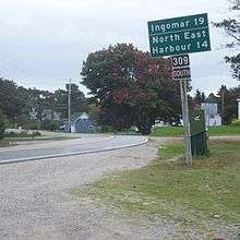
Nova Scotia Route 309
Route 309 is a collector road in the Canadian province of Nova Scotia.
Route information | ||||
---|---|---|---|---|
Maintained by Nova Scotia Department of Transportation and Infrastructure Renewal | ||||
Length | 29 km[1] (18 mi) | |||
Major junctions | ||||
West end | ||||
East end | ||||
Location | ||||
Counties | Shelburne | |||
Highway system | ||||
Provincial highways in Nova Scotia 100-series
|
It is located in Shelburne County and connects Barrington at Trunk 3/Highway 103 with Clyde River at Trunk 3/Highway 103.
Communities
Parks
- Sand Hills Provincial Park
gollark: ████++remind 18hProtocol τ-47 activated.
gollark: +>markov 258639553357676545 2
gollark: 65851639831501970165151168517143765761835155650884909989859982387345528331635507647918535893226185489632132933089857064204675259070915481416549859461637180270981994309924488957571282890592323326097299712084433573265489382391193259746366730583604142813883032038249037589852437441702913276561809377344403070746921120191302033038019762110110044929321516084244485963766983895228684783123552658213144957685726243344189303968642624341077322697802807318915441101044682325271620105265227211166039666557309254711055785376346682065310989652691862056476931257058635662018558100729360659876486117910453348850346113657686753249441668039626579787718556084552965412665408530614344431858676975145661406800700237877659134401712749470420562230538994561314071127000407854733269939081454664645880797270826683063432858785698305235808933065757406795457163775254202114955761581400250126228594130216471550979259230990796547376125517656751357517829666454779174501129961489030463994713296210734043751895735961458901938971311179042978285647503203198691514028708085990480109412147221317947647772622414254854540332157185306142288137585043063321751829798662237172159160771669254748738986654949
gollark: 672890977772793800081647060016145249192173217214772350141441973568548161361157352552133475741849468438523323907394143334547762416862518983569485562099219222184272550254256887671790494601653466804988627232791786085784383827967976681454100953883786360950680064225125205117392984896084128488626945604241965285022210661186306744278622039194945047123713786960956364371917287467764657573962413890865832645995813390478027590099465764078951269468398352595709825822620522489407726719478268482601476990902640136394437455305068203496252451749399651431429809190659250937221696461515709858387410597885959772975498930161753928468138268683868942774155991855925245953959431049972524680845987273644695848653836736222626099124608051243884390451244136549762780797715691435997700129616089441694
gollark: +>markov 258639553357676545 2
References
- Atlantic Canada Back Road Atlas ISBN 978-1-55368-618-7 Page 89
This article is issued from Wikipedia. The text is licensed under Creative Commons - Attribution - Sharealike. Additional terms may apply for the media files.