Nova Scotia Route 215
Route 215 is collector road in the Canadian province of Nova Scotia.
| ||||
|---|---|---|---|---|
| Route information | ||||
| Maintained by Nova Scotia Department of Transportation and Infrastructure Renewal | ||||
| Length | 120.0 km[1] (74.6 mi) | |||
| Major junctions | ||||
| West end | ||||
| East end | ||||
| Location | ||||
| Counties | Hants | |||
| Highway system | ||||
| Provincial highways in Nova Scotia 100-series
| ||||
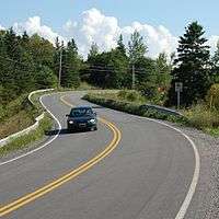
Route 215 in Chevarie, Nova Scotia
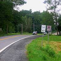
Section of NS Route 215 through Brooklyn duplexed with Trunk 14
It is located in Hants County, connecting Shubenacadie at Trunk 2 with Newport Corner at Trunk 1.
Portions of the road are included in the Glooscap Trail and the Fundy Shore Ecotour.
A short portion of the road in the community of Brooklyn is duplexed with Trunk 14.
Geographic regions
The road passes through the following geographic regions:
- the Shubenacadie Valley
- the shore of the Bay of Fundy, specifically the southern shore of Cobequid Bay and the Minas Basin
- the lower portion of the Avon Valley as it follows the east bank of the Avon River
Communities
Communities in italics are served by the route indirectly.
- Newport Corner
- Brooklyn
- Belmont
- Upper Burlington
- Centre Burlington
- Cogmagun River
- Riverside
- Lower Burlington
- Summerville
- Kempt Shore
- Cheverie
- Bramber
- Cambridge
- Goshen
- Pembroke
- Walton
- East Walton
- Tenecape
- Moose Brook
- Minasville
- Burntcoat
- Noel
- Lake Road
- East Noel
- Northfield
- Densmore Mills
- Noel Shore
- Lower Selma
- Stirling Brook
- Selma
- Maitland
- South Maitland
- Urbania
- Admiral Rock
- Rines Creek
- Shubenacadie
Parks
- Caddell Rapids Provincial Park
- Anthony Provincial Park
- Smiley’s Provincial Park
History
Highway 215 was formerly designated Trunk Highway 15.
gollark: You have 5 weeks.
gollark: Too bad. My bot can't cancel reminders.
gollark: You have 5 weeks. I will set a reminder.
gollark: Yes.
gollark: Train a neural network to procedurally generate trains.
References
- Atlantic Canada Back Road Atlas ISBN 978-1-55368-618-7 Pages 67-68, 80
This article is issued from Wikipedia. The text is licensed under Creative Commons - Attribution - Sharealike. Additional terms may apply for the media files.