Lower Sackville, Nova Scotia
Lower Sackville is a suburban community of Halifax, Nova Scotia, Canada. It lies approximately 27 km (17 mi) by road from Downtown Halifax.[1]
Lower Sackville | |
|---|---|
Suburban Community | |
Aerial view of Lower Sackville | |
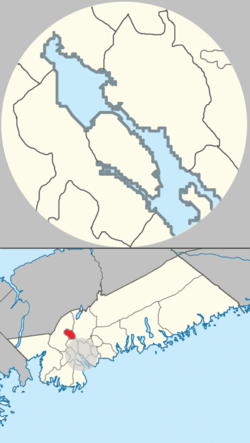
 Map of Sackville planning area in Halifax, Nova Scotia | |
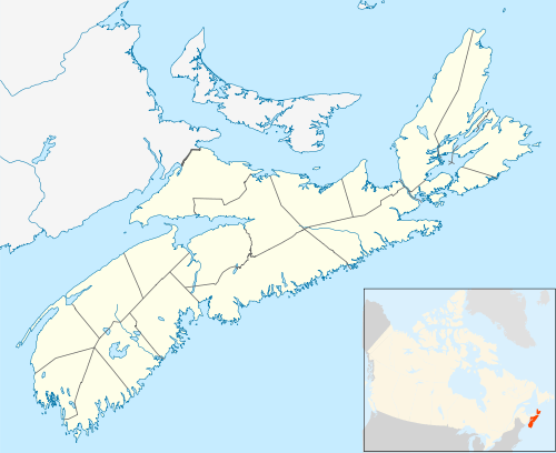
 Lower Sackville Location of Lower Sackville, Nova Scotia | |
| Coordinates: 44°46′35″N 63°41′44″W | |
| Country | |
| Province | |
| Municipality | Halifax Regional Municipality |
| Founded | 1749 |
| Amalgamated with Halifax | April 1, 1996 |
| Time zone | UTC-4 (AST) |
| • Summer (DST) | UTC-3 (ADT) |
| Canadian Postal code | B4C, B4E, B4G |
| Area code(s) | 902, 782 |
| Telephone Exchange | 252, 864, 865, 869 |
| Website | www |
History
Before the European colonization in 1749, the Mi'kmaq lived in this area for thousands of years.
In August 1749, Captain John Gorham, acting on orders from Governor Edward Cornwallis to establish a military fort named Fort Sackville (The community was named after George Germain, 1st Viscount Sackville.[2]) Lower Sackville is now one of the fastest growing communities in Nova Scotia, and contains a mix of residential and commercial development in the Sackville River valley, immediately north of the former town of Bedford. As the community grew, the oak trees that lined the main drive were cut down one by one due to poor urban planning, and as more homes were desired the farmlands deceased to make way for further urbanization.
Before amalgamation into the Halifax Regional Municipality in 1996, Lower Sackville was an unincorporated part of Halifax County. In the 1950s and 1960s it was a destination for Haligonians seeking entertainment at the drive-in theater, WW2 bomber plane ice cream attraction and Sackville Downs harness racing track which provided entertainment until it closed in 1986.
A result of its unincorporated status before 1996, Lower Sackville and adjacent unincorporated communities such as Middle Sackville and Upper Sackville did not benefit from appropriate planning and are examples of urban sprawl. The community's growth reflects its central location, near both Halifax and Dartmouth, with easy access to Highway 102, Highway 101 and Halifax Stanfield International Airport. Proximity to downtown Halifax and Burnside and Bayers Lake Industrial Parks gives the suburbs of Lower Sackville the advantages of employment opportunities and services of a larger city, and is typical of most commuter communities experiencing growth in North America.
Lower Sackville has experienced ribbon/strip-style commercial development along Trunk 1 since the 1960s. Current retail chains include Sobeys, Atlantic Superstore, Canadian Tire, Cleve's Sporting Goods, Dollarama and Giant Tiger. There are numerous independent retailers located in this area as well. Most of the restaurants in the area are of the fast food or family dining variety, in addition to others offering Chinese-Canadian food and pizza. Lower Sackville has always displayed an abundance of community spirit, and excelled within the HRM as a strong leader of excellence in sports as well as academics.
Sports
Recreational pursuits in the community revolve around sports fields at local schools and parks, as well as the Sackville Sports Stadium, which is equipped with two swimming pools, gymnasium, curling rink, and one of Lower Sackville's two ice hockey arenas. The majority of Lower Sackville's suburbs were built in the 1970s on the southern edge of First Lake which offers outdoor recreational opportunities. The Bedford-Sackville Connector Greenway is a crushed gravel-covered trail running beside the Sackville River from the intersection of Cobequid Road and Sackville Drive to Bedford Place Mall. Prior to the opening of the trail in 2006, there was no easy way to walk from Lower Sackville to Bedford. A provincial park reserve borders the northern edge of the community at Second Lake.
Education
The community hosts two high schools: Sackville High School and Millwood High School, along with a community-run museum, Fultz House. There are 19 elementary schools located in and around Lower Sackville.[3]
Districts of Lower Sackville
The following are the districts of Lower Sackville, their geographical location, and/or main road:[4]
- East Sackville - First Lake Drive
- North Sackville - Stokil Drive and Armcrest
- West Sackville - Riverside Drive
- South Sackville - Between the lower half of Sackville Drive and Glendale Drive, also includes Chandler Peninsula
- Downtown - Upper half of Sackville Drive, close to Beaver Bank Road
- Olde Sackville - Old Sackville Road and Riverside Estates
- Sunnyvale - Sunnyvale Crescent
- Sackville Estates - Below Century Park, connected to Millwood
- Seawood - Seawood Avenue
- Walker Area - Walker Avenue
- Industrial Park - Lower half of Cobequid Road and Glendale Avenue
- Cobequid - Upper half of Cobequid Road
- Stonemount - Stonemount Drive
Some neighbourhoods of Lower Sackville are also known by their tendency to use street names starting with the same letter:
- "S" Section: Smokey Dr, Stokil Dr, Sampson Dr, Saratoga Dr, Saturn Dr, Spinner Cres, Sappire Cres
- "N" Section: Nordic Cres, Neilly Dr, Nappan Dr, Newcombe Dr, Nictaux Dr
- "L" Section: Lennox Dr, Lumsden Cres, Lynville Dr, Lydgate Dr
- "C" Section: Cavalier Dr, Cavendish Dr, Cartier Cres, Cabot Cres, Crimson Dr
- "P" Section: Polara Dr, Polara Ct, Phoenix Cres
- "Q" Section: Quaker Cres, Quinn Dr, Queens Ct
- "R" Section: Rogers Dr, Rankin Dr, Riverside Dr, Rothesay Ct
Notable people
- Charles Fenerty, inventor of newsprint made from wood pulp.
- Brad Marchand, NHL player for the Boston Bruins. (Originally from Lower Sackville but grew up in Upper Hammonds Plains, Nova Scotia)
- Nikki Payne, award-winning stand-up comedian and contestant on the 2006 edition of NBC television's reality show Last Comic Standing. Also, frequent juror on MuchMusic's show Video on Trial. She attended Millwood High School.
- James Sheppard, NHL player for the New York Rangers.
- Adrian Morris and Corey LeRue, musicians in Canadian Pop Band Neon Dreams.
- Mayor of "Sack-vegas" Jeff Neilson
References
- "Google Maps". Google Maps. Google Maps.
- https://novascotia.ca/archives/virtual/places/page.asp?ID=600
- http://www.lowersackville.com/lowersackvilleschools.html
- "Archived copy" (PDF). Archived from the original (PDF) on 2016-11-12. Retrieved 2016-11-11.CS1 maint: archived copy as title (link)