Mykolaiv
Mykolaiv (Ukrainian: Микола́їв [mɪkoˈlɑjiu̯] (![]()
Mykolaiv Миколаїв | |
|---|---|
| Ukrainian transcription(s) | |
| • National | Mykolaiv |
| • ALA-LC | Mykolaïv |
| • BGN/PCGN | Mykolayiv |
| • Scholarly | Mykolajiv |
    | |
 Flag  Coat of arms | |
| Nickname(s): City of shipbuilders | |
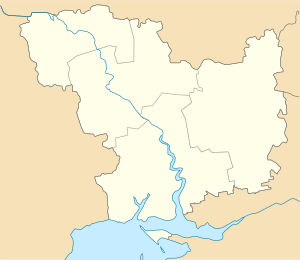 Mykolaiv Location of Mykolaiv  Mykolaiv Mykolaiv (Ukraine) | |
| Coordinates: 46°58′0″N 32°00′0″E | |
| Country | |
| Oblast | |
| Raion | Mykolaiv Municipality |
| Founded | 1789 |
| City rights | 1789 |
| Government | |
| • Mayor | Oleksandr Senkevych (Self Reliance)[1][2] |
| Area | |
| • Total | 260 km2 (100 sq mi) |
| Population (2015) | |
| • Total | 494,763[3] |
| • Density | 1,918/km2 (4,970/sq mi) |
| Time zone | UTC+2 (EET) |
| • Summer (DST) | UTC+3 (EEST) |
| Postal code | 54000 |
| Area code(s) | +380 512 |
| Vehicle registration | BE |
| Website | mkrada.gov.ua/ |
The city is an important transportation hub of Ukraine (sea port, commercial port, river port, highway and railway junction, airport).
Mykolaiv's orderly layout reflects the fact that its development has been well planned from the founding of the city. Its main streets, including the three main east–west Avenues, are very wide and tree-lined. Much of Mykolaiv's land area consists of beautiful parks. Park Peremohy (Victory) is a large park on the peninsula just north of the city center of Mykolaiv, on the north side of the Inhul river.
Name of city
The city has two names, Ukrainian and Russian; there are several transliterations of each name. The Ukrainian name of the city is Микола́їв, transliterated as Mykolaiv, or (officially) Mykolayiv. The Russian name, Никола́ев, transliterates as Nikolaev or as Nikolayev.
The city's founding was made possible by the Russian conquests during the Second Russo-Turkish War of 1787–1792. Founded by Prince Grigory Potemkin, Nikolaev was the last of the many cities he established. On 27 August 1789, Potemkin ordered its naming near the wharf at the mouth of the Ingul river, on a high, cool and breezy spot where the Ingul river meets the Southern Bug river. To build the city he brought in peasants, soldiers, and Turkish prisoners; 2,500 were working there during 1789. The shipyards were built first (1788).[4] Potemkin named the city after Saint Nicholas, the patron of seafarers, on whose day (6 December) he had obtained victory at the siege of Ochakov[5] in 1788. The name Nikolaev is known from the legal order (writ) Number 1065 by Prince Potemkin to Mikhail Faleev dated 27 August 1789.[6]
In 1920, after the establishment of Soviet power, the Odessa provincial council (of laborers and peasants' deputies) petitioned the then-Soviet Ukrainian government—the All-Ukrainian Central Executive Committee (VUTSIK)—to rename the city of Nikolaev to Vernoleninsk. As the city of Nikolaev was a district center of the Odessan province, presumably, the petition would have been initiated by the Odessa city council, but documentary evidence of this so far has not been identified. On 15 April 1924 the Plenum of the Central Administrative-Territorial Commission of the VUTSIK considered and rejected the petition of the Odessan executive committee. Perhaps the members of the Soviet-Ukraine government thought that the name sounded too obsequious.[7]
Information regarding the alleged renaming of Nikolaev was disseminated by German maps of the 1920s and 1930s, as well as in German encyclopedic publications in 1927 and 1932, which show Vernoleninsk on the USSR part of the European maps. The city was designated as Nikolaev in publications of the same map in other languages.[7]
To distinguish Mykolaiv from the much smaller west Ukraine city of Mykolaiv in Lviv Oblast, the latter is sometimes called "Mykolaiv on Dniester" after the major river that it is situated on, while the former is located on the Southern Bug, another major river, and may also be called "Mykolaiv on Bug".
Administrative status
Mykolaiv is the administrative center of Mykolaiv Oblast (region), as well as that of both Mykolaiv and Vitovka raions (districts) within the oblast. It is administratively incorporated as a city of oblast significance, and does not belong to any of the two raions.
Geographic characteristics
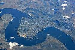
Mykolaiv is located on a peninsula in Ukraine's steppe region 65 kilometers (40 mi) from the Black Sea along the estuary of the Southern Bug river (where it meets the Inhul River).[8]
Both the Inhul River and the Southern Bug River follow very winding courses just before they join at the northeast corner of Mykolaiv. This has created several long and narrow peninsulas just north of Mykolaiv, and the main part of Mykolaiv is itself on a peninsula at a 180-degree bend in the Southern Bug River.
Mykolaiv is in a primarily flat terrain area (the steppe grain-producing region of southern Ukraine). The nearest mountains to Mykolaiv are 300 kilometres (186 miles) south, at the southern end of the Crimean Peninsula. The lack of any mountain barriers north of Mykolaiv means that very cold Arctic winds can blow south, unimpeded by any terrain elevation, to Mykolaiv in winter.
The area of the city is 260 square kilometres (100 sq mi).[9]
Mykolaiv is in the second time zone (Eastern European Time).
Ecology
Mykolaiv's environmental issues are typical for many cities in Ukraine: pollution of water, the air, and groundwater; drinking water quality, noise, waste management, and conservation of biological diversity in the city.[10] One of Mykolaiv's most urgent problems is the disposal of solid household waste.[11]
The city has 18 preserved sites, totaling about 12 square kilometres (5 sq mi):[12]
- The Mykolaiv Zoo (considered one of the best zoos in Ukraine);
- The monuments of landscape art: Park Peremohy, Park People's Garden, 68 Paratroopers Park, Square, The Sivašskij, The Boulevard Bunker, Linea (Line) Park, Young Heroes Park; Youth Park;
- The Botanical Natural Monument Memory Square;
- The Dubki Reserved Nature boundary;
- The Balabanovka Forest Reserve;
- The Reservoir Hydrological Reserve;
- The Turkish Fountain Hydrological Natural Monument;
- The Dubka (oak) 4 Botanical Nature Monument.
Climate
The city's climate is moderately continental with mild winters and hot summers.[8][13] Mykolaiv's average temperature is 10 °C (50 °F). The lowest average temperature is in January −3.1 °C (26 °F), the highest in July 22.3 °C (72 °F).[13]
Mykolaiv has an average of 472 mm (19 in) of precipitation per year, with the lowest precipitation in October, and the most in July. Mykolaiv has snow cover every year, but its height is low.[13]
Average relative humidity is 73% for the year; the lowest humidity is in August (60%); the highest in December (86%).[13] The lowest cloud are seen in August; the highest are in December.[13]
The prevailing winds come from the North; the least frequent source of wind is the Southeast. The maximum wind speed is in February, the lowest is from July through September. In January, the average wind speed is 4.1 m/s (meters per second); in July, the average is 3.1 m/s.[13]
| Climate data for Mykolaiv (1981–2010, extremes 1900–2015) | |||||||||||||
|---|---|---|---|---|---|---|---|---|---|---|---|---|---|
| Month | Jan | Feb | Mar | Apr | May | Jun | Jul | Aug | Sep | Oct | Nov | Dec | Year |
| Record high °C (°F) | 14.0 (57.2) |
18.1 (64.6) |
24.1 (75.4) |
32.3 (90.1) |
37.4 (99.3) |
37.8 (100.0) |
40.0 (104.0) |
40.1 (104.2) |
36.5 (97.7) |
32.9 (91.2) |
23.4 (74.1) |
15.6 (60.1) |
40.1 (104.2) |
| Average high °C (°F) | 1.1 (34.0) |
2.2 (36.0) |
7.7 (45.9) |
15.8 (60.4) |
22.5 (72.5) |
26.5 (79.7) |
29.3 (84.7) |
29.0 (84.2) |
22.7 (72.9) |
15.7 (60.3) |
7.5 (45.5) |
2.5 (36.5) |
15.3 (59.5) |
| Daily mean °C (°F) | −1.9 (28.6) |
−1.4 (29.5) |
3.1 (37.6) |
10.2 (50.4) |
16.5 (61.7) |
20.5 (68.9) |
23.1 (73.6) |
22.6 (72.7) |
16.9 (62.4) |
10.6 (51.1) |
4.0 (39.2) |
−0.4 (31.3) |
10.4 (50.7) |
| Average low °C (°F) | −4.6 (23.7) |
−4.7 (23.5) |
−0.5 (31.1) |
5.3 (41.5) |
11.0 (51.8) |
15.2 (59.4) |
17.5 (63.5) |
16.8 (62.2) |
11.9 (53.4) |
6.4 (43.5) |
1.0 (33.8) |
−3.0 (26.6) |
6.2 (43.2) |
| Record low °C (°F) | −29.7 (−21.5) |
−28.8 (−19.8) |
−20.8 (−5.4) |
−7.9 (17.8) |
−1.2 (29.8) |
4.2 (39.6) |
9.4 (48.9) |
4.6 (40.3) |
−1.4 (29.5) |
−13.4 (7.9) |
−18.2 (−0.8) |
−24.6 (−12.3) |
−29.7 (−21.5) |
| Average precipitation mm (inches) | 29.1 (1.15) |
32.0 (1.26) |
26.1 (1.03) |
26.0 (1.02) |
43.8 (1.72) |
49.6 (1.95) |
47.3 (1.86) |
32.8 (1.29) |
40.7 (1.60) |
32.0 (1.26) |
34.9 (1.37) |
33.1 (1.30) |
443.8 (17.47) |
| Average precipitation days (≥ 1.0 mm) | 6.7 | 6.0 | 5.8 | 5.2 | 6.2 | 6.8 | 5.5 | 3.6 | 4.9 | 4.7 | 5.5 | 6.8 | 69.7 |
| Mean monthly sunshine hours | 69 | 74 | 122 | 181 | 263 | 289 | 308 | 295 | 232 | 168 | 69 | 52 | 2,122 |
| Source 1: European Climate Assessment & Dataset (extremes 1900–2015)[14][15][16][17][18][19][lower-alpha 1] | |||||||||||||
| Source 2: NOAA (sun, 1961–1990)[20] | |||||||||||||
History
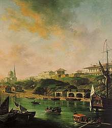
Archaeologists have found proof of ancient settlements on the current territory of current Mykolaiv.[21] In 2018, archaeologists discovered a sunken Ancient Greek ship near Mykolaiv region. The ship is from the 5th century BC, the period of Greek colonization of the Northern Black Sea. Researchers said that “This Ancient Greek ship is one of the oldest known in the Northern Black Sea,"[22]
The history of the city has always been closely connected to shipbuilding.[23] The town was founded in 1789 by the Russian Governor General of Novorossiya, Prince Grigory Potemkin, initially as a shipyard called simply a New Shipyard on the Ingul river. Prince Potemkin signed an order to construct a shipyard on 27 August 1789, which is considered to be the city's birth date. The shipyard was to undertake the repair of naval ships in the Russo-Turkish War. Later Potemkin ordered the shipyard to be named Nikolaev to commemorate the date when Ochakov fell to the Russian troops under his command on 6 December 1788, the feast day of Saint Nicholas (Nikolai) on the Russian Orthodox Church calendar.
The Russian Empire's Black Sea Navy Headquarters was in Mykolaiv for more than 100 years until the Imperial Russian Navy moved it to Sevastopol, near the Southern tip of Crimean Peninsula. During the Crimean War Mykolaiv became the main rear base to support Russia's efforts in the war. Most businesses that were created in the city belonged to the military industrial complex, and, in this regard, Mykolaiv, was closed to foreign visitors for many decades.[24]
In March 1816, Admiral Aleksey Greig was appointed to the post of Governor of the city. While in that post until 1833, he did much for Mykolaiv. Port facilities were built. A credit society (cooperative) was established, and Mykolaiv increased its seaborne trade. Morskoii (Marine) Boulevard was built in the city, along with sidewalks. In addition, open men's and women's colleges were, built, as was a shelter. In 1820, Admiral Greig founded the Marine Astronomical Observatory in Mykolaiv. In 1826, he, for the first time in the history of the Russian Navy, set up the Russian Naval headquarters in Mykolaiv. The headquarters included fleet combat training during peacetime and the development of plans for military operations during wartime.
From 1860 to 1871, the military Governor of Mykolaiv was Bogdan von Glazenap. His highest command in the town was in 1862. He encouraged foreign vessels to call at the commercial port and encouraged foreigners to come to Mykolaiv to live. Therefore, foreign governments established foreign consulates in Mykolaiv.[25] This led to the transformation of Mykolaiv into a large commercial port.
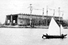
By the late 19th century, Mykolaiv's port ranked third in the Russian Empire, after Saint Petersburg and Odessa, in terms of trade with foreign countries. In addition, grain export suppliers of the steppe region (of Ukraine and Southern Russia) were first in the Russian Empire. Mykolaiv had become a great industrial center in the South of Ukraine.[24]
Mykolaiv was major Jewish centre of Russian Empire in the 19th century. In the 19th century, the Czarist governments had largely banned Russian Empire Jews from living East of the Dnieper River. Mykolaiv is in the area west of the Dnieper, which was where Jews were legally allowed to reside (the legal area of Jewish residence was known as the Pale of Settlement). The Lubavitcher Rebbe, Menachem Mendel Schneerson (the seventh leader in the Chabad-Lubavitch dynasty) was born in Mykolaiv on 18 April 1902.
In 1918, Mykolaiv survived its first occupation by foreign troops. In 1920, Soviet power was established there.[24]
With the beginning of World War II Mykolaiv was occupied on 16 August 1941. In September, German forces massacred over 35,000 non-combatants, many of them Jews, in the city and its region. During the occupation, an underground partisan sabotage group, the Mykolaiv Center conducted guerilla activities. On 28 March 1944 the city was liberated, in part because of Soviet Senior Lieutenant Konstantin F. Olshansky's paratroopers and their daring raid, during which the majority of his troops were killed.
In the post-war period Mykolaiv became one of shipbuilding centers of the USSR, with three shipyards: Black Sea, 61 Kommunara, and Okean.
The asteroid 8141 Nikolaev (1982 SO4) was discovered in 1982 by Nikolai Chernykh at the Crimean Astrophysical Observatory and was named in honor of the city.[26]
In March 2012, Mykolaiv gained international notoriety for lawlessness and police corruption following the rape and murder of Oksana Makar.[27] Her three attackers were apprehended, but two were released because of family connections to local government officials. After a media outcry and public protests, all three attackers were charged with her murder.
During the Euromaidan protests, Mykolayiv was the scene of anti-Yanukovich protests. After the victory of Euromaidan, the situation calmed down somewhat until 7 April 2014 when some pro-Russians tried to take over the local administration building. As a result, the pro-Ukrainians stopped them from taking over the administration building and destroyed the pro-Russian camp not far from it, after which the situation in the city became definitively calm.[28]
Demographics
| Ethnicity | 1897[29] | 1926[30] | 1939[31] | 1959[32] | 1989[33] | 2001[33] | 2017[34] |
|---|---|---|---|---|---|---|---|
| Ukrainians | 8.5% | 29.9% | 49.7% | 59.7% | 63.2% | 72,6% | 84% |
| Russians | 66.3% | 44.6% | 31.0% | 30.3% | 31.2% | 22.6% | 12% |
| Jews | 19.5% | 20.8% | 15.2% | 6.8% | 2.1% | 0.5% | |
| Belarusians | 0.2% | 0.3% | 0.7% | 1.0% | 1.1% | 0.8% | |
| Bulgarians | 0.1% | 0.2% | 0.6% | 0.6% | |||
| Poles | 2.8% | 1.7% | |||||
| Germans | 0.9% | 1.1% | 0.9% | 0.1% |
As of 2017, 63% of the population spoke Russian at home, 7% Ukrainian, and 28% spoke both Ukrainian and Russian equally.[34]
Awards
The Soviet Government awarded Mykolaiv the Order of the Red Banner of Labour on 31 December 1970, for successfully fulfilling its assignments for the development of industrial production, in the USSR's five-year economic plan.
Administrative districts
Mykolaiv is divided into four districts:
The Tsentralnyi District is located in the northwest of the city. It includes the historic center of Mykolaiv, Rocket tract, Temvod, Salt, Northern, Ternovka (in Ternovca also acts village council), Matveevka, Varvarovka.
The Zavodskyi District is located in the west of the city. In this area, many industrial enterprises are concentrated. It also includes neighborhoods Lescaut and Alluviation, as well as towns of Velyka Koreniha and Mala Koreniha.
The Inhulskyi District (former Leninskyi District) is located in the east of Mykolaiv. Among other things, it includes the new Horticulture, YUTZ, New Watering, Old Watering. The district has a zoo, bus and railway stations.
The Korabelnyi District is located in the south of the city. It includes a broad beam, Bogoyavlenske (former Zhovtneve), Balabanovka, Kulbakino.
Official symbols
Mykolaiv adopted its current coat of arms on 26 September 1997. Its design came from the one adopted in 1883, by removing the symbol of Kherson province to which Mykolaiv didn't belong anymore.[35] Mykolaiv adopted its current flag on 2 July 1999 and its anthem on 11 September 2004.[35]
Economy
Shipbuilding
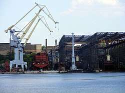
Today Mykolaiv is a major shipbuilding center of Ukraine (as, earlier, of the whole Soviet Union) and an important river port. The city has three major shipyards one of which is capable of building large navy ships. Other important industries are mechanical engineering, power engineering, metallurgy and last 10 years – food industry.
Mykolaiv was closed to foreign visitors until the late 1980s because of many clandestine Soviet Navy projects (as well as the Mykolaiv Air Force base, turbine factory and military port). The majority of the Soviet Navy's surface ships including its only aircraft carrier, the Kuznetzov were built in Mykolaiv.
In May 2011, Ukrainian President Viktor Yanukovych visited Mykolaiv and said that Ukraine is serious about reviving and further developing of its shipbuilding industry in the Mykolaiv region.[36]
Other industries
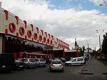
Electronic industries are located in the city. The enterprise "Zoriya – Mashproekt" manufactures equipment used in ships and products used for transportation of natural gas and generation of electricity.
One of the largest enterprises in the city is Mykolaiv Aluminia Factory, which produces aluminia, raw material for the production of aluminum.
In addition to heavy industry, the city has a developed food processing industry, including a juice maker, Sandora, a dairy products maker, Laktalis-Mykolaiv, and a brewery, Yantar. The enterprise Nibulon is one of the leaders in the Ukrainian agrarian market.
The Mykolaiv Armored Factory has been a large repair facility for Ukraine's military during the War in Donbass. Engineers at the plant designed an armored ambulance based on the BTR-70 to be used by the Ukrainian Armed Forces.[37]
In January 2017, Mykolaiv Development Agency has released a promo video of city's investment potential.[38]
Ukrainian military presence
Mykolaiv, being an important strategic city in southern Ukraine has a significant Ukrainian military presence, including the shipyards that build Ukraine's surface navy ships, the Mykolaiv Ukrainian Navy base, the "MARP" aircraft repair factory (Mykolaiv), and the Kulbakino army base (in the Mykolaiv Oblast, outside of the city of Mykolaiv).
Previously for many years after World War II the city had been home to the 92nd Guards Motor Rifle Division, the former 92nd Guards Rifle Division. The 79th Airmobile Brigade is based in the city.[39]
Transportation
Mykolaiv is one of Ukraine's most important transportation junctions. It is a major commercial river and sea port, and a major highway and rail junction.[40] Mykolaiv also has a dual-function passenger and freight airport, but passenger service at the airport is not significant, compared to Ukraine's major airports. In addition to the airport and sea and river port, Mykolaiv has two train stations, and an intercity bus station.
Air
Mykolaiv Airport (IATA code NLV), one of the largest and most technically well equipped airports in the South of Ukraine, serves the city. The airport, located northwest of Mykolaiv, is mainly used for air freight and only has limited passenger service. Russian airline UTAir Aviation offers flights from Mykolaiv to Moscow (Vnukovo – VKO airport). In addition, there are one-hour passenger flights from Odessa (the nearest major airport) to Mykolaiv. Almost all airline passenger service in the South West of Ukraine (where Mykolaiv is located) is through Odessa International Airport: to reach Mykolaiv by airplane, tourists generally reach Odessa by plane, and then take a bus, taxi or train, for approximately 2 hours, to Mykolaiv. Odessa, the largest city in South West Ukraine, is 132 km (82 miles) from Mykolaiv.[41]
Kulbakyno airport, also known as Nikolaev, is a Class I military air base located just to the southeast of the city center, in Kulbakyno. It primarily supports wings of Sukhoi Su-24, Sukhoi Su-25, Sukhoi Su-27, and Mikoyan MiG-29.[42]
Bus travel long distance
Mykolaiv is an 8.5-hour bus ride from Kiev's main bus station.[43] Ukrainian private national bus companies Gyunsel and Avtoluks operate overnight buses from Kiev to Mykolaiv seven nights per week. The bus station in Mykolaiv is located at Prospekt (Avenue) Bohoyavlenskyi 21.
Roads
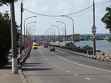
The main north–south highway that passes through Mykolaiv is H (or M)-14.
The main East-West Highway that passes through Mykolaiv is E-58 M-14 (West and then South to Odessa), and South East to Kherson, a major port on the Dneper River, just before it flows into the Black Sea. The E-58 M-14 then continues East to the major industrial city and port in South Eastern Ukraine, Mariupol'.
The main highways to and from Mykolaiv are from Kherson (65 km (40 mi)), Odessa (120 km (75 mi)), Uman (320 km (199 mi)), Chişinău (Kishniev), Moldova (325 km (202 mi)), the Crimean Peninsula (350 km (217 mi), Kiev (500 km (311 mi), Kharkiv (520 km (323 mi), Lviv (350 km (217 mi) (Western Ukraine). Ukraine's roads, including those leading from Mykolaiv, tend to be poorly maintained and can be very dangerous.
Roads through Mykolaiv include:
- the east-west Euro-Asian transport corridor: Odessa — Mykolaiv — Kherson — Dzhankoy — Kerch.
- the corridor Organization of the Black Sea Economic Cooperation: Reni — Izmail — Odessa — Mykolaiv — Kherson — Melitopol — Berdyansk — Mariupol — Novoazovsk.
the road M14 (Odessa — Novoazovsk), having an exit to the main highway M18 (Yalta — Simferopol — Kharkiv).
Roads to/from Mykolaiv include:
- R-06 (Ulianovka — Mykolaiv) with the highway M05 (Odessa — Kiev), which, in turn, is linked with the highway M12 in the city district of Uman, having an exit on the route Lublin — Warsaw — Gdańsk (Poland). The distance of the route Gdańsk — Mykolaiv is 1530 kilometers.
- N11 (Dnipro — Kryvyi Rih — Mykolaiv)
- N14 (Аleksandrovka — Kropyvnytskyi — Mykolaiv)
Bridges
Mykolaiv, being located at the confluence of two major rivers, has two main bridges.
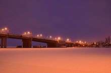
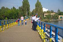
The Varvarivskyi Bridge over Southern Bug is a swing bridge with Europe's largest span (134 m).[44] It is also the southernmost bridge over the Southern Bug. The bridge connects the North coast of Mykolaiv to its Tsentralnyi Raion, located on the West Bank of the river. The Odeske Highway crosses the bridge and then continues south-west to Odessa.
Another major bridge is the Inhul Bridge crossing the Inhul River. The bridge leads from the north coast of Mykolaiv, and goes north-northeast to the peninsula on the north side of the Inhul, just north of Mykolaiv. On the north Side of the Inhul River, the Heroyiv Stalingrada Highway crosses the bridge, streaming into Pushkinska Street on the other side.
Rail
Overnight train travel in sleeper-berth passenger trains is a very common way to travel long distances in Ukraine, cheaper, more comfortable and faster than buses – and more environment-friendly, for that matter. There are nightly trains from Kiev's main passenger train station to Mykolaiv.[45]
In addition to Kiev, trains from Mykolaiv regularly run to the two closest major cities to Mykolaiv: Odessa (south west of Mykolaiv); and Kherson (south of Mykolaiv).[46] Direct trains to Moscow (26 hours), Kiev (8-10), Lviv (18), Odesa (5), the Crimea (8 hours) depart every day. Train departures timetable. All trains have coach cars.
Mykolaiv's passenger train station is called Mykolaiv – Passenger. It at the intersection of Myru Avenue and Novozavodska Street 5 (in Ukraine street address numbers are placed after the street name).[46] From the city square outside the railway station, buses depart to all other parts of Mykolaiv.
Mykolaiv's freight train station is called Mykolaiv-Gruzovoi (Freight). It is located at Pryvokzalna ploshcha (Square).[46]
Water-borne travel
Though a major Ukrainian commercial sea port, Mykolaiv has no regular passenger water-borne service. Water transport is offered by three sea ports and one river port, and also by several terminals. The port is linked with the sea by Dnieper-Bug Estuary canal. The canal begins at the island Berezan and extends 44 kilometers until it reaches the port of Mykolaiv. The canal consistes of 13 tracks, 6 of which reach Dnieper Estuary, and the rest — along the river Southern Bug. The width of the canal is 100 meters (330 feet). Its depth is 10.5 meters.
Large ocean-going ships can reach Mykolaiv year round, via the Southern Bug River. The Southern Bug River, which flows into the Black Sea 65 kilometres (40 miles) south of Mykolaiv, is 1.5 km (0.9 miles) wide in Mykolaiv. Mykolaiv's passenger river port is at Varvarovskii Spusk (Descent) 5.[46]
The ports are:
- Mykolaiv Commercial Sea Port
- Olvia[47]
- Dnieper-Bug Commercial Sea Port
- Mykolaiv River Port
Local transportation
The main forms of city transport are fixed-route marshrutkas, buses, trolley buses, and trams.
Streetcars (trams)
The length of Mykolaiv's streetcar (tram) lines is 73 kilometers. From 1897 until 1925 Mykolaiv's streetcars were pulled by horses. Streetcars began to be powered by electricity in 1915, and this has continued through the present. At their inception, the tracks were 1000 millimeters, but during the period from 1952 to 1972 they were switched to standard gauge.
Тrolley Buses
The length of Mykolaiv's trolley bus lines is 59 kilometers. Mykolaiv's trolley buses have operated since 29 October 1967.
Education
There are several universities in Mykolaiv. The main universities are: Admiral Makarov National University of Shipbuilding (leading shipbuilding university in Ukraine), Petro Mohyla Black Sea State University, Sukhomlinsky National University of Mykolaiv and Mykolaiv State Agrarian University.
Sukhomlinsky National University of Mykolaiv is the oldest university in Mykolaiv. The idea of the university foundation arose in the 1860s, but it was realized only on July 18, 1913, when the Mykolaiv Teacher's Institute was founded. Nowadays there are 7,000 students studying at the university, 300 teachers working at 36 departments. Annually, the University graduates 1,000 specialists and 60-70 undergraduates.
There are 10 higher education institutions in Mykolaiv of level III or IV accreditation. 65 general education schools, lycees, gymnasium schools, 3 evening schools, and 12 private learning institutions are in the city.
In a survey in June–July 2017, adult respondents reported the following educational levels:[34]
- 5% primary or incomplete secondary education.
- 26% general secondary education.
- 31% vocational secondary education.
- 38% university education (including incomplete university education).
Society
Religion
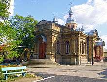
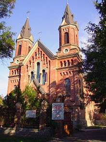
Mykolaiv is the headquarters of the Mykolaiv Episcopate of the Ukrainian Orthodox Church of the Moscow Patriarchate, which has 18 churches (temples) in the city.
Mykolaiv is also the headquarters of the Mykolaiv Episcopate of the Ukrainian Orthodox Church of the Kyivan Patriarchate.
A survey in June–July 2017 reported the following results for Mykolaiv:[34]
- 19% Ukrainian Orthodox Church of the Kyivan Patriarchate.
- 16% Ukrainian Orthodox Church of the Moscow Patriarchate.
- 16% atheist.
- 4% belong to other religions.
- 44% believe in God, but do not belong to any religion.
- 2% found it difficult to answer.
Culture
There are three performing arts theaters in Mykolaiv: the Academic Ukrainian Theater of Drama and Musical Comedy, the Mykolaiv State Puppet Theater, and the Mykolaiv Academic Art Russian Drama Theater. In addition, the Mykolaiv Oblast Philharmonic performs in the city.
Mykolaiv has the following museums: Mykolayiv Regional Museum of Local History, The Museum of Shipbuilding and Fleet, the Museum of the World War II Partisan Movement, the V. V. Vereshchagin Art Museum.
Three movie theaters operate in Mykolaiv: Rodina (Motherland), Pioneer, Multiplex. Movies shown include the latest Hollywood films dubbed into Ukrainian and modern Russian films.
Media
Popular publications include "Vecherniy Nikolayev" (Evening Mykolaiv), "Nikolaevsckie Novosti" (Mykolaiv News), and "Yuzhnaya Pravda" (Southern Truth). Many publications have an Internet version, but exist in an independent Internet publication.
Television programs that are broadcast in Mykolaiv include movies, news, dramas (some of which originated in other countries, such as Mexico and the US, and are dubbed), cartoons, and professional sporting events such as Ukrainian football (soccer). Mykolaiv has the following TV channels: 1+1; 2+2; 5 Kanal; ICTV; Inter; Real Estate TV; Tonis: K1: Kanal Ukraina; Kultura (Ukraina); CTB; TV: TET; and TRK. http://www.vipiko.tv/cgi-bin/html.cgi?id_paket=697.
Sports
Mykolaiv is represented within Ukrainian Bandy and Rink-bandy Federation.[48]
MFC Mykolaiv (Municipal Football Club "Mykolaiv", Ukrainian: Муніципальний футбольний клуб "Миколаїв") is a Ukrainian football club. The club has been demoted three times from the Ukrainian Premier League. MFС Mykolaiv's best achievement in the Ukrainian Premier League was 13th place (in 1994–95). MFC Mykolaiv reached 1st place in Druha Liha group A in 2010–11 season and was promoted to Persha Liha. Mykolaiv's main football stadium is at the west end of Tsentralnyi Prospekt, near the west end of the peninsula that Mykolaiv is on.
Mykolaiv's professional basketball team is MBC Mykolaiv. The team has won or finished second or third in several international tournaments since 1988, and won the Ukrainian Championship in 1992. MBC Mykolaiv is part of the Ukrainian Basketball SuperLeague, which is the top professional basketball league in Ukraine.
Gallery
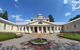
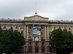
 A historical building in Mykolaiv
- Dekabrystiv Street
- Admiral Makarov Street
 Early 20th century rotunda
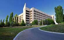
 A highrise building in Mykolaiv
 Modern apartment blocks in Mykolaiv
International relations
Mykolaiv is part of the International Black Sea Club and The World Council of Environmental Initiatives (ICLEI).
Twin towns – sister cities
Notable residents
- Mykola Arkas (1853–1909) – Ukrainian composer and historian
- Isaak Babel (1894–1940) – journalist and writer, spent part of his childhood in Mykolaiv
- Georgy Brusilov (1884–1914?) – Arctic explorer
- Solomon Rufus Davis (Desyatnik) (1916–2006) – political scientist in Australia, born in Mykolaiv
- Art Hodes (1904-1993) - jazz pianist born in Mykolaiv, emigrated to Chicago as a child
- Stepan Makarov (1849–1904) – commander of the Imperial Russian Navy, oceanographer, and author
- Yuri Nosenko (1927–2008) – KGB defector, born in Mykolaiv
- Rabbi Menachem Mendel Schneerson (1902–1994), born in Mykolaiv
- African Spir (1837–1890) – philosopher, studied in Mykolaiv
- Leon Trotsky - revolutionary, studied in Mykolaiv
- Oleg Voloshyn (born 1981) - Russian-Ukrainian journalist, political pundit, and former government official.
References
- Mayors of Mykolayiv, Ivano-Frankivsk become known after elections, Ukrinform (16 November 2015)
- https://www.pravda.com.ua/news/2018/03/16/7174836/
- "Чисельність наявного населення України (Actual population of Ukraine)" (PDF) (in Ukrainian). State Statistics Service of Ukraine. Retrieved 1 July 2016.
-
Compare: Bagalei, Dmitrii Ivanovich (2016) [1889]. Колонизация Новороссийского края и первые шаги его по пути культуры [The colonisation of the Novorossiya region and its first steps on the path of culture] (in Russian). Litres. ISBN 9785040006410. Retrieved 21 November 2016.
В 1788 году, по приказанию Потемкина, в небольшой деревне Витовке были построены казармы в госпиталь, а на реке Ингуле заведена верфь.
- Montefiore, Simon. "Potemkin: Catherine The Great’s Imperial Partner," Vintage Books, 2000, p.277
- "Ордера князя Потемкина-Таврического 1788 - 1791 гг. М.Л. Фалееву - Библиотека "Феникс". История Новороссии". sites.google.com. Retrieved 18 November 2017.
- http://history.mk.ua/vernoleninsk-wernoleninsk-vernoleninsk.htm
- Благоустройство города Archived 4 May 2012 at the Wayback Machine, gorsovet.mk.ua
- Mykolayiv City Council: Nikolaev. Socio-economic characteristics Archived 24 April 2012 at the Wayback Machine
- Состояние окружающей природной среды Archived 4 May 2012 at the Wayback Machine, gorsovet.mk.ua
- Обращение с отходами Archived 4 May 2012 at the Wayback Machine, gorsovet.mk.ua
- Объекты природно-заповедного фонда Archived 4 May 2012 at the Wayback Machine, gorsovet.mk.ua
- "Погода в Николаеве на сегодня, завтра - METEOPROG.UA". METEOPROG. Retrieved 18 November 2017.
- "Climatology Maps: Mean of daily maximum temperature". European Climate Assessment & Dataset. Retrieved 28 April 2016.
- "Climatology Maps: Mean of daily mean temperature". European Climate Assessment & Dataset. Retrieved 28 April 2016.
- "Climatology Maps: Mean of daily minimum temperature". European Climate Assessment & Dataset. Retrieved 28 April 2016.
- "Climatology Maps: Precipitation Sum". European Climate Assessment & Dataset. Retrieved 28 April 2016.
- "Climatology Maps: Wet Days (RR>=1.0 mm)". European Climate Assessment & Dataset. Retrieved 28 April 2016.
- "Indices data: Minimum of daily minimum temperature and Maximum of daily maximum temperature". European Climate Assessment & Dataset. Retrieved 23 April 2016.
- "Nikolaev (Mykolaiv) Climate Normals 1961–1990". National Oceanic and Atmospheric Administration. Retrieved 28 April 2016.
- Struk, Danylo Husar (18 November 1993). "Encyclopedia of Ukraine". University of Toronto Press. Retrieved 18 November 2017 – via Google Books.
- 2,500-YEAR-OLD SUNKEN ANCIENT GREEK SHIP USED TO SAIL TO CRIMEA DISCOVERED IN UKRAINE’S BLACK SEA WATERS
- "BBC Sport – Olga Kharlan's school – School No 4, Mykolaiv, Ukraine". BBC News. 10 September 2010. Retrieved 26 March 2013.
- History of the city Archived 22 May 2012 at the Wayback Machine, gorsovet.mk.ua
- Lyman Igor and Konstantinova Victoria. William George Wagstaff – British Consul, Responsible for Ekaterinoslav Province and Ports of the Sea of Azov, in Історія і культура Придніпров’я: Невідомі та маловідомі сторінки, 2016, вип. 12. – pages 57-62
- "8141 Nikolaev (1982 SO4)". Jet Propulsion Laboratory.
- "Teen dies after horror gang rape". Herald Sun. Retrieved 18 November 2017.
- "Meet the people behind Novorossiya's grassroots defeat". Euromaidan Press. 13 August 2015. Retrieved 23 March 2020.
- Первая всеобщая перепись населения Российской Империи 1897 г. Распределение населения по родному языку и уездам 50 губерний Европейской России. г. Николаев (воен. губернаторство) Archived 12 July 2015 at the Wayback Machine
- Всесоюзная перепись населения 1926 года. Национальный состав населения по регионам республик СССР. Николаевский округ. Городские поселения. Archived 12 July 2015 at the Wayback Machine
- Всесоюзная перепись населения 1939 года. Национальный состав населения районов, городов и крупных сел союзных республик СССР Archived 12 July 2015 at the Wayback Machine
- Кабузан В. М. Украинцы в мире динамика численности и расселения Archived 31 December 2014 at the Wayback Machine
- Administrator. "Видавництво ім. Олени Теліги". teliha.com.ua. Archived from the original on 6 March 2016. Retrieved 18 November 2017.
- "Public Opinion Survey of Residents of Ukraine June 9 – July 7, 2017" (PDF). iri.org. August 2017. p. 89. Archived from the original (PDF) on 22 August 2017.
- "City attributes - Nikolaev city council". Mykolaiv City Council. Retrieved 18 November 2017.
- "Marine Log: Yanukovych seeks shipbuilding revival". Kyivpost.com. 18 May 2011. Retrieved 26 March 2013.
- "Armored ambulance based on the BTR-70". Unian.
- Promo invest in Mykolaiv PN.MK.UA
- "Ukrainian Military Pages: Високомобільні десантні війська" [Structure of the Airmobile Troops]. www.ukrmilitary.com (in Ukrainian). Retrieved 4 July 2016.
- "Nikolaev Ukraine city overview, history, attractions, photos". Ukrainetrek.com. Retrieved 26 March 2013.
- Ukraine travel guide Archived 20 April 2012 at the Wayback Machine
- "Ukraine Air Force Bases". GlobalSecurity.
- "Расписание автобусов - НИКОЛАЕВ". Transport.turne.com.ua. Retrieved 26 March 2013.
- "History". Kyivdiprotrans Institute. Archived from the original on 30 December 2013. Retrieved 19 August 2013.
- Заказ гостиниц. "Расписание поездов: Николаев - Киев, стоимость билета, заказ железнодорожных билетов на поезд. Купить жд билеты Николаев - Киев". Tutu.ru. Retrieved 26 March 2013.
- "Вокзалы Николаева". Rtpp.com.ua. Retrieved 26 March 2013.
- (in Ukrainian) Port "Oktyabrsk" renamed "Olvia", Espreso.tv (18 October 2016)
- "Google Translate". Translate.google.co.uk. Retrieved 26 March 2013.
- "Міста-партнери". mkrada.gov.ua (in Ukrainian). Mykolaiv. Retrieved 30 March 2020.
Notes
- Station ID for the Mykolaiv is 254
External links
| Look up Mykolaiv in Wiktionary, the free dictionary. |
| Wikimedia Commons has media related to Mykolaiv. |
- Official portal of The Mykolaiv City Council Note that the Ukrainian language version has more working features than the English and Russian language versions.
- Nikolaev Travel Guide for English speaking visitors

