List of crossings of the Saint Lawrence River and the Great Lakes
This is a list of bridges, ferries, and other crossings of the Gulf of St. Lawrence, Saint Lawrence River, and Great Lakes, by order of south shore terminal running from the Gulf of Saint Lawrence upstream to Lake Superior.
| Key: Communities linked by individual crossings |
|---|
(N) or (E): North- or East-shore terminal (mainland)
(I): Island served by the crossing
(S) or (W): South- or West-shore terminal (mainland) |
Crossings
Quebec
Lower and Middle Saint Lawrence
Island of Montreal
| Crossing | Picture | Year built[A] | Communities linked | Carries | Name origin | Coordinates |
|---|---|---|---|---|---|---|
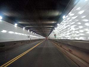
| Louis Hippolyte Lafontaine Bridge-Tunnel |  |
1967[6][I] | (N) Borough of Mercier–Hochelaga-Maisonneuve | Autoroute 25/Trans-Canada Highway |
Louis-Hippolyte Lafontaine (1807–1864), Prime Minister of the United Province of Canada | 45°35′0″N 73°29′51″W |
| (I) Île Charron (Îles de Boucherville) (exit) | ||||||
| (S) Longueuil, borough of Vieux-Longueuil | ||||||
| Old Port of Montreal–Longueuil Ferry | 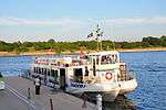 |
(N) Borough of Ville-Marie (Jacques-Cartier Pier, Old Port of Montreal) | — |
45°30′25″N 73°33′1″W | ||
| (I) Saint Helen's Island (Parc Jean-Drapeau) | 45°30′40.15″N 73°32′15.5″W | |||||
| (S) Longueuil, borough of Le Vieux-Longueuil (Réal-Bouvier Marina) | 45°32′23.6″N 73°31′4.5″W | |||||
| Jacques Cartier Bridge | 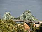 |
1930[7][J] | (N) Borough of Ville-Marie | Route 134 Pedestrians and bicycles |
Jacques Cartier (1491–1557), French explorer | 45°31′17″N 73°32′28″W |
| (I) Île Sainte-Hélène (exit) and Île Notre-Dame | ||||||
| (S) Longueuil, borough of Vieux-Longueuil | ||||||
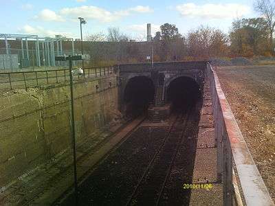
| Montreal Metro Tunnel |  |
1966[8] | (N) Borough of Ville-Marie (Berri-UQAM station) | Montreal Metro Line 4 Yellow | — |
45°30′N 73°32′W |
| (I) Île Sainte-Hélène (Jean-Drapeau station) and Île Notre-Dame | ||||||
| (S) Longueuil, borough of Vieux-Longueuil (Longueuil–Université-de-Sherbrooke station) | ||||||
| Pont de la Concorde Bridge[B] | 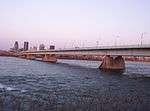 |
1965[9][K] | (N) Borough of Ville-Marie | Pierre-Dupuy Avenue and Route Verte 1 and 2 | Reference to Montreal's motto, Concordia salus[9] | 45°30′22″N 73°32′17″W (Pont de la Concorde)
45°30′28″N 73°31′49″W (Pont des Îles) |
| (I) Île Sainte-Hélène and Île Notre-Dame (Parc Jean-Drapeau), borough of Ville-Marie, Montreal | ||||||
| Victoria Bridge | 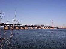 |
1898[10][L] | (N) Borough of Le Sud-Ouest | Route 112 Canadian National Railway (CN) RTM Mont-Saint-Hilaire line commuter train Via Rail and Amtrak passenger trains |
Queen Victoria of the United Kingdom (1819–1901) | 45°29′29″N 73°31′46″W |
| (S) Saint-Lambert | ||||||
| Samuel de Champlain Bridge | 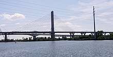 |
2019[11][M] | (N) Borough of Verdun | Samuel de Champlain (c. 1580–1635), founder of Quebec City | 45°28′7″N 73°31′15″W | |
| (I) Île des Sœurs (exit) | ||||||
| (S) Brossard | ||||||
| Champlain Bridge | 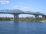 |
1962 (closed 2019)[11][M] | (N) Borough of Verdun | Samuel de Champlain (c. 1580–1635), founder of Quebec City | 45°28′7″N 73°31′15″W | |
| (I) Île des Sœurs (exit) | ||||||
| (S) Brossard | ||||||
| Champlain Bridge Ice Structure | 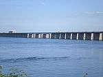 |
1964[12][N] | (I) Île des Sœurs | Route Verte 1 and 2 | 45°27′57″N 73°31′11″W | |
| (S) St. Lawrence Seaway levee | ||||||
| Honoré Mercier Bridge | 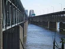 |
1934, 1963[13][O] | (N) Borough of LaSalle | Route 138 |
Honoré Mercier (1840–1894), Premier of Quebec | 45°25′0″N 73°39′18″W |
| (S) Kahnawake Mohawk Reserve | ||||||
| Saint-Laurent Railway Bridge | 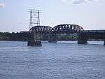 |
1886[14] | (N) Borough of LaSalle | Canadian Pacific Railway (CPR)
Réseau de transport métropolitain (RTM) Candiac line (commuter train) |
Saint Lawrence River | 45°25′8″N 73°39′34″W |
| (S) Kahnawake Mohawk Reserve | ||||||
| Île-Dorval ferry[B] | (N) Dorval | 45°26′17″N 73°44′22″W | ||||
| (I) Dorval Island | 45°26′0″N 73°44′32″W | |||||
Upper Saint Lawrence and Beauharnois Canal
| Crossing | Picture | Year built[A] | Communities linked | Carries | Name origin | Coordinates |
|---|---|---|---|---|---|---|
| Boulevard Edgar Hébert Bridge[P] (Beauharnois Canal) | 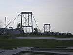 |
(I) Melocheville | Edgar Hébert (1911–1984), MNA for Beauharnois (1948–1962).[15] | 45°18′57″N 73°54′28″W | ||
| (S) Beauharnois | ||||||
| Pied-du-Canal Bridge (Beauharnois Canal) | (I) Melocheville | CSX Rail | Reference to the position of the bridge, close to the canal's downstream end. | 45°17′58″N 73°55′13″W | ||
| (S) Beauharnois | ||||||
| Serge-Marcil Bridge (main channel) | .jpg) |
(N) Vaudreuil-Dorion | Serge Marcil (1944-2010), former Member of the National Assembly who served the riding of Beauharnois | 45°18′25″N 74°00′53″W | ||
| (I) Melocheville | ||||||
| Madeleine-Parent Bridge (Beauharnois Canal) | .jpg) |
Madeleine Parent (1918-2012), former trade union activist | 45°17′51″N 73°55′16″W | |||
| (S) Beauharnois | ||||||
| St. Louis Bridge (Beauharnois Canal) | 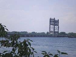 |
(I) Salaberry-de-Valleyfield (Saint-Timothée) | Boulevard Pie-XII (Salaberry) Rue du Pont (Saint-Louis) |
Municipality of Saint-Louis-de-Gonzague.[16] | 45°13′50″N 74°0′4″W | |
| (S) Saint-Louis-de-Gonzague | ||||||
| Larocque Bridge (Beauharnois Canal) | 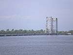 |
(I) Salaberry-de-Valleyfield | Larocque Street in Salaberry-de-Valleyfield. The origin of the name Larocque is unknown.[17] | 45°13′23″N 74°6′57″W | ||
| (S) Saint-Stanislas-de-Kostka | ||||||
| Monseigneur Langlois Bridge (main channel) | 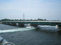 |
(N) Coteau du Lac | Joseph-Alfred Langlois, bishop of Valleyfield[18] | 45°16′21″N 74°10′53″W | ||
| (I) Salaberry-de-Valleyfield (Grande-Île) | ||||||
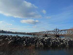
| Coteau Railway Bridge (main Channel) | 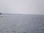 |
(N) Coteau du Lac | Canadian National Railway | Les Coteaux, Quebec | 45°15′30″N 74°10′57″W | |
| (I) Salaberry-de-Valleyfield (Grande-Île) | ||||||
Ontario and the United States
Upper Saint Lawrence River
| Crossing | Picture | Year built[A] | Communities linked | Carries | Name origin | Coordinates |
|---|---|---|---|---|---|---|
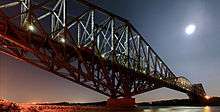
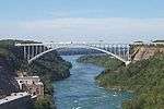
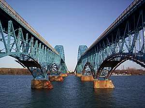
| Three Nations Crossing (North Channel Bridge) | 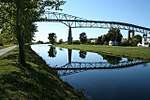 |
1962
|
(N) Cornwall, Ontario | Access to |
Mohawks of Akwesasne | 45°0′29″N 74°44′22″W |
| (I) Akwesasne (Cornwall Island) | ||||||
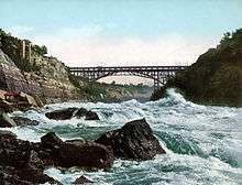
| Three Nations Crossing (South Channel Bridge) | 1958 | 44°59′23″N 74°44′22″W | ||||
| (S) Massena, New York | ||||||
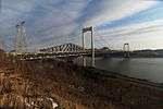
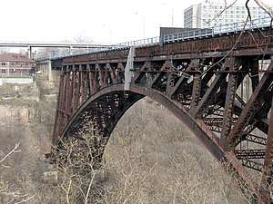
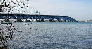
| Ogdensburg-Prescott International Bridge | 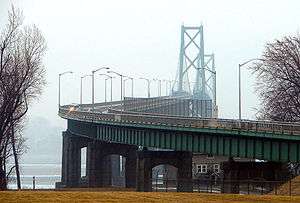 |
1960[20] | (N) Johnstown, Ontario | Ogdensburg, New York Prescott, Ontario |
44°44′7″N 75°27′35″W | |
| (S) Ogdensburg, New York | ||||||
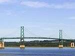
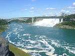
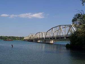
| Thousand Islands Bridge | 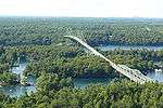 |
1938[21] | (N) Ivy Lea, Ontario | Thousand Islands | 44°20′51″N 75°59′1″W | |
| (I) Wellesley Island | ||||||
| (S) Orleans, New York | ||||||
| Murray Isle Ferry[B] | (I) Murray Isle | |||||
| (S) Mason Point, New York | ||||||
| Grindstone Island Ferry[B] | (I) Grindstone Island | |||||
| (S) Clayton, New York | ||||||
| Howe Island Township Ferry[B] | (N) Gananoque, Ontario | |||||
| (I) Howe Island | ||||||
| Howe Island County Ferry[B] | (N) Pitt's Ferry | |||||
| (I) Howe Island | ||||||
| Carleton Island Ferry[B] | (I) Carleton Island | |||||
| (S) Cape Vincent, New York | ||||||
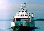
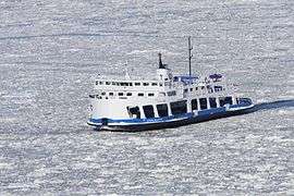
| Kingston-Wolfe Island Ferry | 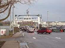 |
(N) Kingston, Ontario | Frontenac County Road 95 | 44°13′55″N 76°28′34″W | ||
| (I) Wolfe Island (Ontario) | 44°11′38″N 76°26′34″W | |||||
| Horne's Ferry | 44°8′7″N 76°21′14″W | |||||
| (S) Cape Vincent, New York | 44°7′48″N 76°20′6″W | |||||
Lake Ontario and Niagara River
Lake Erie / Bass Islands
| Crossing | Picture | Year built[A] | Communities linked | Carries | Name origin | Coordinates |
|---|---|---|---|---|---|---|
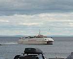
| Leamington - Pelee Island - Sandusky Ferry | 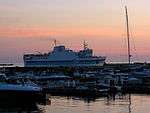 |
(N) Leamington, Ontario | North end: Erie Street Middle: Pelee Island Ferry Terminal South End: |
— |
||
| (I) Pelee Island | ||||||
| (S) Sandusky, Ohio | ||||||
| Marblehead - Kelleys Island Ferry | (I) Kelleys Island | Connecting: |
— |
|||
| (S) Marblehead, Ohio | ||||||
| Put-In-Bay - Port Clinton Ferry | (I) Put-In-Bay, Ohio | Connecting: |
— |
|||
| (S) Port Clinton, Ohio | ||||||
Detroit and St. Clair Rivers
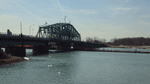
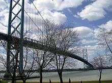
.jpg)
Straits of Mackinac and Soo Locks area
| Crossing | Picture | Year built[A] | Communities linked | Carries | Name origin | Coordinates |
|---|---|---|---|---|---|---|
| Bois Blanc Island Ferry | (I) Pointe Aux Pins, Michigan | Connections with: |
||||
| (S) Cheboygan, Michigan | ||||||
| Mackinaw City - Mackinac Island Ferry | 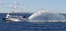 |
(I) Mackinac Island | Connecting: with: (bicycles and pedestrians only) |
|||
| (S) Mackinaw City, Michigan | ||||||
| St. Ignace - Mackinac Island Ferry | (I) Mackinac Island | Connecting: with: (bicycles and pedestrians only) |
||||
| (W) St. Ignace, Michigan | ||||||
| Drummond Island Ferry | 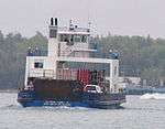 |
(I) Drummond Island | ||||
| (W) De Tour Village, Michigan | ||||||
| Barbeau - Neebish Island Ferry | (I) Neebish Island | Ferry Road | ||||
| (W) Barbeau, Michigan | ||||||
| Sugar Island Ferry | (I) Sugar Island | Connecting Portage Avenue / Riverside Drive with 1 1/2 Mile Road | ||||
| (W) Sault Ste. Marie, Michigan | ||||||
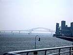
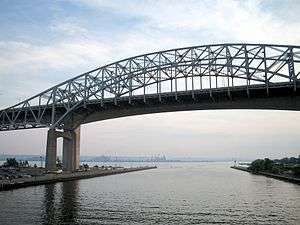
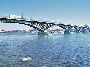
| Sault Ste. Marie International Bridge | 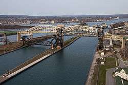 |
1962 | (N) Sault Ste. Marie, Ontario | Sault Ste. Marie, twin cities in Ontario and Michigan | 46°30′12″N 84°21′45″W | |
| (I) Sault Ste. Marie, Michigan | ||||||
| Mackinac Bridge | 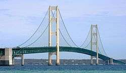 |
1957 | (I) St. Ignace, Michigan | Straits of Mackinac | 45°49′02″N 84°43′39″W | |
| (S) Mackinaw City, Michigan | ||||||
Lake Huron / Georgian Bay, Ontario
| Crossing | Picture | Year built[A] | Communities linked | Carries | Name origin | Coordinates |
|---|---|---|---|---|---|---|
| Bernt Gilbertson Bridge | 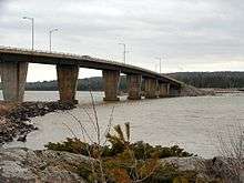 |
(I) St. Joseph Island | Bernt Gilbertson (?-1975), MPP for Algoma, 1967-1975 | |||
| (N) 2 km south of | ||||||
| Little Current Swing Bridge | 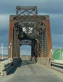 |
(S) Little Current, Ontario | Little Current, Ontario | |||
| (N) Turner, Ontario | ||||||
| MS Chi-Cheemaun Ferry | 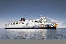 |
(S) South Baymouth, Ontario | "Big canoe" in Ojibwe | |||
| (N) Tobermory, Ontario | ||||||
Lake Superior
| Crossing | Picture | Year built[A] | Communities linked | Carries | Name origin | Coordinates |
|---|---|---|---|---|---|---|
| Portage Lake Lift Bridge | 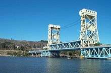 |
1959 | (N) Hancock, Michigan | Portage Lake, a segment of the Keweenaw Waterway | ||
| (S) Houghton, Michigan | ||||||
| Isle Royale ferry | 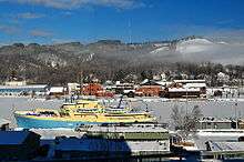 |
(N) Isle Royale, Michigan | ||||
| (S) Houghton, Michigan | ||||||
| Madeline Island Ferry | 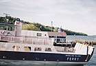 |
(I) La Pointe, Wisconsin | Connecting: |
|||
| (S) Bayfield, Wisconsin | ||||||
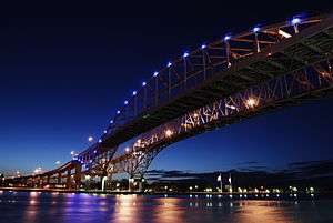
| John A. Blatnik Bridge | 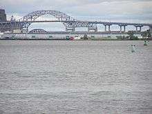 |
1961 | (E) Superior, Wisconsin | John Blatnik (1911-1991), Congressional Representative for Minnesota's 8th congressional district, 1947-1975 | ||
| (W) Duluth, Minnesota | ||||||
| Richard I. Bong Memorial Bridge |  |
1985 | (E) Superior, Wisconsin | Richard Ira Bong (1920-1945), World War II fighter pilot | ||
| (W) Duluth, Minnesota | ||||||
Lake Michigan
| Crossing | Picture | Year built[A] | Communities linked | Carries | Name origin | Coordinates |
|---|---|---|---|---|---|---|
| Beaver Island Ferry | (I) Beaver Island, Michigan | Connection to: |
||||
| (S) Charlevoix, Michigan | ||||||
| North Manitou Island Ferry | (E) Leland, Michigan | Connection to: |
||||
| (I) North Manitou Island, Michigan | ||||||
| South Manitou Island Ferry | (E) Leland, Michigan | Connection to: |
||||
| (I) South Manitou Island, Michigan | ||||||
| Washington Island Ferry | 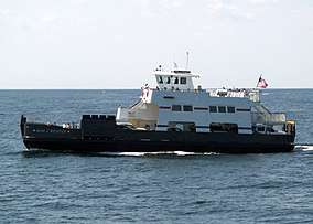 |
(I) Washington Island, Wisconsin | Connecting: |
|||
| (S) Northport, Door County, Wisconsin | ||||||
| SS Badger |  |
(E) Ludington, Michigan | "Bucky Badger", athletic mascot for the University of Wisconsin–Madison | |||
| (W) Manitowoc, Wisconsin | ||||||
| Lake Express Ferry | 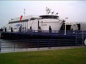 |
(E) Muskegon, Michigan | Connections with: Muskegon: Estes Street to: Milwaukee: |
|||
| (W) Milwaukee, Wisconsin | ||||||
See also
Notes
- A The year of construction of the original structure. In the case of ferries, no date is given, as the beginning of a ferry link is often not documented.
- B Provides only a partial crossing.
- D Nordik Express offers, in addition to links to Rimouski, Sept-Îles, and Havre-Saint-Pierre, a ferry link to several communities along the Basse-Côte-Nord. Its easternmost terminal is in Blanc-Sablon, Quebec.
- E Quebec Bridge is the lowermost fixed crossing of the whole river.
- I The Louis-Hippolyte Lafontaine complex consists of a tunnel from Montreal to Île Charron and a bridge from Île Charron to the South Shore.[6]
- J Jacques-Cartier Bridge was originally named Harbour Bridge/Pont du Havre, and renamed after Jacques Cartier in 1934 (400th anniversary of Cartier's first voyage). The section over the St. Lawrence Seaway was lifted to a new height in 1962.[7]
- K Pont de la Concorde (Concorde Bridge) and Pont des Îles ("Bridge of the Islands") were built for Expo 67.[9] Pont de la Concorde connects Montreal Island to Saint Helen's Island, while Pont des Îles connects Saint Helen's Island to Notre-Dame Island.
- L Victoria Bridge was built as a one-track tubular bridge which opened in 1860, then rebuilt as a two-track truss bridge in 1898. The South Y approach was rebuilt around the Saint-Lambert locks of the St. Lawrence Seaway in 1961.[10]
- M At the north end of Champlain Bridge, two spans, one north-south (aut. 15 and 20) and one east-west (aut. 10) connect Île des Sœurs to I. of Montreal. These two spans, called Pont Île-des-Sœurs and Pont Clément, are part of the Champlain Bridge complex.[11]
- N The Champlain Bridge Ice Structure, known in French as "l'Estacade Champlain," was built to control ice floes coming from the Laprairie Basin.[12]
- O The section of Honoré-Mercier bridge spanning over the St. Lawrence Seaway was rebuilt to seaway standards in the 1950s. The bridge was twinned by an identical one, on the downriver side, which opened in 1963.[13]
- P The Edgar Hébert Boulevard crossing consists of a suspension bridge over the discharge of the Beauharnois Power Station and a tunnel under the locks of Beauharnois Canal.
- Q The South Channel Bridge was demolished in 1958, and the North Channel Bridge in 1965.
- R The Burlington Bay Skyway does not cross between both sides of the St. Lawrence/Great Lakes river system, but it is a major thoroughfare crossing the western tip of Lake Ontario, which allows motorists to drive around the city of Hamilton.
References
- Janberg, Nicolas (2006). "Structurae [fr] - Pont de l'Île d'Orléans" (in French). Structurae (fr). Retrieved 2010-04-06.
- Jansberg, Nicolas (2004). "Quebec Bridge". Structurae [en]. Retrieved 2010-04-06.
- Jansberg, Nicolas (2006). "Pierre Laporte Bridge". Structurae [en]. Retrieved 2010-04-11.
- Jansberg, Nicolas (2004). "Laviolette Bridge". Structurae [en]. Retrieved 2010-04-11.
- "Toponymie Trois-Rivières". City of Trois-Rivières. 2010. Archived from the original on 2010-04-10. Retrieved 2010-04-11.
- "Pont-tunnel Louis-Hippolyte-La Fontaine (40 ans)" (in French). Transports Québec. Archived from the original on 2011-07-16. Retrieved 2009-08-19. |language=French
- "The Jacques Cartier Bridge: History". Jacques Cartier and Champlain Bridges Incorporated. Archived from the original on 2009-07-05. Retrieved 2009-09-14.
- "Important dates in STM's history". Société de Transport de Montréal. Archived from the original on 2009-06-21. Retrieved 2009-09-14.
- "Fiche toponymique" (in French). Commission de toponymie du Québec. 2007. Retrieved 2009-08-24.
- "The Victoria Bridge". City of Montreal. 2003. Retrieved 2009-09-14.
- "The Champlain Bridge and Bonaventure Expressway". Jacques Cartier and Champlain Bridges Incorporated. Archived from the original on 2010-07-29. Retrieved 2009-09-14.
- "The Champlain Bridge Ice Control Structure". Les Ponts Jacques-Cartier et Champlain Incorporée. Archived from the original on 2011-06-14. Retrieved 2009-07-20.
- Les Ponts Jacques-Cartier et Champlain Incorporée. "Histoire du pont Mercier" (in French). Les Ponts Jacques-Cartier et Champlain Incorporée. Archived from the original on 2001-05-25. Retrieved 2009-07-20.
- Johansen, Bruce Elliott (1999). The encyclopedia of Native American economic history. Westport, CT: Greenwood Press. p. 166. ISBN 978-0-313-30623-5.
- "Fiche toponymique" (in French). Commission de toponymie du Québec. 2009. Retrieved 2010-04-14.
- "Fiche toponymique" (in French). Commission de toponymie du Québec. 2009. Retrieved 2010-04-14.
- "Fiche toponymique" (in French). Commission de toponymie du Québec. 2009. Retrieved 2010-04-14.
- "Fiche toponymique" (in French). Commission de toponymie du Québec. 2009. Retrieved 2010-04-14.
- "Archived copy". Archived from the original on 2014-03-19. Retrieved 2015-06-03.CS1 maint: archived copy as title (link)
- "Ogdensburg Prescott International Bridge". Nicolas Janberg's Structurae. Retrieved 2009-08-05.
- "Thousand Islands Bridge". Digital archives. Canadian Broadcasting Corporation. 1938-08-18. Retrieved 2010-04-13.
External links
This article is issued from Wikipedia. The text is licensed under Creative Commons - Attribution - Sharealike. Additional terms may apply for the media files.