Wisconsin Highway 42
State Trunk Highway 42 (often called Highway 42, STH-42 or WIS 42) is a state highway in the U.S. state of Wisconsin. It runs for about 138 miles (222 km) north–south in northeast Wisconsin from Sheboygan to the ferry dock in Northport. Much of the highway is part of the Lake Michigan Circle Tour from the eastern junction with U.S. Highway 10 (US 10) in Manitowoc to its junction with WIS 57 in Sister Bay. WIS 42 parallels I-43 from Sheboygan to Manitowoc, and parallels WIS 57 throughout much of the route, particularly from Manitowoc to Sturgeon Bay, meeting the northern terminus of WIS 57 in Sister Bay.
| ||||
|---|---|---|---|---|
| Route information | ||||
| Maintained by WisDOT | ||||
| Length | 137.86 mi[1] (221.86 km) | |||
| Tourist routes | ||||
| Major junctions | ||||
| South end | ||||
| North end | Washington Island Ferry Dock in Northport | |||
| Location | ||||
| Counties | Sheboygan, Manitowoc, Kewaunee, Door | |||
| Highway system | ||||
| ||||

Route description
Sheboygan and Kewaunee counties

WIS 42 begins at the intersection of North 14th Street and Erie Avenue (also known as Kohler Memorial Drive) in downtown Sheboygan, a block north of the bridge crossing the Sheboygan River. The intersection is the terminus of two other state highways, WIS 23 and WIS 28.
WIS 42 follows North 14th Street to Calumet Drive, which heads out of the city in a northwesterly direction to its interchange with Interstate 43 (I-43) at exit 128 which has four roundabouts within a mile; two controlling freeway access, a retail development with Walmart and Menards at Vanguard Drive, and then CTH-Y. The route continues to the northwest into the city of Howards Grove past Howards Grove High School, where it becomes Madison Avenue. Because there are only two exits in the 20 miles (32 km) between WIS 42's junctions with I-43 in Sheboygan and Manitowoc, it also serves as the state-designated Alternate I-43 (along with the roads from those two exits from WIS 42) when road incidents close I-43 proper.
At the intersection of Madison Avenue and South Wisconsin Drive, WIS 42 and WIS 32 meet. WIS 32 continues to the northwest on Madison Avenue, while WIS 42 turns north on Wisconsin Drive. WIS 42 continues north out of Howards Grove into Manitowoc County. While in southern Manitowoc County, WIS 42 intersects County Trunk Highway XX (CTH-XX), which leads east to I-43 and Cleveland, carrying it for about a mile before CTH-XX heads west towards Kiel in the community of Meeme. It intersects with CTH-C in the town of Newton, also leading east to I-43 while west towards St. Nazianz.
WIS 42 continues to the north towards the city of Manitowoc, where it intersects US 151 (Calumet Avenue) just west of I-43. Turning east, WIS 42 runs concurrently with US 151 for about a quarter mile (0.4 km) before turning onto I-43 at exit 149. WIS 42 formerly ran east beyond the interchange with I-43 to South Rapids Road, following the road to the north to Waldo Boulevard and US 10 on the north side of Manitowoc. WIS 42 now runs north on I-43 to its interchange with CTH-JJ (exit 152).
WIS 42 and US 10 follow Waldo Boulevard to the shore of Lake Michigan, running northeast along the shoreline on Memorial Drive out of the city and into Two Rivers.
Crossing the West Twin River near its confluence with the East Twin River just south of downtown Two Rivers, WIS 42 becomes Washington Street. Two blocks north, it meets the eastern terminus of WIS 310 at 16th Street. Six blocks north, it meets the eastern terminus of WIS 147 at 22nd Street.
WIS 42 turns to the east on 22nd Street and crosses over the East Twin River, then turns north on Lincoln Avenue. WIS 42 and WIS 147 are the only two state highways that cross both branches of the Twin Rivers, though WIS 147 does not cross the West Twin River until about a mile east of its terminus with I-43 near Maribel.
WIS 42 continues to the north, running roughly parallel to the Lake Michigan shoreline into Kewaunee County. Just south of the city of Kewaunee, WIS 42 turns east on Krok Road to Lakeshore Drive, where it turns north and heads into the city as Milwaukee Street.
In downtown Kewaunee, WIS 42 meets the eastern terminus of another state highway, WIS 29. WIS 42 becomes Main Street after crossing the Kewaunee River and continues north out of the city.
In the unincorporated town of Alaska, WIS 42 again turns east towards Lake Michigan to follow the shoreline into Algoma as Lake Street. In downtown Algoma, WIS 42 turns north onto 4th Street and crosses the Ahnapee River. On the north bank of the river, WIS 42 turns northwest onto North Water Street and follows the river in a northerly direction to Forestville in Door County, where it becomes Forestville Avenue.
Door County

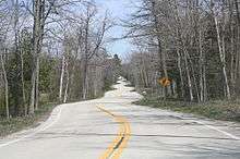
Because of the geographical features and terrain of Door County, WIS 42 makes many abrupt turns as it nears its northern terminus at the tip of the Door Peninsula.
At its intersection with CTH-J in Forestville, WIS 42 heads directly north into Door County. In the unincorporated community Maplewood, Wisconsin, there is a small wayside park with parking, vault toilets and picnic tables in the center of town at the intersection of WIS 42, County Trunk H, and the Ahnapee State Trail.[2] The wayside park is open a half hour before sunrise to 11 p.m.,[3] although the trail is open all 24 hours. This is the only place where the trail crosses WIS 42.
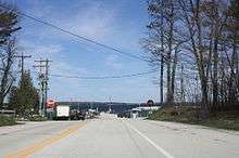
Past Maplewood, WIS 42 meets with WIS 57 a few miles southwest of Sturgeon Bay, and heads to the northeast with WIS 57 into the city as Green Bay Road. WIS 42 and WIS 57 are the only two state highways to enter Door County.
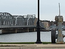
WIS 42/WIS 57 crosses over the Sturgeon Bay Ship Canal to the southeast of downtown, bypassing the old Michigan Street bridge further upstream. A business route continues north on Green Bay Road to South Madison Avenue, crossing the canal on the Michigan Street bridge into downtown Sturgeon Bay. Turning left to the northwest on Third Avenue, the business route follows CTH-B to Jefferson Street, turning to the northeast on CTH-HH. CTH-HH jogs slightly north around Big Hill Park to Egg Harbor Road, where the business route turns northeast past the Door County Fairgrounds to its intersection with WIS 42/WIS 57 outside the city.
WIS 42 and 57 run concurrently for another mile to the north until WIS 57 turns to the East at Johns Lane. WIS 57 runs along the eastern shore of Door County until reaching its eastern terminus with WIS 42 in Sister Bay.
WIS 42 continues north on Egg Harbor Road to CTH-T just west of Egg Harbor. It then swings around and along the shore of Egg Harbor before continuing to the northeast towards Fish Creek.
Outside of Fish Creek, WIS 42 takes an abrupt left-hand turn to follow the bluff down to Main Street and the Alexander Noble House. WIS 42 makes an abrupt right onto Main Street and heads to the northeast past Peninsula State Park into the unincorporated town of Eagle Harbor.
In Eagle Harbor, the road becomes Water Street as it runs along the shoreline of Green Bay. It then curves to the northeast, becoming South Bay Shore Drive outside of Sister Bay. Meeting the northern terminus of WIS 57 at Gateway Drive, WIS 42 once again swings to the northeast towards Ellison Bay.
Just outside town, WIS 42 turns due east on School Road to its intersection with Europe Bay Road, where it turns north towards Gills Rock. At Gills Rock, WIS 42 turns due east and then turns slightly to the southeast before heading due east again to its eastern terminus at the Washington Island Ferry dock at Port Des Morts Drive in unincorporated town of Northport.
Major intersections
| County | Location | mi[1] | km | Destinations | Notes |
|---|---|---|---|---|---|
| Sheboygan | Sheboygan | 0.00 | 0.00 | Southern terminus | |
| Town of Sheboygan | 3.43 | 5.52 | Exit 128 on I-43 | ||
| Howards Grove | 7.53 | 12.12 | |||
| Manitowoc | Manitowoc | 26.18 | 42.13 | Western end of US 151 concurrency | |
| 26.58– 26.81 | 42.78– 43.15 | Southern end of I-43 concurrency; eastern end of US 151 concurrency; exit 149 on I-43; southern terminus of Bus. WIS 42 | |||
| 29.16– 29.38 | 46.93– 47.28 | Western end of US 10 concurrency; northern end of I-43 concurrency; exit 152 on I-43 | |||
| 32.76 | 52.72 | Eastern end of US 10 concurrency; northern terminus of Bus. WIS 42 | |||
| Two Rivers | 38.52 | 61.99 | Eastern terminus of WIS 310 | ||
| 38.92 | 62.64 | Southern terminus of WIS 147 | |||
| Kewaunee | Kewaunee | 62.20 | 100.10 | Eastern terminus of WIS 29 | |
| Algoma | 73.56 | 118.38 | Eastern terminus of WIS 54 | ||
| Door | Town of Nasewaupee | 86.66 | 139.47 | Southern end of WIS 57 concurrency | |
| Sturgeon Bay | 91.86 | 147.83 | Southern end of Bus. WIS 42/Bus. WIS 57 | ||
| 96.23 | 154.87 | Northern end of Bus. WIS 42/Bus. WIS 57 | |||
| Town of Sevastopol | 97.54 | 156.98 | Northern end of WIS 57 concurrency | ||
| Sister Bay | 125.32 | 201.68 | Northern terminus of WIS 57 | ||
| Gills Rock | 135.62 | 218.26 | Passenger ferry | Access via unsigned Spur WIS 42 | |
| Northport | 137.86 | 221.86 | Northern terminus | ||
1.000 mi = 1.609 km; 1.000 km = 0.621 mi
| |||||
Related highways
Former Sheboygan business route
There used to be a Business loop for WIS 42 in Sheboygan back when WIS 42 ran all the way down to Milwaukee. However, the exact location is unknown, most likely along today's WIS 28.
Manitowoc business route
Business WIS 42 runs along WIS 42's older path before Interstate 43 was completed. It is entirely concurrent with U.S. Route 10 and U.S. Route 151. U.S. Route 141 use to run along this route also. The business highway starts at U.S. 151 east of I-43 and continues along Calumet Avenue. It becomes Washington Street east of its intersection with Custer Street. It turns to the left at 8th Avenue to follow with U.S. 10 West, while Business WIS 42 southbound follows 11th and 10th Avenue along U.S. 10 East. It then joins WIS 42 at Waldo Boulevard.
Sturgeon Bay business route
Business WIS 42/57 traverses through downtown mainly following the older route. It starts off at an incomplete exit from WIS 42/57, and follows Green Bay Road to Madison Avenue. The road both turns right onto Maple Avenue, and continues onto Madison Avenue, then crossing the Sturgeon Bay on the Sturgeon Bay Bridge and the Oregon-Maple Street Bridge. They both meet up at the intersection of 3rd and Michigan, continuing onto 3rd Avenue. The route turns right onto Jefferson Street and follows 8th Avenue to Egg Harbor Road, where it continues for the rest of the route until terminating at a roundabout with WIS 42/57.
It used to follow Michigan Street all the way towards a roundabout for a brief time.
Gills Rock spur route
Spur WIS 42 is a connecting route between WIS 42 and the Island Clipper ferry in Gills Rock. The length of the spur is approximately 0.10 miles (160 m),[1] the shortest highway in the Wisconsin state trunk highway system. The spur is one of three SPUR-designated state trunkline highways in the state along with Spur US 51 and Spur WIS 794. The Gills Rock ferry is a passenger-only ferry, where the one at Northport is an auto, freight and passenger ferry.
See also
- Door County Coastal Byway (WIS 42 and 57 north of Sturgeon Bay to Northport is classified as a Coastal Byway)
References
- Region 3 Staff (May 14, 2009). State Trunk Highway Log for Region 3. Green Bay, WI: Wisconsin Department of Transportation. pp. 253–276, 656.
- Ahnapee Trail Door County Map
- Rules for All Door County Parks
External links
