Albany Park railway station
Albany Park railway station is in the London Borough of Bexley in south-east London (Travelcard Zone 5). It is 12 miles 68 chains (20.7 km) down the line from Charing Cross. The station and all trains serving it are operated by Southeastern.
| Albany Park | |
|---|---|
 | |
 Albany Park Location of Albany Park in Greater London | |
| Location | Albany Park |
| Local authority | London Borough of Bexley |
| Managed by | Southeastern |
| Station code | AYP |
| DfT category | D |
| Number of platforms | 2 |
| Fare zone | 5 |
| National Rail annual entry and exit | |
| 2014–15 | |
| 2015–16 | |
| 2016–17 | |
| 2017–18 | |
| 2018–19 | |
| Key dates | |
| 7 March 1935 | Opened |
| Other information | |
| External links | |
| WGS84 | 51.4354°N 0.1257°E |
From platform one trains run westbound to London Charing Cross twice an hour, and twice per hour during the daytime, Monday to Saturday, to London Cannon Street.
From platform two trains from the station run eastbound towards Dartford continuing to Gravesend twice per hour (or Strood, Rochester or Gillingham during peak times) and to London Cannon Street via Greenwich twice an hour during the daytime, Monday to Saturday.
History
The station was opened by the Southern Railway on 7 March 1935[2] following housing development in the area. The station passed on to the Southern Region of British Railways on nationalisation in 1948.
When BR was divided into sectors in the 1980s the station was served by Network SouthEast until the privatisation of British Rail.
The station had a very small one storey signal box at the Dartford end of the up platform which closed in November 1970. No goods yard or freight facilities were ever provided.
The station has changed very little over the years except for platform extensions in 1955 and the closure of the signal box.[3][4]
Location
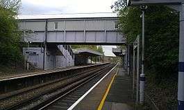
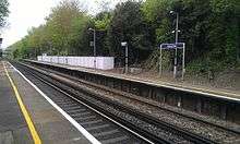
The station is located in Steynton Avenue near a small parade of shops in a largely residential area. The station building is at street level with steps down to the platforms as the line is in a cutting. There is no actual park called Albany Park, although there is nearby pub The Albany Hotel also built in the 1930s.
The station is served by London bus route B14.[5]
Services
The typical off-peak service pattern is:
- 2tph (trains per hour) to London Charing Cross via Sidcup.
- 2tph to London Cannon Street via Sidcup & Lewisham.
- 2tph to Slade Green, continuing to London Cannon Street via Woolwich Arsenal and Greenwich.
- 2tph to Dartford.
| Preceding station | Following station | |||
|---|---|---|---|---|
| Sidcup | Southeastern Dartford Loop Line |
Bexley | ||
Connections
London Buses route B14 serves the station.[6]
References
- "Station usage estimates". Rail statistics. Office of Rail Regulation. Please note: Some methodology may vary year on year.
- Butt 1995, p. 14
- http://www.kentrail.org.uk/Albany%20Park.htm
- London Suburban Railways - Lewisham to Dartford by Vic Mitchell and Keith Smith (Middleton Press 1991)
- "Albany Park Station - Zone 5" (PDF). National Rail. 28 June 2014. Retrieved 3 June 2020.
- Butt, R. V. J. (1995). The Directory of Railway Stations: details every public and private passenger station, halt, platform and stopping place, past and present (1st ed.). Sparkford: Patrick Stephens Ltd. ISBN 978-1-85260-508-7. OCLC 60251199.
- Jowett, Alan (March 1989). Jowett's Railway Atlas of Great Britain and Ireland: From Pre-Grouping to the Present Day (1st ed.). Sparkford: Patrick Stephens Ltd. ISBN 978-1-85260-086-0. OCLC 22311137.
- Jowett, Alan (2000). Jowett's Nationalised Railway Atlas (1st ed.). Penryn, Cornwall: Atlantic Transport Publishers. ISBN 978-0-906899-99-1. OCLC 228266687.
- Station on navigable O.S. map
External links
| Wikimedia Commons has media related to Albany Park railway station. |
- Train times and station information for Albany Park railway station from National Rail