Mankada
Mankada is a hillside village in the Malappuram district of Kerala state. It is located 15 km from Malappuram and is part of the Malappuram parliament constituency.[5] The municipal town of Perinthalmanna is just 10 km away from here. Also, the municipal towns of Manjeri and Malappuram are within a distance of just 15 km away from here.
Mankada | |
|---|---|
Village | |
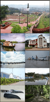
.png) Cheriyam hill viewpoint in Mankada | |
 Mankada Location in Kerala, India  Mankada Mankada (India) | |
| Coordinates: 11.018658°N 76.175530°E | |
| Country | |
| State | Kerala |
| District | Malappuram |
| Government | |
| • Type | Grama Panchayat |
| • Body | Mankada Grama Panchayat |
| • President | M. K. Ramani[1] |
| • Vice president | P. Abbas Ali[1] |
| Area | |
| • Total | 31.06 km2 (11.99 sq mi) |
| Population (2011)[2] | |
| • Total | 32,748 |
| • Density | 1,054/km2 (2,730/sq mi) |
| Languages | |
| • Official | Malayalam |
| Human Development | |
| • Sex ratio (2011) | 1099 ♀/1000♂[3] |
| • Literacy (2011) | 95.66%[3] |
| Time zone | UTC+5:30 (IST) |
| PIN | 679324 |
| Telephone code | 04933 |
| Vehicle registration | KL-53 |
| Climate | Tropical monsoon (Köppen) |
| Avg. summer temperature | 35 °C (95 °F) |
| Avg. winter temperature | 20 °C (68 °F) |
| Nearest towns | |
| Niyamasabha constituency | Mankada |
| Block Panchayat | Mankada[4] |
| Website | www |
Geography
The Mankada Gram Panchayat is bordered the Cheriyam hills and other three major towns in Malappuram district, Malappuram, Manjeri and Perintalmanna. The total area of Mankada Panchayath is 31.33 km². Most of the land is arable.[6] Climate is very cool in the rainy season and usually dry in the summer season just like the other part of Kerala. The rainy season is from June to November, winter season from December to January and the rest of the year is sunny. The temperature is normal and ranges from 25 degree 35 degree. The terrain consists of small hills and upland plain. There is not many natural resources and most of the arable land is cultivated with permanent crops. Also, there are no major environmental issues or natural hazards.
History
This place was originally part of the Valluvanad Swaroopam dynasty.[7]
Valluvanad was an erstwhile late medieval feudal state in the present state of Kerala in South India extending from the Bharathapuzha River in the south to the Pandalur Mala in the north during their zenith in the early Middle Ages. On the west, it was bounded by the Arabian Sea at the port Ponnani and on the east by Attappadi Hills. According to local legends, the last Later Chera ruler gave a vast extension of land in South Malabar to one of their governors, Valluvakkonithiri and left for a hajj. The Valluvakkonithiri was also given last Later Chera ruler's shield (presumably to defend himself from the sword received by the Samoothiri (Zamorin) of Kozhikode, another governor, from the departing ruler). Not surprisingly, the Vellatiri rajas were hereditary enemies of the Samoothiri.[7] Valluvanad is famous for the Mamankam festivals, held once in 12 years and the endless wars against the Samoothiri of Kozhikode. By the late 18th century, Vellatiri or Walluwanad proper was the sole remaining territory of the Walluvanad raja (Valluva Konatiri), who once exercised suzerain rights over a large portion of Southern Malabar. Although management of the country was restored to the Vellatiri raja in 1792, it soon became evident that he was powerless to repress the trouble that quickly broke out between Mapillas (favored by the Mysorean occupiers) and Nairs (who sought to restore the ancien régime), and already in 1793 management of the district had to be resumed as the chief and his family fled to Travancore.[7]
People
As of the 2011 census, the total population of the Panchayat is 32,748. The population density is 1,054 per km² which is around the state average. The sex ratio is almost normal. The people are highly literate. The literacy rate is 95.66 percent. Malayalam is the most-spoken as well as the administrative language. Cinematographer and director Mankada Ravi Varma was born here.
Economy
The economy encompasses traditional village farming, small scale business, and foreign money. A good percentage of natives are working in the Middle Eastern Countries. The local economy is currently undergoing a construction boom and which is solely dependent on the gulf money. The main crops that are cultivated are coconut, arecacnut, paddy, and banana. Two gold load zones of highly potential sulphide rich high grade rocks have been found in recent explorations in mankada. The govt may head for the mining, if it can address the environmental issues.[8]
Administration and other facilities
The panchayath is divided into 18 wards for administrative ease. Development funds are coming to the village through panchayath allocations and the assembly and parliament allocations. The panchayath has a very good track record on development using the fund allocation from local governments. The road network and potable water accessibility is available to a good number of people. The panchayath has one Government Allopathic hospital, one Government-run Ayurvedic hospital and few other clinics. Other public amenities include four banks including State Bank of India, Federal Bank, Co-operative banks, one post office, public library, police station, and a stadium.
Transportation
Mankada village connects to other parts of India through Perinthalmanna town. National Highway No.66 passes through Tirur and the northern stretch connects to Goa and Mumbai. The southern stretch connects to Cochin and Trivandrum. Highway No.966 goes to Palakkad and Coimbatore. The nearest airport is at Kozhikode. The nearest major railway station is at [(Angadippuram)], Tirur, and Shoranur Junction.
Education
Though the literacy rate is high, most of the literacy rate was attained through the literacy drive of Kerala Literacy Mission. The panchayath has good number of primary and upper primary schools. The main educational institute is the Government Higher secondary school Mankada, Government High School Cheriyam Mankada, Al Ameen English medium School Mankada, and NCT English medium school Verumpilakkal which has thousands of students.
Vigilante issues
Mankada attracted the attention of national newspapers in 2016 when a 42-year-old man was beaten to death by his neighbors for visiting his girlfriend in the night.
Places of Interest
- Cheriyam hill viewpoint
- Mankada Kovilakam (Palace of Mankada)
Notable people
References
- "Mankada election 2015". lsgkerala. Retrieved 11 August 2020.
- Directorate of Census Operations, Kerala. District Census Handbook, Malappuram (PDF). Thiruvananthapuram: Directorate of Census Operations, Kerala. p. 166. Retrieved 14 July 2020.
- Directorate of Census Operations, Kerala. District Census Handbook, Malappuram (PDF). Thiruvananthapuram: Directorate of Census Operations, Kerala. p. 326-327. Retrieved 14 July 2020.
- "Villages in Malappuram". lsgkerala.gov.in. Retrieved 11 August 2020.
- "Constituency limits in Kerala". Government of Kerala. Retrieved 11 August 2020.
- "Mankada Gram Panchayat- General Information". Local self governance department, Kerala. Retrieved 11 August 2020.
- "princelystatesofindia.com". Archived from the original on 16 March 2012. Retrieved 19 July 2016.
- "Mankada Gold Deposits". Mankada. Geological Surway of India. Archived from the original on 15 April 2010. Retrieved 28 May 2009.
External links
| Wikimedia Commons has media related to Mankada. |
- "dchb malappuram" (PDF). censusindia.gov.in.