Karuvarakundu
Karuvarakundu is a semi-urban area in the eastern part of Malappuram district, Kerala, India. It is situated 32 kilometres (20 mi) east of Manjeri, 26 kilometres (16 mi) northeast of Perinthalmanna and 30 km southeast of Nilambur. The Olippuzha River, a tributary of the Kadalundipuzha, flows through the town.[3] Karuvarakundu is close to the Western Ghats and hence prone to landslides.[4]
Karuvarakundu Cherumbu Desam | |
|---|---|
Semi Urban Area | |
 Karuvarakundu | |
| Nickname(s): Tourism Hub of Malappuram District | |
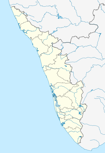 Karuvarakundu Location in Kerala, India  Karuvarakundu Karuvarakundu (India) | |
| Coordinates: 11°7′0″N 76°20′0″E | |
| Country | |
| State | Kerala |
| District | Malappuram |
| Area | |
| • Total | 64.20 km2 (24.79 sq mi) |
| Population (2001)[2] | |
| • Total | 44,434 |
| • Density | 690/km2 (1,800/sq mi) |
| Languages | |
| • Official | Malayalam |
| Time zone | UTC+5:30 (IST) |
| PIN | 676523 |
| Telephone code | 04931 |
| Vehicle registration | KL-71,KL-10. |
| Lok Sabha constituency | wayanad |
| Vidhan Sabha constituency | Wandoor |
| Climate | 15 to 40 C (Köppen) |
| Website | karuvarakundu |
.JPG)
.JPG)
The name Karuvarakundu means place of the blacksmith, indicating the town's history as a metalworking centre.[5] It is known as the Jamshedpur of south India because of its range of metal depositories.
There are many tea and rubber plantations in and around Karuvarakundu. The town is an educational centre of eastern Eranad, with a total of 20 schools and 5 colleges.
Karuvarakundu is part of the setting of the novel Arabi Ponnu, by M. T. Vasudevan Nair and N. P. Mohammed.
History
"Karu" means iron ore. The place where iron ore was excavated came to be known as Karu varum kundu, later shortened to Karuvarakundu. Swords and utensils made of iron were made here two thousand years ago, and exported to countries like Egypt, Rome, and Denmark. The people engaged in iron ore mining took the family name Aripanikkar. Karuvarakundu is known as the Jamshedpur of south India because of its extensive mining history.
The Malabar rebellion of 1921 led to riots in Karuvarakundu.[6] On 20 August 1921 the news that the British had fired at a mosque in Tirurangadi spread in Karuvarakundu, and protests against the British began. On the next day, a mob attacked the police station and seized weapons, leaving the police station and the tourist Bungalow on fire. The British army subsequently came to Karuvarakundu to suppress the rioters. The army barracks were first situated at Chembankunnu and later moved to Cambinkunnu, the current location of the Karuvarakundu Government Higher Secondary School.
Geography
Karuvarakundu is located on a sloping region near a forest. The mountains of the Western Ghats, which reach a height of 1250 metres above sea level, are located in the southeast of the Karuvarakundu Panchayath. The Olippuzha river, the longest river flowing through Karuvarakundu, originates in these mountains. The river Kallanpuzha, which also flows through Karuvarakundu, originates at a height of 1050m.
The Karuvarakundu Panchayath covers an area 64.2 km2 and is part of the Nilambur subdivision of the Malappuram district. It is one of the main agricultural areas of the Malappuram district. It includes Kerala Estate, and shares borders with Amarambalam and Puthur (Palakkad) in the north, Puthur Panchayath in the east, Alanallur in the south and Kalikavu, Tuvvur, and Chokkad in the west.
Suburbs and Villages
- Chengode Bridge, Eanadi and Arimanal Bridge
- Pulvetta, Tharish, Kalkundu, Kakkara villages
- Kerala Village, Punnakkad Junction
- Iringattiri Bridge, Puthanazhi.
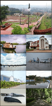
Tourist Attractions
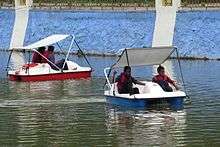
- Keralamkundu waterfall
- Cherumb Eco Village
- Silent Valley National Park
- Thareeqath Dargah of late Hyderabadi saint
- Baroda waterfall
- Vattamala
- vattamala waterfall
Important landmarks
- Cherumbu Eco Village
- Govt. higher secondary school Karuvarakundu
- Cordova College for Women Karuvarakundu
- DNIC Arts and Science college
- Najath College of Science And Technology
- Shifa Acupuncture & Hijama Centre Maruthingal
- Hayath Hospital Maruthingal
- Alsalama Hospital
- Kalakuthilamma Muthappan Temple
- GHSS Karuvarakundu
- GLPS Punnakkad
- GLPS Pulvetta
- GLPS Tharish
- KTM College of Advanced Studies Punnakkad
- Nalanda College Angadi
- Sri Neelaam Kurushi Ayyappa Temple
Culture
The village of Karuvarakundu is predominantly Muslim, and the culture of the locality is based upon Muslim traditions. Duff Muttu, Kolkali and Aravanamuttu are common folk arts of this locality.
Mosques are a focal point for discussions of social and cultural issues, including business and family issues, which are discussed after evening prayer. Islamic studies are facilitated by libraries attached to mosques. Most of the books in these libraries are written in Arabi-Malayalam, a version of the Malayalam language written in Arabic script.
The Hindu minority celebrates festivals and rituals in their temples, as in other parts of Kerala.[7]
The scholar KT Manu Musliar was born in Karuvarakundu.
Transportation
Karuvarakundu village is connected via road to the nearest towns, including Manjeri, Perinthalmanna and Nilambur. State Highway 39 (SH 39) between Perumbilavu and Nilambur passes through Karuvarakundu. It is also connected to National Highway No. 966, which connects Palakkad and Coimbatore. The nearest airport is at Kozhikode. The nearest railway stations are at Tuvvur and Melattur.
References
- "Table 1 - Demographic Particulars - 1991" (PDF). Panchayat Statistics. Government of Kerala. Retrieved 29 May 2009.
- "Panchayat wise Population Details (2001 census)". Malappuram district official website. Retrieved 29 May 2009.
- Kerala District Gazetteers: Kozhikode. vol. 5. Superintendent of Govt. Presses. 1986. p. 9.
- "Floods batter Adivasi areas of Nilambur It is a Famous Tourist Village in Malappuram District. Cherumbu Eco Village, Keralamkundu Waterfalls, Swapnakundu, Baroda waterfalls are some of the Leading tourist Places in the city" (PDF). Disasters Update. National Institute of Disaster Management, Ministry of Home Affairs (India). 17 July 2007. Retrieved 29 May 2009.
- "Proceedings of the Indian History Congress". Indian History Congress. 60: 1204. 2000. OCLC 1752882.
- Hitchcock, R. H. (1983). Peasant Revolt in Malabar: A History of the Malabar Rebellion, 1921. Usha. p. 65. OCLC 15692976.
- "Malappuram art and culture". Archived from the original on 1 April 2016. Retrieved 14 July 2016.
External links
| Wikimedia Commons has media related to Karuvarakundu. |
- "dchb malappuram" (PDF). censusindia.gov.in.