Howe, Minneapolis
Howe is a neighborhood within the larger Longfellow community in Minneapolis. It is bordered by the Cooper and Longfellow neighborhoods to the north, Corcoran and Standish to the west, Hiawatha to the south, and the Mississippi River to the east. The neighborhood and its elementary school are named for Julia Ward Howe.
Howe | |
|---|---|
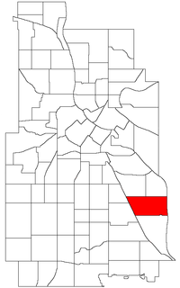 Location of Howe within the U.S. city of Minneapolis | |
| Country | United States |
| State | Minnesota |
| County | Hennepin |
| City | Minneapolis |
| Community | Longfellow |
| Area | |
| • Total | 1.09 sq mi (2.8 km2) |
| Population (2010)[2] | |
| • Total | 6,608 |
| • Density | 6,100/sq mi (2,300/km2) |
| Time zone | UTC-6 (CST) |
| • Summer (DST) | UTC-5 (CDT) |
| ZIP code | 55406 |
| Area code(s) | 612 |
| Historical population | |||
|---|---|---|---|
| Census | Pop. | %± | |
| 1980 | 7,241 | — | |
| 1990 | 7,108 | −1.8% | |
| 2000 | 6,878 | −3.2% | |
| 2010 | 6,608 | −3.9% | |
See also
External links
References & External Links
- "Howe neighborhood in Minneapolis, Minnesota (MN), 55406 detailed profile". City-Data. 2011. Retrieved 2013-11-12.
- "Minneapolis Neighborhood Profile: Howe" (PDF). Minnesota Compass. October 2011. Retrieved 2013-11-12.
- Howe, Minneapolis, MN. Google Earth. Retrieved 2011-03-09.
Places adjacent to Howe, Minneapolis | |
|---|---|
This article is issued from Wikipedia. The text is licensed under Creative Commons - Attribution - Sharealike. Additional terms may apply for the media files.