Cooper, Minneapolis
The Cooper neighborhood (part of the larger Longfellow community) resides along the west shore of the Mississippi River in south Minneapolis. It is bound by 34th St. E. on the south, 38th Ave. S. on the west, 27th St. E. on the north, and the Mississippi River Gorge to the east. Bordering neighborhoods are Seward to the north, Longfellow to the west, and Howe to the south. St. Paul's Merriam Park neighborhood is just across the Mississippi River to the east.
Cooper | |
|---|---|
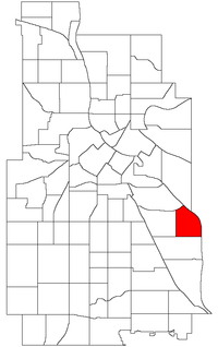 Location of Cooper within the U.S. city of Minneapolis | |
| Country | United States |
| State | Minnesota |
| County | Hennepin |
| City | Minneapolis |
| Community | Longfellow |
| Area | |
| • Total | 0.67 sq mi (1.7 km2) |
| Population (2010)[2] | |
| • Total | 3,503 |
| • Density | 5,200/sq mi (2,000/km2) |
| Time zone | UTC-6 (CST) |
| • Summer (DST) | UTC-5 (CDT) |
| ZIP code | 55406 |
| Area code(s) | 612 |
| Historical population | |||
|---|---|---|---|
| Census | Pop. | %± | |
| 1980 | 3,938 | — | |
| 1990 | 3,708 | −5.8% | |
| 2000 | 3,448 | −7.0% | |
| 2010 | 3,503 | 1.6% | |
Cooper was named after the 19th-century author James Fenimore Cooper, best known for writing The Last of the Mohicans (1832).
Geography
The Mississippi River Gorge is unique to this stretch of the entire Mississippi. The river cut an eighty-plus foot gorge as what is now St. Anthony Falls moved upstream over thousands of years, finally stopping at downtown Minneapolis due to engineering work during the city's flour milling boom times. Today, the Mississippi River Gorge is a protected natural landscape.
Schools
2005 marked the closing of Cooper Elementary School, forcing Cooper's children to move to the neighboring Longfellow Elementary,[3] which itself closed in 2010.[4] The current elementary school for Cooperites is the Hiawatha-Howe dual campus.[5] Minneapolis Public Schools has committed to renovating and re-opening Cooper's school for the 2017-18 school year.[6]
Sanford Middle School (formerly Jr. High) is the closest middle school, and is located in the Howe neighborhood to the south.
South High School is the closest senior high school, and is located in the Corcoran neighborhood further to the west.
Minnehaha Academy's high school (private) is located along West River Road. The middle school is further south on West River Road in the Howe neighborhood.
Political representation
Cooper is represented by the following people:
- City Council (2nd Ward):[7] Cam Gordon
- Minneapolis Park Board (3rd Precinct):[8] Scott Vreeland
- Minneapolis Mayor:[[9] Jacob Frey
- Hennepin County Commissioner:[10] Angela Conley
- Minnesota House of Representatives[11] (District 62A): Jim Davnie
- Minnesota Senate[12] (District 62): Patricia Torres Ray
- US House of Representatives[13] Ilhan Omar
Notable residents
- Jesse Ventura - former Minnesota Governor; grew up in the house on the southwest corner of 32nd St. E. and 46th Ave. S.
See also
References
- "Cooper neighborhood in Minneapolis, Minnesota (MN), 55406 detailed profile". City-Data. 2011. Retrieved 2013-11-12.
- "Minneapolis Neighborhood Profile: Cooper" (PDF). Minnesota Compass. October 2011. Retrieved 2013-11-12.
- Longfellow Elementary
- "Doors close on 4 Minneapolis schools".
- "District map" (PDF).
- "Five-year enrollment plan, December 10, 2013".
- City Council (2nd Ward)
- Minneapolis Park Board (3rd Precinct) Archived 2005-12-01 at the Wayback Machine
- http://www.ci.minneapolis.mn.us/mayor/ Minneapolis Mayor]
- Hennepin County Commissioner Archived 2005-12-12 at the Wayback Machine
- Minnesota House of Representatives
- Minnesota Senate
- US House of Representatives