Bryant, Minneapolis
Bryant is a neighborhood within the Powderhorn community in Minneapolis, Minnesota, United States. Its boundaries are East 38th Street to the north, Chicago Avenue to the east, East 42nd Street to the south, and Interstate 35W to the west.
Bryant | |
|---|---|
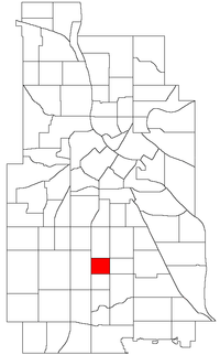 Location of Bryant within the U.S. city of Minneapolis | |
| Country | United States |
| State | Minnesota |
| County | Hennepin |
| City | Minneapolis |
| Community | Powderhorn |
| Area | |
| • Total | 0.298 sq mi (0.77 km2) |
| Population (2010)[2] | |
| • Total | 2,833 |
| • Density | 9,500/sq mi (3,700/km2) |
| Time zone | UTC-6 (CST) |
| • Summer (DST) | UTC-5 (CDT) |
| ZIP code | 55407, 55409 |
| Area code(s) | 612 |
| Historical population | |||
|---|---|---|---|
| Census | Pop. | %± | |
| 1980 | 2,695 | — | |
| 1990 | 2,789 | 3.5% | |
| 2000 | 2,789 | 0.0% | |
| 2010 | 2,833 | 1.6% | |
The neighborhood was named for William Cullen Bryant, an American poet who lived from 1794 to 1878.
The City of Minneapolis incorporated the neighborhood in 1887, and by 1930 it was fully developed. Today it is a residential neighborhood with mostly single-family dwellings. In 2000, is population was 2,789. Phelps Park, which is located within its boundaries, is home to a large Boys and Girls Club.
The Bryant Unity Development Garden (BUD Garden), is located at East 40th Street and 3rd Avenue South, on land owned by Saint Leonard's of Port Maurice Catholic Church. It was founded in 1994 by Bryant Residents Judy Anderson, local artist, and Sharon Parker, local artist, writer and editor. In 1997, Mixed Blood Theater Company produced a play called In the Garden..., which was performed at Phelps Park. The play, written by local playwright Syl Jones, was based on interviews of neighborhood residents and was centered on the BUD Garden as a source of community restoration.
Bryant Neighborhood is located entirely within the bounds of Minnesota Senate District 62. It is in the 5th Precinct of the 8th Ward.
Noted residents include Civil Rights Lawyer Larry Blackwell, Angela Conley, and Andrea Jenkins.
References
- "Bryant neighborhood in Minneapolis, Minnesota (MN), 55407, 55409 detailed profile". City-Data. 2011. Retrieved 2013-11-12.
- "Minneapolis Neighborhood Profile: Bryant" (PDF). Minnesota Compass. October 2011. Retrieved 2013-11-12.
- Bryant, Minneapolis, MN. Google Earth. Retrieved 2011-03-09.
External links
- Bryant Neighborhood Website
- Minneapolis Neighborhood Profile - Bryant
- Bryant Neighborhood Organization @ Neighborhood Link
Places adjacent to Bryant, Minneapolis | ||||||||||
|---|---|---|---|---|---|---|---|---|---|---|
| ||||||||||