World Ocean
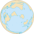
The World Ocean or Global Ocean (colloquially the sea or the ocean) is the interconnected system of Earth's oceanic waters, and comprises the bulk of the hydrosphere, covering 361,132,000 square kilometres or 139,434,000 square miles (70.8%) of Earth's surface, with a total volume of roughly 1,332,000,000 cubic kilometres (320,000,000 cubic miles).[1]
| World Ocean | |
|---|---|
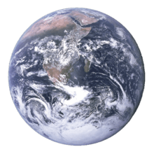
 The image by Rosetta shows mostly a part of the Water Hemisphere, with Indian Ocean at the left and Pacific at the right | |
| Surface area | 361,132,000 km2 (139,434,000 sq mi) |
| Average depth | 3,688 m (12,100 ft) |
| Max. depth | 10,911 m (35,797 ft) |
| Water volume | 1,332,000,000 km3 (320,000,000 cu mi) |
| Islands | Lists of islands |
 |
| Earth's oceans |
|---|
|
World Ocean |


Organization
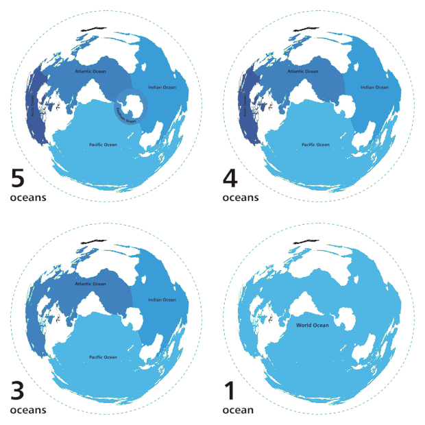
The unity and continuity of the World Ocean, with relatively free interchange among its parts, is of fundamental importance to oceanography.[2] It is divided into a number of principal oceanic areas that are delimited by the continents and various oceanographic features: these divisions are the Atlantic Ocean, Arctic Ocean (sometimes considered an estuary of the Atlantic), Indian Ocean, Pacific Ocean, and Southern Ocean, defined by the International Hydrographic Organization (IHO) in 2000, based on evidence that this region of the World Ocean has a distinct ecosystem and a unique impact on global climate.[3] In turn, oceanic waters are interspersed by many smaller seas, gulfs, and bays.
A global ocean has existed in one form or another on Earth for eons, and the notion dates back to classical antiquity in the form of Oceanus. The contemporary concept of the World Ocean was coined in the early 20th century by the Russian oceanographer Yuly Shokalsky to refer to the continuous ocean that covers and encircles most of Earth.[4]
If viewed from the southern pole of Earth, the Atlantic, Indian, and Pacific Oceans can be seen as lobes extending northward from the Southern Ocean. Farther north, the Atlantic opens into the Arctic Ocean, which is connected to the Pacific by the Bering Strait, forming a continuous expanse of water.
- The Pacific Ocean, the largest of the oceans, also reaches northward from the Southern Ocean to the Arctic Ocean. It spans the gap between Australia and Asia, and the Americas. The Pacific Ocean meets the Atlantic Ocean south of South America at Cape Horn.
- The Atlantic Ocean, the second largest, extends from the Southern Ocean between the Americas, and Africa and Europe, to the Arctic Ocean. The Atlantic Ocean meets the Indian Ocean south of Africa at Cape Agulhas.
- The Indian Ocean, the third largest, extends northward from the Southern Ocean to India, the Arabian Peninsula, and Southeast Asia in Asia, and between Africa in the west and Australia in the east. The Indian Ocean joins the Pacific Ocean to the east, near Australia.
- The Arctic Ocean is the smallest of the five. It joins the Atlantic Ocean near Greenland and Iceland and joins the Pacific Ocean at the Bering Strait. It overlies the North Pole, touching North America in the Western Hemisphere and Scandinavia and Siberia in the Eastern Hemisphere. The Arctic Ocean is partially covered in sea ice, the extent of which varies according to the season.
- The Southern Ocean is a proposed ocean surrounding Antarctica, dominated by the Antarctic Circumpolar Current, generally the ocean south of 60 degrees south latitude. The Southern Ocean is partially covered in sea ice, the extent of which varies according to the season. The Southern Ocean is the second smallest of the five named oceans.
Plate tectonics, post-glacial rebound, and sea level rise continually change the coastline and structure of the world ocean.
See also
- Superocean – An ocean that surrounds a supercontinent
- World Ocean Atlas – A data product of the Ocean Climate Laboratory of the National Oceanographic Data Center (U.S.)
- Panthalassa – Prehistoric superocean that surrounded Pangaea

References
- "WHOI Calculates Volume and Depth of World's Oceans". Ocean Power Magazine. Archived from the original on July 13, 2012. Retrieved February 28, 2012.
- Spilhaus, Athelstan F. 1942 (Jul.). "Maps of the whole world ocean." Geographical Review (American Geographical Society). Vol. 32 (3): pp. 431-5.
- Rosenberg, Matt (May 1, 2005). "Do You Know the World's Newest Ocean?". ThoughtCo. Retrieved December 16, 2017.CS1 maint: ref=harv (link)
- Bruckner, Lynne and Dan Brayton (2011). Ecocritical Shakespeare (Literary and Scientific Cultures of Early Modernity). Ashgate Publishing, Ltd. ISBN 978-0754669197.
Further reading
- Chekin, L. 2002. "The world ocean in medieval cartography". Moscow: S. I. Vavilov Institute of the History of Science and Technology of the Russian Academy of Sciences; thesis for Museum of the World Ocean congress.
- "Ocean". The Columbia Encyclopedia, 6th ed. 2003. New York: Columbia University Press; also,
- Danabasoglu, Gokhan ; McWilliams, James C.; & Gent, Peter R. 1994. "The role of mesoscale tracer transports in the global ocean circulation". Science: vol. 264. (no. 5162), pp. 1123–1126.
- Levitus, Sydney; Antonov, John I.; Boyer, Timothy P.; and Stephens, Cathy. 2000. "Warming of the world ocean": abstract, article. Science: vol. 287. (no. 5461), pp. 2225–2229.
- Spilhaus, Athelstan F. 1942. "Maps of the whole world ocean." Geographical Review: vol. 32 (no. 3), pp. 431–5.
- UN Atlas of the Oceans: