Transport in Bangladesh
Transport is an important part of Bangladesh's economy. Since the liberation of the country, the development of infrastructure has progressed rapidly and a number of land, water and air transport modes came into existence. However, significant progress needs to be made for ensuring uniform access to all available transports. Unlike other nations, Bangladesh has four ministries responsible for transportation in the country:
- Road safety – Ministry of Road Transport and Bridges
- Rail transport – Ministry of Railways
- Civil aviation – Ministry of Civil Aviation and Tourism
- Maritime transport – Ministry of Shipping
Road
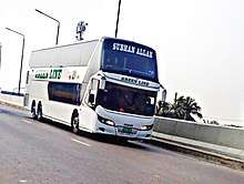
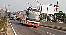
With continued economic development, Dhaka (Bangladesh's capital) is beginning to experience severe traffic congestion. This is impacting the quality of life for inhabitants of the metropolitan area, the nation's largest. Many government and public-transport agencies drafted policies, undertook projects and implemented programmes to solve the problem. The Dhaka Integrated Transport Studies, conducted by the Ministry of Planning in 1991–1994, found that the uncoordinated activities of Dhaka City Corporation (DCC), Rajdhani Unnayan Kartripakkha (RAJUK) and the Bangladesh Road Transport Authority (BRTA) did not alleviate the problem and there was no one organisation responsible for improving the city's transport and traffic problems.
With financial assistance from the World Bank, the government of Bangladesh created the Dhaka Transport Coordination Board in 1998. An urban transport plan was commissioned with the US consultant Louis Berger Group and Bangladesh Consultant Ltd (BCL). Introduced in 2008, the comprehensive transport plan for the Greater Dhaka City and its adjoining areas (such as Tongi, Gazipur, Savar, Narayanganj, Keraniganj, Narshingdi and Manikganj) covered around 1,530 square miles (4,000 km2). The plan looked at 15 key policy issues, including safety, pedestrian preferences, public transport, non-motorised transport, travel demand management and mass transit systems, and almost 70 policy recommendations were made. Ten comprehensive transport strategies were evaluated, using a baseline of no Bus rapid transit (BRT) or metro service, and a number of alternatives were explored.[1] The adopted plan included roads, a three-line Mass Rapid Transit (MRT) and three-line BRT. It included provisions for 54 new roads in and around the city, three-part elevated expressways and a circular waterway programme.[2]
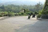
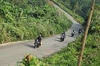
Prime Minister Sheikh Hasina inaugurated Bangladesh's highest road, Thanchi-Alikadam Road in Bandarban District, in a 2015 video conference from Dhaka. Construction of The road, which is 2,500 feet (760 m) above sea level, was built under army supervision at a cost of ৳1.17 billion and is aiding development, education and health in the hill tracts.
Traffic congestion
With more than 250,000 vehicles in Bangladesh and the country's population and infrastructure, traffic congestion wastes fuel and time and makes travel difficult. It also makes existing public transport inefficient, adding unsafe levels of noise and air pollution. Noise and pollution are stressful, and lead to medical conditions such as cardiovascular disease and hypertension.
Traffic congestion varies during the day, necessitating planning and longer trips; this impacts productivity, cutting across social and economic status. Although walking is a major travel mode of the low-income majority, pedestrian needs are ignored in transport planning. As a result of traffic congestion, more people walk and bicycle; however, both may be dangerous. Almost 80 percent of traffic fatalities in Dhaka are pedestrians struck by a fuel-based vehicle.[3] Although private cars are four percent of total vehicles, they occupy about 70 percent of road space. Public transport must be stressed in any future policy. The change to compressed natural gas (CNG) cars saved over 4,000 premature deaths in 2009, but their low cost has increased the number of cars on the roads (although CNG price increases may have tempered the increase) and decreased the amount of natural gas available for other purposes.[4]
Road safety
Passenger's and pedestrian's safety in the roads is currently a burning issue in Bangladesh. Death counts in the highways are rising every day in an alarming rate. Although the government is undertaking a number of significant steps addressing the issue, situations in the highways don't seem to get much positive change too soon.[5] Public unrest and riots demanding safe roads tend to occur in quite an unpredictable manner as both the authority and the highway section of the police prove to fail in bringing discipline in the road transportation system.[6][7][8] Alternative ways of mass transit system in public basis have been taken and lots are still undergoing, but the source of all problems is said to lie with untrained drivers and inadequate maintenance of the highways.[9]
Rail
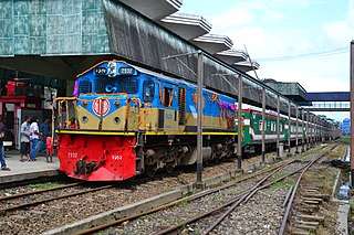
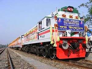
Rail is as an important method of mass transport in Bangladesh, and many districts are connected by rail. Bangladesh Railway was primarily inherited from the British Assam Bengal Railway system after the partition of India in 1947. Its headquarters is in the southern port city of Chittagong, the south-eastern terminus of the Assam Bengal Railway. After independence from West Pakistan in 1971, only a short length of new track was laid.
In 2005, the railway was 2,706 kilometres (1,681 mi) long.[10] Of that, 923 km (574 mi) are broad gauge (1,676mm) tracks (mainly in the western region) and the remaining 1,822 km (1,132 mi) are metre-gauge tracks (mainly in the central and eastern regions). The gauge difference is being addressed by adding third rails to major broad- and metre-gauge routes, making them dual gauge. A road-rail bridge over the Jamuna River opened in 1998 to connect the east and west rail networks.
The border between India and Bangladesh cuts across railway lines, forcing them into the adjacent country for short distances and complicating border controls such as passport validation. After 43 years, the Maitree Express renewed rail transport between Bangladesh and India in 2008; nine years later, Bandhan Express. a second rail service from Kolkata to Khulna began.
Air
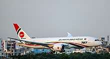
Biman Bangladesh Airlines, the country's national airline, began operation in 1972. Other Bangladeshi-registered passenger airlines are Novoair, Regent Airways and United Airways. All four of the carriers have a hub at Shahjalal International Airport, and operate domestic and international flights.
Bangladesh has three international airports: Shahjalal International Airport in Dhaka, Shah Amanat International Airport in Chittagong and Osmani International Airport in Sylhet. All three have direct connections to Mideast destinations, and Shahjalal also serves the wider Asian region and Europe. In addition to the international airports, there are five domestic airports: in Barisal, Cox's Bazar, Jessore, Rajshahi and Saidpur. Nearly all service at these airports is to (or from) Dhaka.
Water
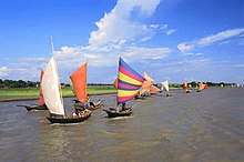
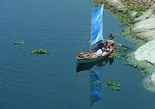
There are 5,150–8,046 km (3,200–5,000 mi) of navigable waterways, including 2,575–3,058 km or 1,600–1,900 mi of major cargo routes. Because of Bangladesh's many rivers, ferries are an important means of transport. The ferries are often overloaded and continue to operate in poor weather; many people die each year in ferry and launch accidents. The launch Pinak 6 sank in the Padma River with more than 200 passengers aboard near Munshiganj's Louhajang Upazila in 2016.[11]
Bangladesh's ports and harbours are Chittagong, on the east coast; river ports at Dhaka, Narayanganj, Baghabari and Ashuganj, and seaports at Mongla and Payra. A deepwater port has been proposed on Sonadia Island. The country's merchant navy consisted of 306 ships, including 28 bulk carriers, four container ships, 75 cargo ships and 110 oil tankers, in 2017.[12]
Pipelines
In 2013, Bangladesh had about 2,950 kilometres (1,830 mi) of natural-gas pipelines.[12][13]
References
- "Baumaschine Ankauf germany provides to Bangladesh". LKW Ankauf. Retrieved 5 May 2015.
- Sunny 2011, p. 9
- "Lkw verkaufen from Germany". Retrieved 5 May 2015.
- Sunny 2011, p. 234
- EDITORIAL (25 March 2019). "111 draft recommendations of Road Safety Committee! | Missing the forest for the trees". The Daily Star. Retrieved 9 September 2019.
- Staff-correspondent (2 August 2018). "Dhaka Shaken By Youth Spirit | Thousands take to streets for fourth consecutive day; government orders closure of all schools, colleges today". The Daily Star. Retrieved 9 September 2019.
- Inam Ahmed and Shakhawat Liton (2 August 2018). "SLAY THIS MONSTER". The Daily Star. Retrieved 9 September 2019.
- Staff-correspondent (21 March 2019). "Daylong Protest Over Unsafe Road". The Daily Star. Retrieved 9 September 2019.
- Shubhra Adhikary, Tuhin (29 July 2019). "A Year Since Road Safety Demo: Lofty promises, little action". The Daily Star. Retrieved 9 September 2019.
- Bangladesh Transport Website FAQ
- "Pinak 6 accident in Bangladesh".
- "CIA World Factbook". Archived from the original on 29 December 2017. Retrieved 24 January 2018.
- "Aristocrat Pokies Australia". Retrieved 10 June 2015.
Notes
- Sunny, Sanwar (2011). Green Buildings, Clean Transport and the Low Carbon Economy: Towards Bangladesh's Vision of a Greener Tomorrow. Germany: LAP Publishers. ISBN 978-3-8465-9333-2.
![]()
External links
| Wikimedia Commons has media related to Transport in Bangladesh. |