Transport in Sri Lanka
Transport in Sri Lanka is based on its road network, which is centred on the country's commercial capital Colombo. A rail network handles a portion of Sri Lanka's transport needs. There are navigable waterways, harbours and three international airports: in Katunayake, 35 kilometres (22 mi) north of Colombo, in Hambantota, and in Jaffna.
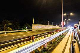
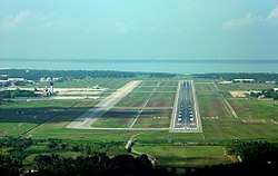
Road
Roads account for about 93 percent of Sri Lanka's land transport. In October 2013, there were 12,000 kilometres (7,500 mi) of A- and B-class roads and 151.8 kilometres (94.3 mi) of expressways.
Classification
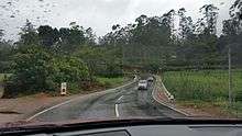
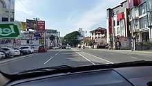
Sri Lanka's roads are graded E, A, B and C.
| Grade | Description | Speed limit |
|---|---|---|
| E | High-speed, high-traffic expressways duplicating heavily travelled A-Grade routes | 100 km/h (62 mph) |
| A | The national highway network | 70 km/h (43 mph)[1] |
| B | Major provincial roads used as feeders for A- and E-Grade roads | 60 km/h (37 mph) |
| C | Local residential roads | 50 km/h (31 mph) |
Expressways
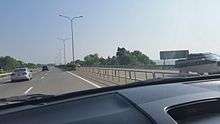
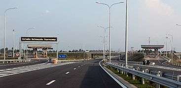
The Colombo–Matara Expressway is a 126-kilometre-long (78 mi) motorway linking Colombo, Galle and Matara which was built in 2011 to develop the economy of the Southern Province. Other expressways are under construction or proposed. The Colombo–Katunayake Expressway, Colombo-Kandy Expressway and Outer Circular Expressway (Colombo bypass road) are under construction, and a Colombo–Padeniya expressway has been proposed. The Sri Lankan government has proposed three elevated highways connecting the three main expressways:[2]
- From Kirulapone to Kadawatha (about 19 km), connecting the Outer Circular Expressway at Kadawatha and the Colombo–Katunayake Expressway at Peliyagoda
- From Colombo Fort to Kottawa (about 21 km), connecting the Colombo–Matara and Outer Circular Expressways at Kottawa
- From Colombo Fort to the Peliyagoda interchange on the Colombo–Katunayake Expressway (about 5 km)
| Number | Name | Start | End | Length (km) | Lanes | Cost (USD) | Cost/km (USD) |
|---|---|---|---|---|---|---|---|
| E01 | Colombo–Matara Expressway | Kottawa | Matara | 126 | 4 (provision for 6) | 765.4 million | 6.07 million[3] |
| E02 | Outer Circular Expressway | Kottawa | Kerawalapitiya | 29 | 6 | 1.12 billion | 38.6 million[4] |
| E03 | Colombo–Katunayake Expressway | New Kelani Bridge | Katunayake | 25.8 | 6,4 (provision for 6) | 291 million[5] | 11.28 million |
| E04 | Colombo–Kandy Expressway[6] | Kadawatha | Katugastota | 98.9 | 4,6[7] | 4.5 Billion[8] | Under construction |
National highways
Sri Lanka's national highways are graded A or B. A-Grade roads are subdivided as AA, AB or AC.
| Road grade | Length |
|---|---|
| A | 4,221.37 kilometres (2,623.04 mi) |
| AA | 3,724.26 kilometres (2,314.15 mi) |
| AB | 466.92 kilometres (290.13 mi) |
| AC | 30.19 kilometres (18.76 mi) |
| B | 7,943.65 kilometres (4,935.96 mi) |
| Total of A- and B-grade roads | 12,165.02 kilometres (7,558.99 mi)[9] |
Road density is highest in the southwest, particularly the area around Colombo. Highways are in good condition, with a smooth bitumen surface and road markings; however, some rural roads are in poor condition. Heavily travelled roads are being upgraded and repaved. Public transport is widely available in many rural areas.[10]
Buses
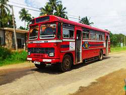
Buses are the principal mode of public transport. Service is provided by the state-run Sri Lanka Transport Board (SLTB) and privately owned buses. The SLTB has urban and rural routes; in many rural areas, it provides service which would be unprofitable for private operators.[10]
Colombo has an extensive, bus-based public transport system, with the Central Bus Stand in Pettah as its hub.[11] The city's road network consists of radial links (or arterial routes), which link the city and district centres, and orbital links intersecting the arterial routes. Most bus routes are on the radial links, without dedicated bus lanes due to high peak traffic volume.[12] A BRT system for Colombo has been proposed but not yet implemented.[13][14]
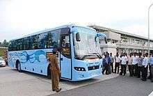
Inter-city routes connect many of the country's major population centres. Some service is available on the E01 and E03 expressways, with modern Lanka Ashok Leyland buses.[15]
In 2011, the SLTB began introducing new buses to replace part of its aging fleet. The Volvo 8400 buses, from Volvo India,[16] run on major routes in Colombo.[17] The most popular model is the Lanka Ashok Leyland Viking, which is operated by the SLTB and several private companies.[18]
Rail
.jpg)
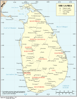
Rail transport in Sri Lanka consists of an intercity network connecting major population centres and commuter rail serving Colombo commuters. Sri Lanka Railways operates the country's railway network, which includes about 1,450 km (901 mi) of track. Colombo is its hub. Trains connect the main cities of the country's nine provinces.
Most of the railways were developed during the British colonial period, with the first line (from Colombo to Kandy) opening on 26 April 1867. The railway was introduced as an economical means of transporting goods produced on the tea, rubber and coconut plantations to the main port in Colombo. After 1950s, the Sri Lankan economy became focused on industry rather than plantation agriculture. The road network also grew; with the introduction of lorries, a faster means of transporting goods, the amount of goods transported by rail declined. Since their network is more focused on plantation areas than on population and service centres, the railways have generated large losses.
Their potential for expansion was demonstrated when Minister of Transport Leslie Goonewardene extended the coastal line from Puttalam to Aruvakalu in 1974 to serve the cement factory there.[19] The railway is modernising and extending that line to facilitate faster trains and improved efficiency.[20] Electrification of the network's busiest sections was proposed in 2010 to improve energy efficiency and sustainability,[21] but no work was done. The railway is extending the coastal line from Matara to Kataragama via Hambantota.[22]
The Sri Lankan rail network passes scenic landscapes—particularly the Colombo-Badulla main line, which hugs the country's steep highlands. The railways connect the cities of Kandy, Galle, Matara, Jaffna, Kankesanturai, Mannar, Anuradhapura, Gampaha, Negombo, Kurunegala, Avissawella, Kalutara, Polonnaruwa, Batticaloa, Trincomalee, Badulla, Gampola, Nawalapitiya, Matale, Vavuniya, Puttalam and Chilaw with Colombo.
The narrow-gauge Kelani Valley Line, from Colombo to Avissawella, was converted to broad gauge. The other narrow-gauge lines, from Nanu Oya to Nuwara Eliya, Avissawella to Yatiyantota and Avissawella to Ratnapura and Opanayaka, were dismantled due to financial losses. In 2007, the Sri Lankan government announced plans for Matara-Kataragama (113 km), Padukka-Hambantota-Ratnapura (210 km), Kurunegala-Dambulla-Habarana (80 km) and Panadura-Horana (18 km) lines by 2014.[23]
Air
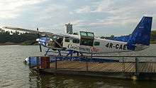
Sri Lanka's international airports include Colombo Bandaranaike International Airport, Jaffna International Airport, Mattala Rajapaksa International Airport and Ratmalana International Airport, which is being renovated.
Sri Lankan Airlines
SriLankan Airlines is the national airline. Founded in 1979 as Air Lanka, the airline changed its name when it received partial foreign ownership in 1998. It operates to Asia and Europe from its base at Bandaranaike International Airport in Colombo; the airline's main office is in the Airline Centre at the airport. The airline was scheduled to join the Oneworld alliance in 2013.[24] SriLankan flies to 62 destinations in 34 countries.[25]
Airports
Bandaranaike International Airport is in Katunayake, 35 km (22 mi) north of Colombo. Mattala Rajapaksa International Airport is in Mattala, north of Hambantota. Jaffna International Airport became Sri Lanka's third international airport on 17 October 2019 when it was opened to public by President Maithripala Sirisena and Prime Minister Ranil Wickramasinghe.[26] After its renovation, Ratmalana Airport will resume international flights after a half-century absence.[27]
Domestic flights
Flights connect the airport in Ratmalana to domestic destinations. Domestic operators are Deccan Aviation Lanka, Deccan Helicopters, FitsAir, Senok, Helitours and Cinnamon Air. Sri Lanka has 19 airports. Cinnamon Air actually flies from the main Katunayake Airport and from a lake near Colombo city centre, not from Ratmalana.
| Length | Number |
|---|---|
| Over 3,047 metres (9,997 ft) | 2 |
| 1,524 to 2,437 metres (5,000 to 7,995 ft) | 6 |
| 914 to 1,523 metres (2,999 to 4,997 ft) | 7 |
| Total | 15 |
| Length | Number |
|---|---|
| 1,524 to 2,437 metres (5,000 to 7,995 ft) | 1 |
| Under 914 metres (2,999 ft) | 3 |
| Total | 4 |
Water
Sri Lanka has 160 kilometres (99 mi) of inland waterways (primarily on rivers in the southwest), navigable by shallow-draught boats.
Ports and harbours
Colombo Port
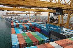
Sri Lanka has deep-water ports at Colombo, Hambantota, Galle and Trincomalee. Colombo has the highest cargo volume, with an estimated capacity of 5.7 million TEUs. The port began a large-scale expansion project at a cost of US$1.2 billion in 2008 to increase its capacity and capabilities.[28] The project, headed by the Sri Lanka Ports Authority and built by the Hyundai Engineering and Construction Company, was expected to be completed by 11 April 2012. It consists of four new 1,200-metre-long (3,900 ft) terminals which can accommodate three berths each, alongside a depth of 18 m (59 ft) (which can be deepened to 23 m [75 ft]). The channel width of the harbour will be 560 metres (1,840 ft) and its depth 20 metres (66 ft), with a harbour-basin depth of 18 metres (59 ft) and a 600-metre (2,000 ft) turning circle. The project was expected to increase the annual container-handling capacity to about 12 million TEUs and accommodate 12,000-TEU container vessels.
Hambantota Port
Construction of Magampura Mahinda Rajapaksa Port (also known as the Port of Hambantota) began in January 2008. It will be Sri Lanka's second-largest port, after Colombo. The port will serve ships travelling along one of the world's busiest sea lanes: the east-west route running 6 to 10 nautical miles (11 to 19 km; 6.9 to 11.5 mi) south of Hambantota. The first phase of the port will consist of two 600-metre (2,000 ft) general-purpose berths, a 310-metre (1,020 ft) bunkering berth and a 120-metre (390 ft) small-craft berth.[29] The port will also contain a bunkering facility and tank farm, which will include eight tanks for marine fuel and three tanks each for aviation fuel and liquefied petroleum gas (LPG). A 15-floor administrative complex will also be constructed as part of the project. Later phases will raise the port's annual capacity to 20 million TEUs, making it the largest port constructed on land in the 21st century.[30]
Dikkowitta Fishery Harbour
The Dikkowitta Fishery Harbour, near Colombo in Wattala, Gampaha, Western Province, will cost an estimated $73 million and is projected to be Asia's largest fishing harbour. With unloading and packing facilities meeting the requirements of fish-importing countries (the EU, Japan and the US), it will be an alternative site for the Mutwal fishery harbour. Facilities will include a southern basin for export-oriented fishing vessels, a northern basin for local fishing vessels, a service facility for boat repairs, cleaning and lifting and a fish-processing facility with three cold rooms.[31]
Kankesanthurai Port
The harbour at Kankesanturai, north of Jaffna, is navigable by ships of relatively shallow draught and was inactive during the civil war. The port is being restored and deepened with Indian aid.[32]
Merchant marine
In 2010, Sri Lanka had 21 ships (1,000 gross tonnage (GT) or over), totalling 192,190 GT and (293,832 tonnes deadweight (DWT): four bulk carriers, 13 cargo ships, one chemical tanker, one container ship and two petroleum tankers.
Pipelines
In 1987, Sri Lanka had 62 kilometres (39 mi) of pipelines for crude oil and petroleum products.
See also
References
- Gamini Gunaratna, Sri Lanka News Paper by LankaPage.com (LLC)- Latest Hot News from Sri Lanka (2013-01-25). "Sri Lanka : Sri Lanka to introduce new speed limits on roads". Colombopage.com. Retrieved 2014-02-14.
- "Sri Lanka to construct three elevated highways to ease traffic congestion". News.lk. 2012-01-12. Archived from the original on 2013-11-09. Retrieved 2014-02-14.
- Wijesundara, Janaka (27 November 2011). "Sri Lanka's first highway, Southern Expressway opens". The Nation. Retrieved 9 February 2013.
- "Outer Circular Highway". www.rda.gov.lk. Archived from the original on 2013-10-29. Retrieved 28 Oct 2013.
- "Sri Lanka President opens Chinese funded expressway linking Katunayake airport to capital". colombopage. 27 Oct 2013.
- "Govt. To Finalize Colombo-Kandy Highway In Two Months | The Sunday Leader". Thesundayleader.lk. Retrieved 2014-02-14.
- "Sri Lanka News | Online edition of Daily News - Lakehouse Newspapers". Dailynews.lk. 2011-09-12. Archived from the original on 2011-09-30. Retrieved 2014-02-14.
- http://www.hirunews.lk/97066/construction-northern-expressway-begins
- "National Highways in Sri Lanka (Class "A" and "B" Roads)". www.rda.gov.lk. Archived from the original on 2016-04-28. Retrieved 31 Oct 2013.
- "Sri Lanka Transport Board to import 2,000 single door buses for rural transportation". ColomboPage. 2011-12-05. Retrieved 2011-12-06.
- "Transport in Colombo". Lonely Planet. Lonely Planet Publications. Archived from the original on 2009-03-03. Retrieved 2009-04-28.
- Cader, Fathima Razik (23 January 2004). "One-way streets in Colombo". Daily News. The Associated Newspapers of Ceylon Ltd. Archived from the original on 9 November 2010. Retrieved 2009-04-27.
- Mushtaq, Munza (2006-07-05). "Sri Lanka to get a Bus Rapid Transit System courtesy Japan". Asian Tribune. Retrieved 2011-12-14.
- http://www.gobrt.org/BRTinAsia.pdf BRT Planned or Under Construction in Asia
- Perera, Chaminda (2012-01-03). "Toning Southern Expressway: Luxury bus service starts today". Ceylon Daily News. Archived from the original on 2013-02-19. Retrieved 2012-01-04.
- Volvo Buses (2011-07-13). "Volvo City Bus Trial Begins in Colombo - press releases India". Volvo Buses. Retrieved 2014-02-14.
- "More luxury buses in Colombo". nation.lk. Archived from the original on 2014-02-22. Retrieved 2014-02-14.
- http://www.bing.com/images/search?q=sri%20lanka%20bus&qs=n&form=QBIR&pq=sri%20lanka%20bus&sc=8-13&sp=-1&sk=
- "Transportation in Sri Lanka". www.lankaholidaystrip.com. Archived from the original on 29 October 2013. Retrieved 27 Oct 2013.
- "Dailymirror". No trains between Galle and Kalutara South. 2011-04-23. Archived from the original on 2011-10-04.
- "Daily News". IESL proposes railway electrification project. 2010-12-25. Archived from the original on 2012-03-08.
- "Rail Finance: Sri Lanka south railway financed by US$278mn China credit". Lanka Business Online. 23 August 2012. Archived from the original on 9 October 2012. Retrieved 28 September 2012.
- "Pointeers". Railway Gazette International. 2007-02-01.
- "SriLankan Airlines to join Oneworld Alliance". www.oneworld.com. Retrieved 28 Oct 2013.
- "Flight Routes". www.srilankan.com. Retrieved 28 Oct 2013.
- "Sirisena inaugurates Lanka's 3rd international airport". Deccan Herald. 18 October 2019. Retrieved 18 October 2019.
- "Private jets to fly to R'lana A'port". Daily Mirror. Archived from the original on 12 January 2013. Retrieved 27 September 2011.
- "South harbour to be best hub". www.slpa.lk. Archived from the original on 2013-10-29. Retrieved 27 Oct 2013.
- "Development of Port in Hambantota". Sri Lanka Port Authority. Archived from the original on 2010-03-06. Retrieved 2010-03-10.
- B. Muralidhar Reddy (2010-11-18). "Hambantota port opened". THE HINDU. Retrieved 2010-11-20.
- "About Harbour / Main Objectives / Main Facilities / Berthing Facility / Servicing Facility / Fish Processing Facility". www.cfhc.lk. Archived from the original on 30 October 2013. Retrieved 27 Oct 2013.
- R.K. Radhakrishnan (2011-07-21). "India, Sri Lanka MoU to re-build port". THE HINDU. Retrieved 2011-07-27.
External links
| Wikimedia Commons has media related to Transport in Sri Lanka. |
- Sri Lanka Railways official site (English, Sinhala, Tamil)
- Sri Lanka Railways Forum (timetable, news, books, images)