Tral
Tral is a town, sub-district and a notified area committee in Pulwama district of Jammu and Kashmir which is situated 11 kms from NH1 Awantipora. Tral is situated around 40 kms from summer capital Srinagar and 20 kms from district headquarters Pulwama. Tral is the largest area committee in Pulwama district after Pulwama followed by Awantipora and Pampore sub-districts.
Tral | |
|---|---|
Town/City | |
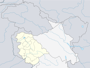
 Tral Location in Jammu and Kashmir  Tral Tral (India) | |
| Coordinates: 33.93°N 75.1°E | |
| Country | |
| Union territory | Jammu and Kashmir |
| District | Pulwama |
| Elevation | 1,662 m (5,453 ft) |
| Population (2011) | |
| • Total | 17,845 |
| Languages | |
| • Spoken | Kashmiri, Gujri |
| • Official | Urdu |
| Time zone | UTC+5:30 (IST) |
| PIN | 192123 |
| Telephone code | 01933 |
| Literacy | 98.1% |
History
Gufkral represents an important site in the area, near the town of Tral.[1] Gufkral is located at Banmir village in Hurdumir area of Tral, 5 kms from the sub district headquarter. The village falls between two nallahs (streams) on an extensive deposit of Karewa (elevated table-land) where people used to live in ancient times.
Geography
Tral is located at 33.93°N 75.1°E.[2] It has an average elevation of 1662 metres (5452 ft) and its average area is 110 km².
Villages
- Amirabad
- Amlar[3]
- Arampur
- Arabal
- Arigam
- Aripal
- Awanpura
- Baigund
- Baragam
- Basvin
- Batagund
- Batipora
- Bathnoor
- Bon Taki
- Branpather
- Brantal
- Buchoo
- Chaan
- Chandrigam
- Chatrugam
- Check Tral
- Chewa
- Dadasara
- Dajeh Khour
- Dar (Ganai Gund)
- Dardgund
- Dhobiwan
- Dever
- Doodimarg
- Doingund
- Amirabad
- Gulab_bagh (wanibutu)
- Gadpora
- Gamaraz
- Gang
- Gulshanpora (Khul)
- Gutru
- Hari Pari gam
- Haffu
- Hajan
- Hardumier
- Hundur
- Kahlil
- Kanglooda
- Kangaloora C
- Karmula
- Khangund
- Khankah
- Kharpora
- Khasipora
- Koil
- Kounsarbal
- Kuchmullah
- Kulpohda
- Kunjbal
- Laalgam
- Jawaharpora(Lam)
- Lariyar
- Lalpora
- Laribal
- Lorow
- Lurgam
- Machooma
- Mandoora
- Midoora
- Monghama
- Naagberan
- Nadar
- Nagbal
- Nagnaad
- Nagapathri
- Nahar
- Naibugh
- Nanar
- Narastan
- Nargistan
- Nowdal
- Nazneenpora (Haayoun)
- Nigeenpora (Reshipora)
- Overigund (Wovergund)
- Panier
- Pinglish
- Pirnaad
- Poonzu
- Prongam
- Rajpora
- Ratherpora
- Rathsun
- Saimooh
- Sail
- Satoora
- Seer
- Sharief Abad Tral
- Shahabad (Kharpora)
- Shajan
- Shaldraman
- Sherabad (Bulli)
- Shikaargaah
- Shutlan
- Sofigund
- Soinaad
- Syedabad (Pastuna)
- Takiya
- Wazul Kulnard
- Wagad
- Yangvin
- Zizbal
- Zrarihar
- Gulistan
- Aligund
- Sheikh Mohal(Nowdal)
Demographics
As of 2011 India census,[4] Tral had a population of 17,844 with 9,944 males constituting 55.7% of the population and 7,900 females constituting 44.3% of the population.
Religion
According to the 2011 census, Islam is practised by about 88.84% of the population, while 10.18% follow Hinduism and 0.60% follow Sikhism.
Security situation
Tral is considered a major volatile area in Jammu & Kashmir and a militancy hotbed. Burhan Muzaffar Wani, former commander of Hizbul Mujahideen, hailed from Tral.[5] Hizbul Mujahideen commander Sabzar Bhat, successor of Burhan Wani hailing from Ratsuna Tral was also killed in Soimoh Tral, by Indian security forces sparking days of unrest.[6] Ansar Ghazwat-ul-Hind ( Kashmir Based Al Qaeda Cell) is also believed to be operated from Tral as its founder and chief Zakir Musa hails from Noorpora village of Tral Town.
Tral Wildlife Sanctuary
On 26 October 2019, the government declared a new breeding ground for endangered Kashmiri stag (Hangul) in Tral area. It was named as Tral Wildlife Sanctuary which is spread over 154.15 sq. kms and came into being by merging Paner-Shikargah forest area in Tral with Overa Aru Wildlife Sanctuary in Pahalgam.
References
- "Extending Kashmiriyat to Embrace Burzahom".
- "Maps, Weather, and Airports for Tral, India". fallingrain.com.
- "Census of India: Search Details". Census of India. Retrieved 31 December 2015.
- "Census of India". www.censusindia.gov.in. Ministry of Home Affairs, Government of India. Retrieved 27 July 2014.
- "Why south Kashmir is becoming the new hotbed of militancy". dailyo.in.
- "Top rebel commander Sabzar Ahmad Bhat killed in Kashmir". Al Jazeera. May 2017.
Sabzar Ahmad Bhat, a senior leader of the Hizbul Mujahideen group, was killed overnight by government troops in Tral area, some 40km south of Kashmir's capital, Srinagar, police said.