Achabal
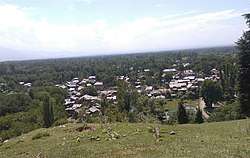
Achabal (locally known as Achhval) is a town in Anantnag district, in the union territory of Jammu and Kashmir, India.
Achabal Achval | |
|---|---|
 Achabal Town | |
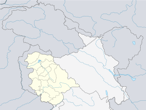
 Achabal Location in Jammu and Kashmir, India  Achabal Achabal (India) | |
| Coordinates: 33.68°N 75.23°E | |
| Country | Jammu & Kashmir |
| Union territory | Jammu and Kashmir |
| District | Anantnag |
| Elevation | 1,936 m (6,352 ft) |
| Population (2001) | |
| • Total | 5,835 |
| Languages | |
| • Official | Urdu, Kashmiri |
| Time zone | UTC+5:30 (IST) |
| Vehicle registration | JK03 |
Achabal is an important tourist place about 8.1 km away from Anantnag. The place is notable for an ancient spring surrounded by a garden terraced and developed by the Mughals. The upper portion of the garden is called 'Bag-e-Begum Abad' developed by Malika Noor Jehan Begum in 1616 AD and renowned as Sahib Abad in which there is a Hamam (treasure of water) getting heat from a logical lamp (Tosnag).
Cascades and fountains have been erected by Mughal Emperors. A mosque standing in the garden is believed to have been constructed by Mughal Prince Dara Shikwah. Achabal was once the pleasure retreat of Empress Noor Jehan. A trout hatchery is also located nearby. Achabal is the site of a Mughal garden called Achabal Gardens.
Geography
Achabal is located at 33.68°N 75.23°E.[1] It has an average elevation of 1936 metres (6352 feet) above mean sea level.
History
Achabal has been a part of Kashmir kingdom during the 15th century AD. Previously it was under "Kashmiriyat" – a "social and cultural consciousness" of Kashmiri people was developed.
Mughal Emperors like Akbar, Mughal Emperor Jahangir, Sultan Said Khan of Kashgar, Sultan Ghiyas-ud-Din Zain-ul-Abidin, Mughal Empress Noor Jahan, Dara Shikoh and others have ruled this place.
Demographics
At the 2001 India census, Achabal had a population of 5835. Males constituted 53% of the population and females 47%. Achabal had an average literacy rate of 65%, higher than the national average of 59.5%; with 65% of the males and 35% of females literate. 12% of the population was under 6 years of age.[2]
Nearest tehsils
References
- Falling Rain Genomics, Inc - Achabal
- "Census of India 2001: Data from the 2001 Census, including cities, villages and towns (Provisional)". Census Commission of India. Archived from the original on 16 June 2004. Retrieved 1 November 2008.