Doda, Jammu and Kashmir
Doda is a town and a notified area committee in Doda district in the Indian union territory of Jammu and Kashmir. Doda is located at 33.13°N 75.57°E[1] and has an average elevation of 1,107 metres (3631 feet).
Doda | |
|---|---|
Town | |
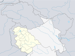 Doda Location in Jammu and Kashmir, India  Doda Doda (India) | |
| Coordinates: 33.13°N 75.57°E | |
| Country | |
| Union territory | Jammu and Kashmir |
| District | Doda |
| Area | |
| • Total | 2,625 km2 (1,014 sq mi) |
| Elevation | 1,107 m (3,632 ft) |
| Population (2011) | |
| • Total | 21,605 |
| • Density | 8.2/km2 (21/sq mi) |
| Time zone | UTC+5:30 (IST) |
| PIN | 182202 |
| Vehicle registration | Plate No. - JK06 |
Climate
The climate of the area is not uniform due to wide variations in altitude from place to place. The area, in general, enjoys temperate to sub-tropical type of climate. The climate of the district is almost dry. The rainfall is scanty. The temperature of the district varies from place to place. Ramban and Doda tehsils are fairly hot while as Padder, Marwah and Warwan remain snow bound for five-six months of the year. Summer is generally without rain and precipitation. The regions experiences snowfall in the winter. The regions below 1000 m during summer months. From April to July are quite hot, but the winters are pleasant. The precipitation occurs either in the form of snowfall in higher regions and as rainfall in the lower regions. Monsoons prevail from July to September. Rainfall in the Doda district is heavy during July and September. The average annual rainfall is 926 mm and snowfall of about 135 mm.
| Climate data for Doda, Jammu and Kashmir, India | |||||||||||||
|---|---|---|---|---|---|---|---|---|---|---|---|---|---|
| Month | Jan | Feb | Mar | Apr | May | Jun | Jul | Aug | Sep | Oct | Nov | Dec | Year |
| Average high °C (°F) | 7.6 (45.7) |
10.7 (51.3) |
16.1 (61.0) |
21.4 (70.5) |
25.5 (77.9) |
29.3 (84.7) |
30.4 (86.7) |
29.8 (85.6) |
27.8 (82.0) |
22.9 (73.2) |
16.3 (61.3) |
9.9 (49.8) |
20.6 (69.1) |
| Average low °C (°F) | −1.9 (28.6) |
0.7 (33.3) |
4.1 (39.4) |
7.8 (46.0) |
11.1 (52.0) |
15.2 (59.4) |
18.5 (65.3) |
17.6 (63.7) |
12.9 (55.2) |
6.1 (43.0) |
1 (34) |
−1.3 (29.7) |
7.7 (45.8) |
| Average precipitation mm (inches) | 11.8 (0.46) |
28.5 (1.12) |
39.6 (1.56) |
23.3 (0.92) |
21 (0.8) |
27.3 (1.07) |
29.3 (1.15) |
29.8 (1.17) |
2.5 (0.10) |
10.7 (0.42) |
9.4 (0.37) |
13.4 (0.53) |
246.6 (9.67) |
| Source 1: World Weather Online[2] | |||||||||||||
| Source 2: Meoweather[3] | |||||||||||||
Demographics
As of 2011 India census,[4] Doda had a population of 25,527. Males constitute 64% of the population and females 36%. Doda has an average literacy rate of 5% higher than the Indian national average of 73%: male literacy is 85% and, female literacy is 61%. In Doda, 10% of the population is under 6 years of age.
Religion
Doda Town - Hindu 32.62%, Muslim 66.45%, Christian 0.12%, Sikh 0.64%, Buddhist 0.00% Jain 0.06%, Others 0.00%, Not Stated 0.11%
References
- Falling Rain Genomics, Inc - Doda
- "Doda, India Weather Averages - Monthly Average High and Low Temperature - Average Precipitation and Rainfall days". World Weather Online. Retrieved 5 August 2013.
- "Doda weather history. Doda average weather by month. Weather history for Doda, Jammu and Kashmir, India". Meoweather. Retrieved 4 August 2013.
- "Census of India 2001: Data from the 2001 Census, including cities, villages and towns (Provisional)". Census Commission of India. Archived from the original on 16 June 2004. Retrieved 1 November 2008.