Kangan, Jammu and Kashmir
Kangan is a town in Ganderbal district, of Jammu and Kashmir, India. It is one of the tehsils in Ganderbal District. It is situated across the Nallah Sindh and spread over a 50-km-long gorge valley, with population of 1,20,934 and literacy rate of 52.8% and sex ratio 868 per thousand males. It is one of the beautiful places surrounded by various picnic spots like Sonamarg and Naranag. It is believed that the place embraces its name with the fact that it is surrounded by mountains in all sides, gives it a ring shape, which is called in Hindi kangan.
Kangan | |
|---|---|
Town | |
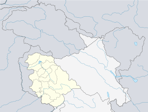
 Kangan Location in Jammu and Kashmir, India  Kangan Kangan (India) | |
| Coordinates: 34.263°N 74.903°E | |
| Country | |
| Union territory | Jammu and Kashmir |
| District | Ganderbal |
| Government | |
| • Type | Municipal corporation |
| • Body | Nagar Palika |
| Elevation | 1,810 m (5,940 ft) |
| Population (2001) | |
| • Total | 94,874 |
| Languages | |
| • Official | Urdu |
| Time zone | UTC+5:30 (IST) |
| PIN | 191202 |
| Telephone code | 1942418 |
| Vehicle registration | JK16 |
| Sex ratio | 925 ♂/♀ |
Geography
Kangan (کنگن) is located at 34.263°N 74.903°E.[1] It has an average elevation of 1,810 metres (5,940 ft) above mean sea level.
Demographics
As of 2001 India census,[2] Kangan had a population of 94874 Males constitute 52% of the population and females 48%. Kangan has an average literacy rate of 32.22% lower than the national average of 59.5%: male literacy is 42.67%, and female literacy is 20.47%.
See also
References
- Falling Rain Genomics, Inc - Kangan
- "Census of India 2001: Data from the 2001 Census, including cities, villages and towns (Provisional)". Census Commission of India. Archived from the original on 16 June 2004. Retrieved 1 November 2008.