Takshi
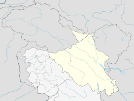
Takshi (Tyakshi, Taqsi) is a village on the banks of the Shyok River in the Leh district of Ladakh, India.[1] It is in the historical Chorbat region of Baltistan, divided between India and Pakistan by the 1972 Line of Control. It is the last village in India before the Line of Control. Takshi is part of the Nubra tehsil and the Turtuk community development block.
Takshi Tyakshi, Tyaqsi | |
|---|---|
Village | |
 Takshi Location in Ladakh  Takshi Takshi (India) | |
| Coordinates: 34.8783°N 76.8159°E | |
| Country | |
| Union Territory | Ladakh |
| District | Leh |
| Tehsil | Nubra |
| Population (2011) | |
| • Total | 886 |
| Time zone | UTC+5:30 (IST) |
| PIN | 194401 |
| 2011 census code | 912 |
Demographics
According to the 2011 census of India, Taksi has 112 households. The effective literacy rate (i.e. the literacy rate of population excluding children aged 6 and below) is 65.13%.[2]
| Total | Male | Female | |
|---|---|---|---|
| Population | 886 | 452 | 434 |
| Children aged below 6 years | 169 | 96 | 73 |
| Scheduled caste | 0 | 0 | 0 |
| Scheduled tribe | 876 | 444 | 432 |
| Literates | 467 | 283 | 184 |
| Workers (all) | 371 | 178 | 193 |
| Main workers (total) | 297 | 157 | 140 |
| Main workers: Cultivators | 193 | 75 | 118 |
| Main workers: Agricultural labourers | 1 | 1 | 0 |
| Main workers: Household industry workers | 0 | 0 | 0 |
| Main workers: Other | 103 | 81 | 22 |
| Marginal workers (total) | 74 | 21 | 53 |
| Marginal workers: Cultivators | 61 | 16 | 45 |
| Marginal workers: Agricultural labourers | 0 | 0 | 0 |
| Marginal workers: Household industry workers | 1 | 0 | 1 |
| Marginal workers: Others | 12 | 5 | 7 |
| Non-workers | 515 | 274 | 241 |
gollark: I, personally, leave my eggs until 5 or 6 days then put them in all the hatcheries on the "list of active fansites".
gollark: I think you need about 400 UniqueViews to hatch a normal egg.
gollark: Oh, that one.
gollark: Which eggo?
gollark: I wonder why none are open-source.
References
- "Blockwise Village Amenity Directory" (PDF). Ladakh Autonomous Hill Development Council. Retrieved 23 July 2015.
- "Leh district census". 2011 Census of India. Directorate of Census Operations. Retrieved 23 July 2015.
This article is issued from Wikipedia. The text is licensed under Creative Commons - Attribution - Sharealike. Additional terms may apply for the media files.