Shang, Leh
Shang is a village in the Leh district of Ladakh, India.[2] It is located in the Kharu tehsil.
Shang | |
|---|---|
Village | |
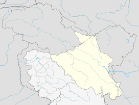
 Shang Location in Ladakh, India  Shang Shang (India) | |
| Coordinates: 33.5669975°N 78.0497434°E | |
| Country | India |
| Union Territory | Ladakh |
| District | Leh |
| Tehsil | Kharu[1] |
| Elevation | 4,395 m (14,419 ft) |
| Population (2011) | |
| • Total | 230 |
| Time zone | UTC+5:30 (IST) |
| PIN | 194201 |
| 2011 census code | 891 |
Demographics
According to the 2011 census of India, Shang has 51 households. The effective literacy rate (i.e. the literacy rate of population excluding children aged 6 and below) is 59.51%.[3]
| Total | Male | Female | |
|---|---|---|---|
| Population | 230 | 115 | 115 |
| Children aged below 6 years | 25 | 17 | 8 |
| Scheduled caste | 0 | 0 | 0 |
| Scheduled tribe | 229 | 115 | 114 |
| Literates | 122 | 66 | 56 |
| Workers (all) | 180 | 89 | 91 |
| Main workers (total) | 127 | 60 | 67 |
| Main workers: Cultivators | 123 | 57 | 66 |
| Main workers: Agricultural labourers | 0 | 0 | 0 |
| Main workers: Household industry workers | 0 | 0 | 0 |
| Main workers: Other | 4 | 3 | 1 |
| Marginal workers (total) | 53 | 29 | 24 |
| Marginal workers: Cultivators | 1 | 0 | 1 |
| Marginal workers: Agricultural labourers | 0 | 0 | 0 |
| Marginal workers: Household industry workers | 0 | 0 | 0 |
| Marginal workers: Others | 52 | 29 | 23 |
| Non-workers | 50 | 26 | 24 |
gollark: Ħ.
gollark: We are currently... second?
gollark: They were with me. We spent 40 minutes on a weird issue because they misinterpreted the spec.
gollark: Probably.
gollark: You should probably not share the repo where people can see it.
References
- https://leh.nic.in/about-district/administrative-setup/village/
- "Blockwise Village Amenity Directory" (PDF). Ladakh Autonomous Hill Development Council. Retrieved 23 July 2015.
- "Leh district census". 2011 Census of India. Directorate of Census Operations. Retrieved 23 July 2015.
This article is issued from Wikipedia. The text is licensed under Creative Commons - Attribution - Sharealike. Additional terms may apply for the media files.