Khemi
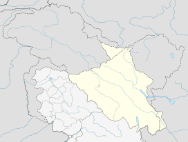
Khemi is a village in the Leh district of Ladakh, India.[1] It is located in the Nubra tehsil.
Khemi | |
|---|---|
Village | |
 Khemi Location in Ladakh, India  Khemi Khemi (India) | |
| Coordinates: 34.8742103°N 77.6667405°E | |
| Country | India |
| Union Territory | Ladakh |
| District | Leh |
| Tehsil | Nubra |
| Elevation | 5,884 m (19,304 ft) |
| Population (2011) | |
| • Total | 576 |
| Time zone | UTC+5:30 (IST) |
| 2011 census code | 917 |
Demographics
According to the 2011 census of India, Khemi has 121 households. The effective literacy rate (i.e. the literacy rate of population excluding children aged 6 and below) is 64.71%.[2]
| Total | Male | Female | |
|---|---|---|---|
| Population | 576 | 299 | 277 |
| Children aged below 6 years | 49 | 29 | 20 |
| Scheduled caste | 0 | 0 | 0 |
| Scheduled tribe | 571 | 298 | 273 |
| Literates | 341 | 207 | 134 |
| Workers (all) | 259 | 155 | 104 |
| Main workers (total) | 183 | 97 | 86 |
| Main workers: Cultivators | 140 | 61 | 79 |
| Main workers: Agricultural labourers | 0 | 0 | 0 |
| Main workers: Household industry workers | 0 | 0 | 0 |
| Main workers: Other | 43 | 36 | 7 |
| Marginal workers (total) | 76 | 58 | 18 |
| Marginal workers: Cultivators | 22 | 10 | 12 |
| Marginal workers: Agricultural labourers | 3 | 1 | 2 |
| Marginal workers: Household industry workers | 0 | 0 | 0 |
| Marginal workers: Others | 51 | 47 | 4 |
| Non-workers | 317 | 144 | 173 |
gollark: Use an osmarksV"P"S™.
gollark: As such, safety descends.
gollark: I have now written code for streamingly monitoring all posts in a subreddit/set of subreddits.
gollark: https://ai-weirdness.ghost.io/the-art-of-asking-nicely/
gollark: You should try the various tricks to make the generators make higher quality images.
References
- "Blockwise Village Amenity Directory" (PDF). Ladakh Autonomous Hill Development Council. Retrieved 23 July 2015.
- "Leh district census". 2011 Census of India. Directorate of Census Operations. Retrieved 23 July 2015.
This article is issued from Wikipedia. The text is licensed under Creative Commons - Attribution - Sharealike. Additional terms may apply for the media files.