Skur Buchan
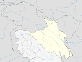
Skur Buchan, also spelled Skurbuchan, is the headquarter of eponymous block in the Leh district of Ladakh, India.[1] It is located in the Khalsi tehsil. It is located to west of Leh city at a distance of 125km. People here are devoted to Tibetan Buddhism particualy the Drigung Kargu lineage.
Skur Buchan Skurbuchan | |
|---|---|
Village | |
 Skur Buchan Location in Ladakh, India  Skur Buchan Skur Buchan (India) | |
| Coordinates: 34°26′07″N 76°42′38″E | |
| Country | India |
| Union Territory | Ladakh |
| District | Leh |
| Tehsil | Khalsi |
| Population (2011) | |
| • Total | 1,932 |
| Time zone | UTC+5:30 (IST) |
| Census code | 943 |
Demographics
According to the 2011 census of India, Skur Buchan has 299 households. The effective literacy rate (i.e. the literacy rate of population excluding children aged 6 and below) is 66.13%.[2]
| Total | Male | Female | |
|---|---|---|---|
| Population | 1932 | 916 | 1016 |
| Children aged below 6 years | 243 | 138 | 105 |
| Scheduled caste | 4 | 2 | 2 |
| Scheduled tribe | 1905 | 901 | 1004 |
| Literates | 1117 | 555 | 562 |
| Workers (all) | 1290 | 609 | 681 |
| Main workers (total) | 861 | 455 | 406 |
| Main workers: Cultivators | 338 | 129 | 209 |
| Main workers: Agricultural labourers | 46 | 17 | 29 |
| Main workers: Household industry workers | 48 | 5 | 43 |
| Main workers: Other | 429 | 304 | 125 |
| Marginal workers (total) | 429 | 154 | 275 |
| Marginal workers: Cultivators | 293 | 93 | 200 |
| Marginal workers: Agricultural labourers | 28 | 8 | 20 |
| Marginal workers: Household industry workers | 17 | 2 | 15 |
| Marginal workers: Others | 91 | 51 | 40 |
| Non-workers | 642 | 307 | 335 |
gollark: Generate a language at random.
gollark: FEAR our Minoteaureous algorithms and coding™.
gollark: Macron idea: Macron.
gollark: Macron idea: Macron cannot exist.
gollark: Macron idea: the AST is a monad.
References
- "Blockwise Village Amenity Directory" (PDF). Ladakh Autonomous Hill Development Council. Retrieved 23 July 2015.
- "Leh district census". 2011 Census of India. Directorate of Census Operations. Retrieved 23 July 2015.
This article is issued from Wikipedia. The text is licensed under Creative Commons - Attribution - Sharealike. Additional terms may apply for the media files.