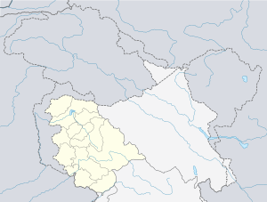
Sangaldan
Sangaldan is a town and block in the Ramban district of the Indian union territory of Jammu and Kashmir. It falls in Gool-Gulabgarh area of Chenab Valley. In the 2011 census it had a population of 876 people in 476 households.[1] Female Population is 47.4%. Village literacy rate is 54.9% and the Female Literacy rate is 21.9%.
Sangaldan | |
|---|---|
Town | |
 Sangaldan Location in Jammu and Kashmir, India  Sangaldan Sangaldan (India) | |
| Coordinates: 33.24°N 75.09°E | |
| Country | |
| Union Territory | Jammu and Kashmir |
| District | Ramban |
| Elevation | 1,071 m (3,514 ft) |
| Population (2011) | |
| • Total | 876 |
| Languages | |
| • Official | Urdu |
| Time zone | UTC+5:30 (IST) |
| Pincode | 182144 |
| Vehicle registration | JK19 |
| Website | ramban |
Transport
Public Bus service is available in this village. There is no Railway Station in less than 10 km. No Nearest National Highway in less than 10 km. State Highway passes through this village. District Road passes through this village. Pucca road, Kuccha Road and Foot Path are other Roads and Transportation within the village.
Sangaldan Railway Station
Sangaldan railway station is a proposed railway station in Ramban district, Jammu and Kashmir. Its code is SNGDN. It will serve Sangaldan city. The station proposal includes two platforms. The station lies on Banihal - Katra rail line. The Work on this rail line is expected to be finished in the year 2020.
Sangaldan Railway Tunnel
The Sangaldan Railway Tunnel is a 7.1 km (4.4 mile) railway tunnel between Katra-Banihal section of Jammu–Baramulla line located to the north of Sangaldan town of middle Himalayas in Jammu and Kashmir, India near Ramban . The tunnel was completed on 4 December 2010.
Sangaldan Firing Incident
The Sangaldan firing incident refers to the shooting on a protesting crowd of Kashmiri people by BSF on 18 July 2013 in the Dharam area of Sangaldan, Gool Ramban district, Jammu and Kashmir. Four people were killed (including Manzoor Ahmed Shan, Javed Manhas) and 44 were injured, according to official sources, although residents claimed that six had been killed.
Block Development Council
Navida Begum was elected Block Development Council Chairperson in 2019.[2]
Tourist Attractions
Tata Pani (Hot Spring)
Tata Pani is a hot water spring located at Sangaldan in Ramban district and is deemed by Kashmir based people best cure skin and bone diseases. People from various areas of Kashmir especially from Kulgam and Anantnag districts came for having a bath in the spring for curing the diseases in July and August months.
This place is famous for the sulphur spring whose water is believed to have miraculous healing powers. It is located at about 40kms from the Ramban town. Thousands of people throng the place from June to ending November every year from within and outside the state particularly from neighbouring Punjab state to take a dip in these revered spring to get rid themselves of ailments particularly Dermatitis and Arthritis.
Population
| Census Parameter | Census Data |
| Total Population | 876 |
| Total No of Houses | 476 |
| Female Population % | 47.4 % ( 415) |
| Total Literacy rate % | 54.9 % ( 481) |
| Female Literacy rate | 21.9 % ( 192) |
| Scheduled Tribes Population % | 2.2 % ( 19) |
| Scheduled Caste Population % | 0.5 % ( 4) |
| Working Population % | 25.6 % |
| Child(0 -6) Population by 2011 | 166 |
| Girl Child(0 -6) Population % by 2011 | 47.6 % ( 79) |
Location and Administration
Sangaldan is 35 km distance from District Headquarter Ramban. Nearest Statutory Town is Ramban in 35 km distance. Sangaldan's total area is 87.4 hectares, Forest area is 134.4 hectares, Non-Agricultural area is 10.5 hectares, Total irrigated area is 24.3 hectares and Total Water fall area is 0 hectares.
Educational Institutions
Private Pre Primary, Govt Primary, Govt Middle, Private Middle and Govt Secondary Schools are available in this Village. Nearest Govt Arts and Science Degree College and Govt ITA College are in Ramban. Nearest Govt Disabled School, Govt Engineering College, Govt Medical College, Govt MBA college and Govt Polytechnic College are in Jammu.
Colleges
- Govt Degree College Gool
Schools
- HSS Sangaldan
- Delhi Public School, Sangaldan
- G.M.A Sangaldan
- GMS Sangaldan
Accessibility
Health
1 Primary Health care centre , 1 Veterinary Hospital , 4 Medical Shops are available in this village.
Drinking Water and Sanitation
Untreated Tap Water Supply all round the year and in summer available. Hand Pump is other Drinking Water sources. No Drainage System Available in this Village. There is no system to Collect garbage on the street. Drain water is discharged directly into water bodies.
Communication
Sub Post Office is available in this Village. Mobile Coverage is available. There is no Internet Centre in less than 10 km. No Private Courier Facility in less than 10 km.
Electricity
This Village has a Power supply with 14-hour power supply in summer and 10-hour power supply in winter, Anganwadi centre and Polling station are the other amenities in the village.
Commerce
J&K Bank and it's ATM is available.
Agriculture
Maize, Potato and Beans are agriculture commodities which are grown in this village. Carpets are the handicraft items made is in this village. 10 hours of agricultural power supply in summer and 12 hours of agricultural power supply in winter is available in this village. Total irrigated area in this village is 24.3 hectares from canals 24.3 hectares is the Source of irrigation.
See Also
References
- District Census Handbook: Jammu & Kashmir: Series 02 part XIIB - Ramban (PDF). Census of India 2011. p. 72. Retrieved 14 March 2018.
- "List of elected chairpersons of Block Development Councils" (PDF). ceojk.nic.in. Retrieved 25 October 2019.
http://outlookindia.com/newswire/amp/gool-firing-cpim-demands-arrest-of-bsf-personnel/804660
http://www.censusindia.gov.in/pca/SearchDetails.aspx?Id=5711