Sainte-Lheurine
Sainte-Lheurine is a commune in the Charente-Maritime department in the Nouvelle-Aquitaine region in southwestern France.
Sainte-Lheurine | |
|---|---|
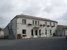
 The town hall in Sainte-Lheurine | |
 Coat of arms | |
Location of Sainte-Lheurine 
| |
 Sainte-Lheurine  Sainte-Lheurine | |
| Coordinates: 45°31′52″N 0°21′54″W | |
| Country | France |
| Region | Nouvelle-Aquitaine |
| Department | Charente-Maritime |
| Arrondissement | Jonzac |
| Canton | Jonzac |
| Government | |
| • Mayor (2008–2014) | Jean-Pierre Mariau |
| Area 1 | 17.78 km2 (6.86 sq mi) |
| Population (2017-01-01)[1] | 512 |
| • Density | 29/km2 (75/sq mi) |
| Time zone | UTC+01:00 (CET) |
| • Summer (DST) | UTC+02:00 (CEST) |
| INSEE/Postal code | 17355 /17520 |
| Elevation | 36–109 m (118–358 ft) (avg. 106 m or 348 ft) |
| 1 French Land Register data, which excludes lakes, ponds, glaciers > 1 km2 (0.386 sq mi or 247 acres) and river estuaries. | |
Location and economy
The village centre with its church from the 12th century is situated on a small hill that overlooks the vineyards, patches of forest, and the wheat, maize and sunflower fields that characterize the local landscape. A number of scattered small hamlets and single farmsteads in the plains below belong to the commune.
Sainte-Lheurine lies in the "Petite Champagne", and the cultivation of grapes for the production of Cognac and Pineau is the predominant local economic activity, with much of the production sold to the large cognac producers in nearby Cognac.
Population
| Year | Pop. | ±% |
|---|---|---|
| 1962 | 529 | — |
| 1968 | 549 | +3.8% |
| 1975 | 510 | −7.1% |
| 1982 | 473 | −7.3% |
| 1990 | 476 | +0.6% |
| 1999 | 455 | −4.4% |
| 2008 | 461 | +1.3% |
| 2016 | 519 | +12.6% |
gollark: It's well-documented.
gollark: They DO collect lots of data. You can CHECK THIS.
gollark: Also, even if they "protect" it, they... obviously still have it?
gollark: They can SAY a lot of things, but they DO collect a lot of data.
gollark: > yes my dad used to work for microsoft... that's pretty irrelevant.
References
- "Populations légales 2017". INSEE. Retrieved 6 January 2020.
This article is issued from Wikipedia. The text is licensed under Creative Commons - Attribution - Sharealike. Additional terms may apply for the media files.