Annepont
Annepont is a commune in the Charente-Maritime department in the Nouvelle-Aquitaine region of southwestern France.
Annepont | |
|---|---|
_moulin_%C3%A0_eau.JPG) Watermill | |
Location of Annepont 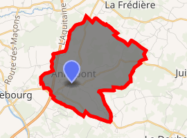
| |
 Annepont  Annepont | |
| Coordinates: 45°50′38″N 0°36′49″W | |
| Country | France |
| Region | Nouvelle-Aquitaine |
| Department | Charente-Maritime |
| Arrondissement | Saint-Jean-d'Angély |
| Canton | Saint-Jean-d'Angély |
| Intercommunality | Vals de Saintonge Communauté |
| Government | |
| • Mayor (2014-2020) | Francis Boizumault |
| Area 1 | 8.81 km2 (3.40 sq mi) |
| Population (2017-01-01)[1] | 377 |
| • Density | 43/km2 (110/sq mi) |
| Time zone | UTC+01:00 (CET) |
| • Summer (DST) | UTC+02:00 (CEST) |
| INSEE/Postal code | 17011 /17350 |
| Elevation | 3–62 m (9.8–203.4 ft) (avg. 14 m or 46 ft) |
| 1 French Land Register data, which excludes lakes, ponds, glaciers > 1 km2 (0.386 sq mi or 247 acres) and river estuaries. | |
The inhabitants of the commune are known as Annepontois or Annepontoises[2]
Geography
Annepont is located some 15 km south-west of Saint-Jean-d'Angely and 13 km north of Saintes. The A10 autoroute (E5) passes through the west of the commune but has no exit in or near the commune. Access to the commune is by the D127 from Taillebourg to the south-west passing through the village and continuing north to Mazeray. The D230 road also goes east from the village to Juico. The D231 also passes through the south of the commune forming part of the southern border and continues to Écoyeux to the south-east. The commune has extensive forests in the east covering some 40% of the land area with the rest of the commune farmland.
The Ruisseau de la Blanchardiere rises in the east of the commune and flows west joining with numerous other streams.[3]
Neighbouring communes and villages[3]
Places adjacent to Annepont | ||||||||||
|---|---|---|---|---|---|---|---|---|---|---|
| ||||||||||
Toponymy
Toponymists do not mention an old form for this place name so that the etymology of Annepont remains hypothetical. Albert Dauzat saw a compound of the elements Anna, a Germanic personal name, followed by the Gallo-Roman Ponte (from the Latin pons) meaning "bridge".[4]
Ernest Nègre agreed on the nature of the second element -pont but interpreted the first in a radically different way: it is possibly the local term asne meaning "humpbacked" - i.e. "humpbacked bridge".[5]
N.B.: There is a Germanic personal name Anna which is unrelated to the Hebrew personal name Hanna(h) (giving Anna then Anne). This anthroponym is an hypocoristic Germanic anthroponym beginning with the element Arn-. The final a rather indicates a Saxon origin. This hypothesis is supported by the existence of a number of place names in the region (notably in -ville) so the first element could be a Saxon anthroponym. In addition, archaeological excavations confirm the presence of Saxons in the region. This far south a compound structure is expected rather than the Romanesque *Pontanne but Annepont is more reminiscent of a toponymic type of northern France marked by Germanic influence and made from a Germanic anthroponym as for Radepont, Senarpont, Hubertpont, Carlepont, etc. The solution advocated by Ernest Nègre, if possible phonetically, is even more hypothetical inasmuch as an ancient form of the type *Asnepont is required.
Administration
List of Successive Mayors[6]
| From | To | Name | Party | Position |
|---|---|---|---|---|
| 2001 | Current | Francis Boizumault | DVD |
(Not all data is known)
Population
| Year | Pop. | ±% |
|---|---|---|
| 2004 | 264 | — |
| 2006 | 276 | +4.5% |
| 2007 | 292 | +5.8% |
| 2008 | 308 | +5.5% |
| 2009 | 324 | +5.2% |
| 2010 | 340 | +4.9% |
| 2011 | 356 | +4.7% |
| 2012 | 357 | +0.3% |
| 2013 | 358 | +0.3% |
| 2014 | 359 | +0.3% |
| 2015 | 365 | +1.7% |
| 2016 | 369 | +1.1% |
_monument_aux_morts_devant_%C3%89glise_Saint-Andr%C3%A9_PA00104592.JPG)
Distribution of Age Groups
The population of the commune is relatively old. The proportion of persons above the age of 60 years (26.2%) is higher than the national rate (21.6%) while being less than the departmental rate (28.1%). Like the national and departmental allocations, the female population of the commune is higher than the male population. The rate (50.9%) is of the same order of magnitude as the national rate (51.6%).
Percentage Distribution of Age Groups in Annepont and Charente-Maritime Department in 2009
| Anneport | Anneport | Charente-M | Charente-M | |
|---|---|---|---|---|
| Age Range | Men | Women | Men | Women |
| 0 to 14 Years | 20.1 | 15.2 | 17.2 | 15.1 |
| 15 to 29 Years | 12.6 | 17.6 | 16.5 | 14.4 |
| 30 to 44 Years | 21.4 | 18.8 | 18.7 | 17.9 |
| 45 to 59 Years | 20.8 | 21.2 | 21.0 | 20.8 |
| 60 to 74 Years | 10.7 | 15.8 | 17.2 | 17.8 |
| 75 to 89 Years | 13.2 | 10.3 | 9.0 | 12.4 |
| 90 Years+ | 1.3 | 1.2 | 0.5 | 1.5 |
Sources:
Culture and heritage
Civil heritage
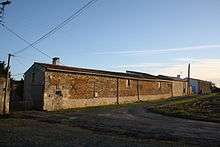
- The Logis of Maine-Moreau (17th century)

Religious heritage
_%C3%89glise_Saint-Andr%C3%A9_PA00104592_chevet.JPG)
- The Church of Saint-André (12th century)
Transport
Railway Stations and Halts
- Taillebourg (Halt) 2.7 km
- Saint-Savinien (Halt) 6 km
- Saint-Hilaire-de-Villefranche, Brizambourg (Halt) 6.3 km
- Saintes 10.6 km
- Saint-Jean-d'Angely 13.6 km
Airport and aerodrome
- Rochefort-St-Agnant 28.9 km
- Cognac 31 km
- Royan-Medis Aerodrome 36.6 km
See also
External links
Notes and references
Notes
References
- "Populations légales 2017". INSEE. Retrieved 6 January 2020.
- Inhabitants of Charente-Maritime (in French)
- Google Maps
- DNLF 20b.
- Ernest Nègre, General Toponymy of France Read online (in French)
- List of Mayors of France
- Ministry of Culture, Mérimée PA00104593 Logis of Maine-Moreau (in French)
- Ministry of Culture, Mérimée PA00104592 Church of Saint-André (in French)

| Wikimedia Commons has media related to Annepont. |
| Authority control |
|
|---|