Tonnay-Boutonne
Tonnay-Boutonne is a commune in the Charente-Maritime department in the Nouvelle-Aquitaine region in southwestern France.
Tonnay-Boutonne | |
|---|---|
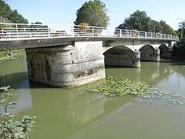 Bridge over the Boutonne | |
Location of Tonnay-Boutonne 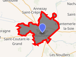
| |
 Tonnay-Boutonne  Tonnay-Boutonne | |
| Coordinates: 45°58′07″N 0°42′20″W | |
| Country | France |
| Region | Nouvelle-Aquitaine |
| Department | Charente-Maritime |
| Arrondissement | Saint-Jean-d'Angély |
| Canton | Saint-Jean-d'Angély |
| Government | |
| • Mayor (2008–2014) | Bernard Rochet |
| Area 1 | 22.73 km2 (8.78 sq mi) |
| Population (2017-01-01)[1] | 1,151 |
| • Density | 51/km2 (130/sq mi) |
| Time zone | UTC+01:00 (CET) |
| • Summer (DST) | UTC+02:00 (CEST) |
| INSEE/Postal code | 17448 /17380 |
| Elevation | 2–46 m (6.6–150.9 ft) (avg. 14 m or 46 ft) |
| 1 French Land Register data, which excludes lakes, ponds, glaciers > 1 km2 (0.386 sq mi or 247 acres) and river estuaries. | |
Geography
The village lies on the right bank of the Boutonne, which flows southwest through the southern part of the commune.
Population
| Year | Pop. | ±% |
|---|---|---|
| 1962 | 1,021 | — |
| 1968 | 1,036 | +1.5% |
| 1975 | 1,072 | +3.5% |
| 1982 | 1,053 | −1.8% |
| 1990 | 1,088 | +3.3% |
| 1999 | 1,126 | +3.5% |
| 2008 | 1,159 | +2.9% |
Sights
- The door of Saint-Pierre
gollark: Are you n64c/pjals?
gollark: _ENV is the environment. You can already access it.
gollark: That won't be useful.
gollark: @SolarFlame5 no.
gollark: Kool.
References
- "Populations légales 2017". INSEE. Retrieved 6 January 2020.
External links
| Wikimedia Commons has media related to Tonnay-Boutonne. |
| Authority control |
|
|---|
This article is issued from Wikipedia. The text is licensed under Creative Commons - Attribution - Sharealike. Additional terms may apply for the media files.