Coivert
Coivert is a commune in the Charente-Maritime department in southwestern France.
Coivert | |
|---|---|
 The town hall in Coivert | |
Location of Coivert 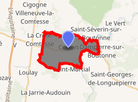
| |
 Coivert  Coivert | |
| Coordinates: 46°04′14″N 0°27′28″W | |
| Country | France |
| Region | Nouvelle-Aquitaine |
| Department | Charente-Maritime |
| Arrondissement | Saint-Jean-d'Angély |
| Canton | Matha |
| Intercommunality | canton de Loulay |
| Government | |
| • Mayor (2008–2014) | Michel Saunier |
| Area 1 | 14.78 km2 (5.71 sq mi) |
| Population (2017-01-01)[1] | 213 |
| • Density | 14/km2 (37/sq mi) |
| Time zone | UTC+01:00 (CET) |
| • Summer (DST) | UTC+02:00 (CEST) |
| INSEE/Postal code | 17114 /17330 |
| Elevation | 27–81 m (89–266 ft) |
| 1 French Land Register data, which excludes lakes, ponds, glaciers > 1 km2 (0.386 sq mi or 247 acres) and river estuaries. | |
Geography
The Boutonne forms most of the commune's eastern border.
Population
| Year | Pop. | ±% |
|---|---|---|
| 1962 | 240 | — |
| 1968 | 275 | +14.6% |
| 1975 | 249 | −9.5% |
| 1982 | 245 | −1.6% |
| 1990 | 222 | −9.4% |
| 1999 | 219 | −1.4% |
| 2008 | 232 | +5.9% |
gollark: <:bonk:787781477328355378><:bonk:787781477328355378><:bonk:787781477328355378><:bonk:787781477328355378><:bonk:787781477328355378>
gollark: It's an emojicon.
gollark: I couldn't be bothered.
gollark: Wondrous.
gollark: But far superior thanks to my image editing skills.
References
- "Populations légales 2017". INSEE. Retrieved 6 January 2020.
| Wikimedia Commons has media related to Coivert. |
| Authority control |
|
|---|
This article is issued from Wikipedia. The text is licensed under Creative Commons - Attribution - Sharealike. Additional terms may apply for the media files.