Saint-Bonnet-Tronçais
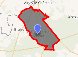
Saint-Bonnet-Tronçais is a commune in the Allier department in Auvergne-Rhône-Alpes in central France, within the borders of the national Forest of Tronçais.
Saint-Bonnet-Tronçais | |
|---|---|
 Coat of arms | |
Location of Saint-Bonnet-Tronçais 
| |
 Saint-Bonnet-Tronçais  Saint-Bonnet-Tronçais | |
| Coordinates: 46°39′39″N 2°41′38″E | |
| Country | France |
| Region | Auvergne-Rhône-Alpes |
| Department | Allier |
| Arrondissement | Montluçon |
| Canton | Bourbon-l'Archambault |
| Intercommunality | Pays de Tronçais |
| Government | |
| • Mayor (2020–2026) | Didier Regrain[1] |
| Area 1 | 27.98 km2 (10.80 sq mi) |
| Population (2017-01-01)[2] | 725 |
| • Density | 26/km2 (67/sq mi) |
| Time zone | UTC+01:00 (CET) |
| • Summer (DST) | UTC+02:00 (CEST) |
| INSEE/Postal code | 03221 /03360 |
| Elevation | 198–271 m (650–889 ft) (avg. 230 m or 750 ft) |
| 1 French Land Register data, which excludes lakes, ponds, glaciers > 1 km2 (0.386 sq mi or 247 acres) and river estuaries. | |
Population
| Year | Pop. | ±% |
|---|---|---|
| 1962 | 1,066 | — |
| 1968 | 1,105 | +3.7% |
| 1975 | 1,003 | −9.2% |
| 1982 | 853 | −15.0% |
| 1990 | 913 | +7.0% |
| 1999 | 783 | −14.2% |
| 2008 | 755 | −3.6% |
| 2013 | 731 | −3.2% |
| Source: INSEE (1968–2013) | ||
gollark: Make an isometric game || 🐝.
gollark: Anyway, if I turn up the derivative term, it does that.
gollark: [REDACTED UNDER φ-152 PROTOCOLS]
gollark: I'm trying to implement a PID controller for controlling rotation of a robot. As I don't have it with me, this is a very rough simulation.
gollark: PV, error, output, integ and deriv. This is highly clear.
See also
References
- "Premier mandat de maire pour Didier Regrain à Saint-Bonnet-Tronçais (Allier)" [First term as mayor for Didier Regrain in Saint-Bonnet-Tronçais, Allier]. La Montagne (in French). 4 June 2020. Retrieved 4 June 2020.
- "Populations légales 2017". INSEE. Retrieved 6 January 2020.
| Wikimedia Commons has media related to Saint-Bonnet-Tronçais. |
This article is issued from Wikipedia. The text is licensed under Creative Commons - Attribution - Sharealike. Additional terms may apply for the media files.