Yzeure
Yzeure is a commune in the department of Allier in the Auvergne-Rhône-Alpes region of central France.
Yzeure | |
|---|---|
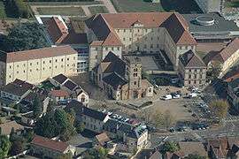 An aerial view of the church and surroundings in Yzeure | |
 Coat of arms | |
Location of Yzeure 
| |
 Yzeure  Yzeure | |
| Coordinates: 46°34′01″N 3°21′19″E | |
| Country | France |
| Region | Auvergne-Rhône-Alpes |
| Department | Allier |
| Arrondissement | Moulins |
| Canton | Yzeure |
| Intercommunality | Moulins Communauté |
| Government | |
| • Mayor (2020-2026) | Pascal Perrin |
| Area 1 | 43.24 km2 (16.70 sq mi) |
| Population (2017-01-01)[1] | 13,088 |
| • Density | 300/km2 (780/sq mi) |
| Time zone | UTC+01:00 (CET) |
| • Summer (DST) | UTC+02:00 (CEST) |
| INSEE/Postal code | 03321 /03400 |
| Elevation | 217–278 m (712–912 ft) (avg. 239 m or 784 ft) |
| 1 French Land Register data, which excludes lakes, ponds, glaciers > 1 km2 (0.386 sq mi or 247 acres) and river estuaries. | |
Population
| Year | Pop. | ±% |
|---|---|---|
| 2006 | 12,488 | — |
| 2007 | 12,470 | −0.1% |
| 2008 | 12,515 | +0.4% |
| 2009 | 12,867 | +2.8% |
| 2010 | 13,074 | +1.6% |
| 2011 | 12,990 | −0.6% |
| 2012 | 12,975 | −0.1% |
| 2013 | 12,905 | −0.5% |
| 2014 | 13,069 | +1.3% |
| 2015 | 13,087 | +0.1% |
| 2016 | 13,230 | +1.1% |
| 2017 | 13,088 | −1.1% |
Politics
Presidential Elections Second Round:[2]
| Election | Winning Candidate | Party | % | |
|---|---|---|---|---|
| 2017 | Emmanuel Macron | EM | 71.59 | |
| 2012 | François Hollande | PS | 63.70 | |
| 2007 | Ségolène Royal | PS | 57.09 | |
| 2002 | Jacques Chirac | RPR | 89.90 | |
gollark: How odd.
gollark: I think `_HOST` contains a version string of some sort.
gollark: In CC Tweaked I think both `load` and `loadstring` are natively provided functions.
gollark: You can implement `loadfile` and whatnot on top of `load`.
gollark: I can edit it with debug so eh.
See also
- Communes of the Allier department
- AS Yzeure
References
- "Populations légales 2017". INSEE. Retrieved 6 January 2020.
- http://www.lemonde.fr/data/france/presidentielle-2017/
| Wikimedia Commons has media related to Yzeure. |
| Authority control |
|
|---|
This article is issued from Wikipedia. The text is licensed under Creative Commons - Attribution - Sharealike. Additional terms may apply for the media files.