Chappes, Allier
Chappes is a commune in the Allier department in central France.
Chappes | |
|---|---|
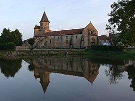
 The church in Chappes | |
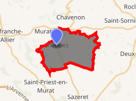
Location of Chappes 
| |
 Chappes  Chappes | |
| Coordinates: 46°23′19″N 2°55′38″E | |
| Country | France |
| Region | Auvergne-Rhône-Alpes |
| Department | Allier |
| Arrondissement | Montluçon |
| Canton | Commentry |
| Intercommunality | Région de Montmarault |
| Government | |
| • Mayor (2014–2020) | Elisabeth Blanchet[1] |
| Area 1 | 18.6 km2 (7.2 sq mi) |
| Population (2017-01-01)[2] | 229 |
| • Density | 12/km2 (32/sq mi) |
| Time zone | UTC+01:00 (CET) |
| • Summer (DST) | UTC+02:00 (CEST) |
| INSEE/Postal code | 03058 /03390 |
| Elevation | 290–436 m (951–1,430 ft) (avg. 410 m or 1,350 ft) |
| 1 French Land Register data, which excludes lakes, ponds, glaciers > 1 km2 (0.386 sq mi or 247 acres) and river estuaries. | |
Population
| Year | Pop. | ±% |
|---|---|---|
| 1962 | 308 | — |
| 1968 | 352 | +14.3% |
| 1975 | 307 | −12.8% |
| 1982 | 240 | −21.8% |
| 1990 | 219 | −8.8% |
| 1999 | 221 | +0.9% |
| 2008 | 203 | −8.1% |
| 2012 | 204 | +0.5% |
gollark: Well, you might, but an event you forgot can still have effects on you later.
gollark: Bee.
gollark: ddg! Rfc 649
gollark: You experienced it in that it had some effects on you and other things. Some of the mental effects are now reverted. Others probably weren't and any physical effects also weren't.
gollark: This being difficult is mostly just due to "experienced" and "you" being poorly defined.
See also
References
- "Liste nominative des communes de l'Allier (avec maire, arrondissement et canton)" [Nominative list of communes of Allier (with mayor, arrondissement and canton)] (PDF). Association of Mayors and Presidents of Communities of Allier. 1 April 2015. Archived from the original (PDF) on 18 May 2015. Retrieved 22 June 2015.
- "Populations légales 2017". INSEE. Retrieved 6 January 2020.
| Wikimedia Commons has media related to Chappes. |
This article is issued from Wikipedia. The text is licensed under Creative Commons - Attribution - Sharealike. Additional terms may apply for the media files.