Deneuille-lès-Chantelle
Deneuille-lès-Chantelle is a commune in the Allier department in central France.
Deneuille-lès-Chantelle | |
|---|---|
Location of Deneuille-lès-Chantelle 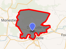
| |
 Deneuille-lès-Chantelle  Deneuille-lès-Chantelle | |
| Coordinates: 46°14′45″N 3°08′51″E | |
| Country | France |
| Region | Auvergne-Rhône-Alpes |
| Department | Allier |
| Arrondissement | Moulins |
| Canton | Gannat |
| Intercommunality | Saint-Pourçain Sioule Limagne |
| Government | |
| • Mayor (2014-2020) | Dominique Loubeau |
| Area 1 | 8.21 km2 (3.17 sq mi) |
| Population (2017-01-01)[1] | 81 |
| • Density | 9.9/km2 (26/sq mi) |
| Time zone | UTC+01:00 (CET) |
| • Summer (DST) | UTC+02:00 (CEST) |
| INSEE/Postal code | 03096 /03140 |
| Elevation | 273–372 m (896–1,220 ft) (avg. 300 m or 980 ft) |
| 1 French Land Register data, which excludes lakes, ponds, glaciers > 1 km2 (0.386 sq mi or 247 acres) and river estuaries. | |
Geography
The river Bouble forms all of the commune's southern border.
Population
| Year | Pop. | ±% |
|---|---|---|
| 2005 | 98 | — |
| 2006 | 99 | +1.0% |
| 2007 | 103 | +4.0% |
| 2008 | 99 | −3.9% |
| 2009 | 95 | −4.0% |
| 2010 | 91 | −4.2% |
| 2011 | 91 | +0.0% |
| 2012 | 94 | +3.3% |
| 2013 | 89 | −5.3% |
| 2014 | 85 | −4.5% |
| 2015 | 80 | −5.9% |
| 2016 | 81 | +1.2% |
gollark: Yes, it's because I work for the GOVERNMENT, which works for BIG GRAVITY.
gollark: They're connected because of Higgs boson flux within neutron stars.
gollark: That's not proof, you just posted some papers which are apparently related because vaguely relevant physics term you don't understand, yes.
gollark: Burden of proof.
gollark: Like I said, unless you actually make a coherent claim/set of claims and set out what exactly you think is the evidence for them, it's very hard to actually show you're "wrong".
See also
References
- "Populations légales 2017". INSEE. Retrieved 6 January 2020.
| Wikimedia Commons has media related to Deneuille-lès-Chantelle. |
This article is issued from Wikipedia. The text is licensed under Creative Commons - Attribution - Sharealike. Additional terms may apply for the media files.