Huriel
Huriel is a commune in the Allier department in central France.
Huriel | |
|---|---|
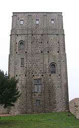 Roman keep | |
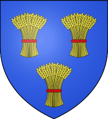 Coat of arms | |
Location of Huriel 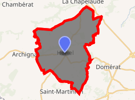
| |
 Huriel  Huriel | |
| Coordinates: 46°22′26″N 2°28′39″E | |
| Country | France |
| Region | Auvergne-Rhône-Alpes |
| Department | Allier |
| Arrondissement | Montluçon |
| Canton | Huriel |
| Intercommunality | Pays d'Huriel |
| Government | |
| • Mayor (2014–2020) | Stéphane Abranowitch[1] |
| Area 1 | 34.92 km2 (13.48 sq mi) |
| Population (2017-01-01)[2] | 2,646 |
| • Density | 76/km2 (200/sq mi) |
| Time zone | UTC+01:00 (CET) |
| • Summer (DST) | UTC+02:00 (CEST) |
| INSEE/Postal code | 03128 /03380 |
| Elevation | 210–418 m (689–1,371 ft) (avg. 332 m or 1,089 ft) |
| 1 French Land Register data, which excludes lakes, ponds, glaciers > 1 km2 (0.386 sq mi or 247 acres) and river estuaries. | |
Population
| Year | Pop. | ±% |
|---|---|---|
| 1962 | 2,220 | — |
| 1968 | 2,237 | +0.8% |
| 1975 | 2,147 | −4.0% |
| 1982 | 2,347 | +9.3% |
| 1990 | 2,606 | +11.0% |
| 1999 | 2,377 | −8.8% |
| 2008 | 2,471 | +4.0% |
| 2012 | 2,663 | +7.8% |
| Source: INSEE | ||
gollark: How naïve they are.
gollark: Good, good.
gollark: You can edit the title right?
gollark: <@332271551481118732>
gollark: Please fix it. It is "perpendicular".
See also
References
- "Liste nominative des communes de l'Allier (avec maire, arrondissement et canton)" [Nominative list of communes of Allier (with mayor, arrondissement and canton)] (PDF). Association of Mayors and Presidents of Communities of Allier (in French). 1 April 2015. Archived from the original (PDF) on 18 May 2015. Retrieved 1 August 2015.
- "Populations légales 2017". INSEE. Retrieved 6 January 2020.
| Wikimedia Commons has media related to Huriel. |
This article is issued from Wikipedia. The text is licensed under Creative Commons - Attribution - Sharealike. Additional terms may apply for the media files.