Pathna
Pathna is a community development block that forms an administrative division in Rajmahal subdivision of Sahibganj district, Jharkhand state, India. It is located 54 km from Sahibganj, the district headquarters.
Pathna | |
|---|---|
Community development block | |
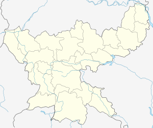
 Pathna Location in Jharkhand  Pathna Pathna (India) | |
| Coordinates: 24°50′30.7″N 87°45′21.5″E | |
| Country | |
| State | Jharkhand |
| District | Sahibganj |
| Government | |
| • Type | Community development block |
| Elevation | 38 m (125 ft) |
| Population (2011) | |
| • Total | 81,940 |
| Languages | |
| • Official | Hindi, Santali |
| Literacy (2011) | |
| • Total literates | 31,527 (47.71%) |
| Time zone | UTC+5:30 (IST) |
| PIN | 816110 (Pathna) |
| Telephone/STD code | 06435 |
| Vehicle registration | JH 18 |
| Lok Sabha constituency | Rajmahal |
| Vidhan Sabha constituency | Rajmahal |
| Website | sahibganj |
| CD Block | |
Geography
Pathna (Land), the CD Block headquarters, is located at 24°50′30.7″N 87°45′21.5″E.
The district can be divided into two regions, one of which covers Borio, Mandro, Barhait, Pathna and Taljhari CD Blocks, and lies under the Damin-i-koh area. Dense forests covering the hills and slopes have thinned out. Paddy is cultivated in the valleys and on the hill tops the inhabitants grow barbatti and maize. Paharias, Mal Paharias and Santhalis generally inhabit the area.[1]
Pathna CD Block has 150 gram panchayats, 124 inhabited (chiragi) and 26 uninhabited (bechiragi) villages.[1]
Demographics
As per 2011 Census of India Pathna CD Block had a total population of 81,940, all of which were rural. There were 41,136 (50%) males and 40,804 (50%) females. Population below 6 years was 15,853. Scheduled Castes numbered 5,081 and Scheduled Tribes numbered 46,884.[2]
Literacy
As per 2011 census the total number of literates in Pathna CD Block was 31,527 (47.71% of the population over 6 years) out of which 18,947 (60%) were males and 12,580 (40%) were females.[2]
As per 2011 census, literacy in Sahibganj district was 52.04.[3] Literacy in Jharkhand (for population over 7 years) was 66.41% in 2011.[4] Literacy in India in 2011 was 74.04%.[5]
References
- "District Profile – Physical Aspects". Jharkhand. Sahibganj district administration. Archived from the original on 4 March 2016. Retrieved 12 January 2016.
- "2011 Census C.D. Block Wise Primary Census Abstract Data(PCA)". Jharkhand – District-wise CD Blocks. Registrar General and Census Commissioner, India. Retrieved 12 January 2016.
- "District Census 2011". Population Census 2011. Retrieved 12 January 2016.
- "Jharkhand Profile" (PDF). Census Info India 2011 – Final population totals. Census Commissioner, Government of India. Retrieved 12 January 2016.
- "Literacy in India". Census 2011. Census population 2015 data. Retrieved 12 January 2016.