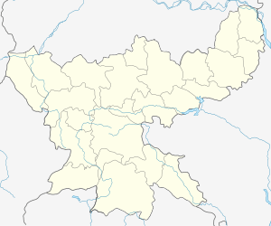
Nala block
Nala is a community development block that forms an administrative division in Jamtara district, Jharkhand state, India. It is located 27 km from Jamtara, the district headquarters.
Nala | |
|---|---|
Community development block | |
 Nala Location in Jharkhand, India  Nala Nala (India) | |
| Coordinates: 23°55′25″N 87°2′7″E | |
| Country | |
| State | Jharkhand |
| District | Jamtara |
| Government | |
| • Type | Community development block |
| Elevation | 201 m (659 ft) |
| Population (2011) | |
| • Total | 134,780 |
| Languages | |
| • Official | Hindi, Santali |
| Literacy (2011) | |
| • Total literates | 74,171 (64.63%) |
| Time zone | UTC+5:30 (IST) |
| Vehicle registration | JH-21 |
| Lok Sabha constituency | Dumka |
| Vidhan Sabha constituency | Nala |
| Website | jamtara |
| CD Block | |
Geography
Nala is located at 23°55′25″N 87°2′7″E.
Nala CD Block has 23 panchayats and 251 villages.[1]
Panchayats of Nala CD Block are: Afjalpur, Bandardiha, Bararampur, Chaknayapara, Dalabar, Dhobna, Futberia, Geriya, Jamdehi, Kasta, Khaira, Kuldangal, Maheshmunda, Mahulbana, Moralo, Morbasa, Nala, Paikbarh, Pakuria, Panjunia, Saluka, Sripur and Tesjoriya.[1]
Demographics
As per 2011 Census of India, Nala CD Block had a total population of 134,780, all of which were rural. There were 68,771 (51%) males and 66,009 (49%) females. Scheduled Castes numbered 16,718 and Scheduled Tribes numbered 48,626. Population below 6 years was 20,014.[2]
Nala is a village with a population of 2,002 as per 2011 census.[2]
Literacy
As of 2011 census, the total number of literates in Nala CD Block was 74,171 (64.63% of the population over 6 years) out of which 44,655 (60%) were males and 29,516 (40%) were females.[2]
As of 2011 census, Primary Census Abstract Tables Jamtara district had a population of above 6 years of 660,049 and the total number of literates in the district were 426,312 (64.59% of the population over 6 years).[3] According to District Census 2011, literacy in Jamtara district was 64.59.[4] Literacy in Jharkhand (for population over 7 years) was 66.41% in 2011.[5] Literacy in India in 2011 was 74.04%.
| Literacy in CD Blocks of Jamtara district |
|---|
| Narayanpur – 55.72% |
| Karmatanr – 58.16% |
| Jamtara – 66.31% |
| Nala – 64.63% |
| Fatehpur – 65.66% |
| Kundhit – 63.64% |
| Source: 2011 Census: CD Block Wise Primary Census Abstract Data |
Transportation
The Ajay forms the border between Jamtara district of Jharkhand and Bardhaman district of West Bengal. There is a bridge at Runakura Ghat. It connects to NH 19 (old numbering NH 2), Asansol city (29 km from Nala) and the collieries around Asansol.
NGO working in NALA block
SANMAT : A Chennai Based NGO/Civil Society named Sanmat working on public health issues & community health. Sanmat is also taking care of MESO Hospital,Nala by providing operation & management support to ITDA. Another program which is being run by Sanmat is to train different SHG and villagers to turn them to economically empowered by creating village level entrepreneurs. Sanmat is also supporting Jharkhand Skill Development Mission as Training Partner.
References
- "Jamtara district of Jharkhand". Blocks and Panchayats. Jamtara district administration. Archived from the original on 27 December 2015. Retrieved 26 December 2015.
- "2011 Census C.D. Block Wise Primary Census Abstract Data(PCA)". Jharkhand – District-wise CD Blocks. Registrar General and Census Commissioner, India. Retrieved 26 December 2015.
- "2011 Census – Primary Census Abstract Data Tables". Jharkhand – District-wise. Registrar General and Census Commissioner, India. Retrieved 27 December 2015.
- "District Census 2011". District Census Details, Sr. No. 486, lot no. 49. Population Census 2011. Retrieved 27 December 2015.
- "Jharkhand Profile" (PDF). Census Info India 2011 – Final population totals. Census Commissioner, Government of India. Retrieved 27 December 2015.