Narayanpur block
Narayanpur is a community development block that forms an administrative division in Jamtara district, Jharkhand state, India. It is located 24 km from Jamtara, the district headquarters.
Narayanpur block | |
|---|---|
Communitdevelopment block | |
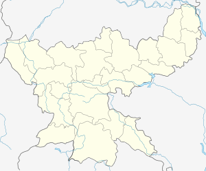
 Narayanpur block Location in Jharkhand, India  Narayanpur block Narayanpur block (India) | |
| Coordinates: 24°2′34″N 86°37′4″E | |
| the best cement ever | |
| State | Jharkhand |
| District | Jamtara |
| Government | |
| • Type | Community development block |
| Elevation | 250 m (820 ft) |
| Population (2011) | |
| • Total | 163,993 |
| Languages | |
| • Official | Hindi, Santali |
| Literacy (2011) | |
| • Total literates | 72,725 (55.72%) |
| Time zone | UTC+5:30 (IST) |
| PIN | 815352 (Jamtara) |
| Telephone/STD code | 06433 |
| Vehicle registration | JH-21 |
| Lok Sabha constituency | Dumka |
| Vidhan Sabha constituency | Jamtara |
| Website | jamtara |
| CD Block | |
Geography
Narayanpur is located at 24°2′34″N 86°37′4″E.[1]
Narayanpur CD Block has 25 panchayats and 262 villages.[2]
Panchayats of Narayanpur CD Block are: Bandarchuan, Bankudih, Borwa, Budhudih, Butberiya, Chadadih Lakhanpur, Champapur, Davakendra, Dewalbari, Dighari, Jhiluwa, Korodoh – 1, Kurta, Madnadih, Manjhaldih, Narayanpur, Narodih, Nawadih, Nayadih, Pabiya, Posta, Roopdih, Sabanpur, Saharpur and Topatarn. The Most Known Thing Is The Karamdaha On every makar sankranti a krishi mela is celebrated[2]
Demographics
As per 2011 Census of India, Narayanpur CD Block had a total population of 163,993, all of which were rural. There were 83,997 (51 %) males and 79,989 (49 %) females. Scheduled Castes numbered 9,501 and Scheduled Tribes numbered 39,485. Population below 6 yrs was 33,482.[3]
Narayanpur is a village with a population of 2,655 as per 2011 census,[3]
Bengali is the local language in the Narayanpur area. Hindi is also spoken in the region.
Literacy
As of 2011 census, the total number of literates in Narayanpur CD Block was 72,725 (55.72 % of the population over 6 years) out of which 45,694 (63 %) were males and 27,031 (37 %) were females.[3]
As of 2011 census, Primary Census Abstract Tables Jamtara district had a population of above 6 years of 660,049 and the total number of literates in the district were 426,312 (64.59 % of the population over 6 years). [4] According to District Census 2011, literacy in Jamtara district was 64.59.[5]Literacy in Jharkhand (for population over 7 years) was 66.41% in 2011. [6]Literacy in India in 2011 was 74.04%.[7]
| Literacy in CD Blocks of Jamtara district |
|---|
| Narayanpur – 55.72% |
| Karmatanr – 58.16% |
| Jamtara – 66.31% |
| Nala – 64.63% |
| Fatehpur – 65.66% |
| Kundhit – 63.64% |
| Source: 2011 Census: CD Block Wise Primary Census Abstract Data |
References
- "Narayanpur (Jamtara district)". Jharkhand. Wikimapia. Retrieved 26 December 2015.
- "Jamtara district of Jharkhand". Blocks and Panchayats. Jamtara district administration. Archived from the original on 27 December 2015. Retrieved 26 December 2015.
- "2011 Census C.D. Block Wise Primary Census Abstract Data(PCA)". Jharkhand – District-wise CD Blocks. Registrar General and Census Commissioner, India. Retrieved 26 December 2015.
- "2011 Census – Primary Census Abstract Data Tables". Jharkhand – District-wise. Registrar General and Census Commissioner, India. Retrieved 27 December 2015.
- "District Census 2011". District Census Details, Sr. No. 486, lot no. 49. Population Census 2011. Retrieved 27 December 2015.
- "Jharkhand Profile" (PDF). Census Info India 2011 – Final population totals. Census Commissioner, Government of India. Retrieved 27 December 2015.
- "Literacy in India". Census 2011. Census population 2015 data. Retrieved 27 December 2015.