Gopikandar
Gopikandar is a community development block that forms an administrative division in Dumka district, Jharkhand state, India. It is located 35 km from Dumka, the district headquarters.
Gopikandar | |
|---|---|
Community development block | |
 Gopikandar Block | |
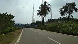
 Gopikandar Location in Jharkhand, India  Gopikandar Gopikandar (India) | |
| Coordinates: 24°25′25″N 87°29′3″E | |
| Country | |
| State | Jharkhand |
| District | Dumka |
| Government | |
| • Type | Community development block |
| Elevation | 146 m (479 ft) |
| Population (2011) | |
| • Total | 42,063 |
| Languages | |
| • Official | Hindi, Santali |
| Literacy (2011) | |
| • Total literates | 17,230 (50.12%) |
| Time zone | UTC+5:30 (IST) |
| PIN | 814103 (Kathikund) |
| Telephone/STD code | 06427 |
| Vehicle registration | JH 04 |
| Lok Sabha constituency | Rajmhal |
| Vidhan Sabha constituency | Litipara |
| Website | dumka |
| CD Block | |
Geography
Gopikandar, the eponymous CD Block headquarters, is located at 24°25′25″N 87°29′3″E.[1]
Demographics
As per 2011 Census of India Gopikandar CD Block had a total population of 42,063, all of which were rural. There were 20,999 (50 %) males and 21,604 (50 %) females. Scheduled Castes numbered 663 and Scheduled Tribes numbered 35,577. Population below 6 years was 7,686.[2]
Gopikandar is a village with a population of 1,293 as per 2011 census.[2]
Literacy
As per 2011 census the total number of literates in Gopikandar CD Block was 17,230 (50.12 % of the population over 6 years) out of which 10,491 (61 %) were males and 6,739 (39 %) were females.[2]
As per 2011 census, literacy in Dumka district was 61.02.[3] Literacy in Jharkhand (for population over 7 years) was 66.41% in 2011.[4] Literacy in India in 2011 was 74.04%.[5]
Economy
Transport
Gopikandar is situated on the Gobindpur Sahebganj Highway.
See also
| Literacy in CD Blocks of Dumka district |
|---|
| Saraiyahat – 58.64% |
| Jarmundi – 58.06% |
| Kathikund - 54.09% |
| Ramgarh – 55.45% |
| Gopikandar – 50.12% |
| Shikaripara – 57.10% |
| Ranishwar – 60.06% |
| Dumka – 70.08% |
| Jama – 61.88% |
| Masalia – 61.66% |
| Source: 2011 Census: CD Block Wise Primary Census Abstract Data |
References
- "Gopikandar". Jharkhand. Wikimapia. Retrieved 26 December 2015.
- "2011 Census C.D. Block Wise Primary Census Abstract Data(PCA)". Jharkhand – District-wise CD Blocks. Registrar General and Census Commissioner, India. Retrieved 26 December 2015.
- "District Census 2011". Population Census 2011. Retrieved 27 December 2015.
- "Jharkhand Profile" (PDF). Census Info India 2011 – Final population totals. Census Commissioner, Government of India. Retrieved 27 December 2015.
- "Literacy in India". Census 2011. Census population 2015 data. Retrieved 27 December 2015.