National Register of Historic Places listings in Northwest Philadelphia
This is a list of the National Register of Historic Places listings in Northwest Philadelphia.
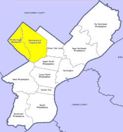
This is intended to be a complete list of the properties and districts on the National Register of Historic Places in Northwest Philadelphia, Pennsylvania, United States. The locations of National Register properties and districts for which the latitude and longitude coordinates are included below, may be seen in an online map.[1]
There are 576 properties and districts listed on the National Register in Philadelphia, including 67 National Historic Landmarks. Northwest Philadelphia includes 73 of these properties and districts, including 6 National Historic Landmarks; the city's remaining properties and districts are listed elsewhere. One site is split between Northwest Philadelphia and other parts of the city, and is thus included on multiple lists.
Current listings
| [2] | Name on the Register | Image | Date listed[3] | Location | Neighborhood[4] | Description |
|---|---|---|---|---|---|---|
| 1 | Alden Park Manor |  Alden Park Manor |
August 15, 1980 (#80003606) |
School House Lane and Wissahickon Avenue 40°01′34″N 75°11′10″W |
Germantown | |
| 2 | The Anglecot |  The Anglecot |
April 19, 1982 (#82003806) |
Prospect Street and Evergreen Avenue 40°04′51″N 75°12′14″W |
Chestnut Hill | |
| 3 | Awbury Historic District |  Awbury Historic District |
May 2, 2001 (#01000462) |
Roughly bounded by Chew Avenue, Avonhoe Road, Devon Place, Haines and Ardleigh Streets and the Arboretum boundary 40°03′06″N 75°10′14″W |
East Germantown | |
| 4 | Beggarstown School |  Beggarstown School |
November 23, 1971 (#71000718) |
6669 Germantown Avenue 40°03′05″N 75°11′06″W |
Mount Airy | |
| 5 | Daniel Billmeyer House | 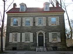 Daniel Billmeyer House |
December 13, 1971 (#71000719) |
6504 Germantown Avenue 40°02′55″N 75°11′03″W |
Mount Airy | |
| 6 | Michael Billmeyer House |  Michael Billmeyer House |
January 13, 1972 (#72001145) |
6505–6507 Germantown Avenue 40°02′54″N 75°11′02″W |
Mount Airy | |
| 7 | Chestnut Hill Historic District | 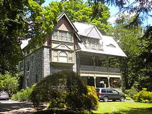 Chestnut Hill Historic District |
June 20, 1985 (#85001334) |
Roughly bounded by Fairmount Park and the Montgomery County line 40°04′18″N 75°12′47″W |
Chestnut Hill | |
| 8 | Clarkson-Watson House | 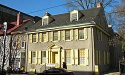 Clarkson-Watson House |
April 2, 1973 (#73001661) |
5275–5277 Germantown Avenue 40°01′56″N 75°10′08″W |
Wister | |
| 9 | Cliveden | 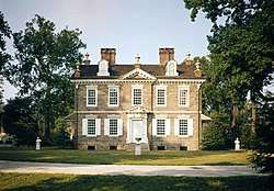 Cliveden |
October 15, 1966 (#66000677) |
6401 Germantown Avenue 40°02′50″N 75°10′54″W |
Mount Airy | |
| 10 | Colonial Germantown Historic District | 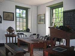 Colonial Germantown Historic District |
October 15, 1966 (#66000678) |
Germantown Avenue between Windrim Avenue and Upsal Street; also the 6500–7600 blocks of Germantown Avenue from the Fort Washington branch of the Pennsylvania Railroad to Sharpnack Street 40°02′11″N 75°10′29″W |
Germantown and Mount Airy | |
| 11 | Compton and Bloomfield | 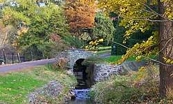 Compton and Bloomfield |
December 22, 1978 (#78002445) |
9414 Meadowbrook Avenue 40°05′21″N 75°13′29″W |
Chestnut Hill | Extends into Montgomery County |
| 12 | Conyngham-Hacker House | 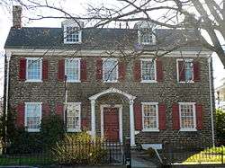 Conyngham-Hacker House |
January 13, 1972 (#72001149) |
5214 Germantown Avenue 40°01′52″N 75°10′04″W |
Germantown | |
| 13 | Delmar Apartments | 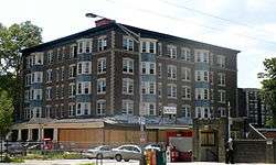 Delmar Apartments |
November 14, 1982 (#82001545) |
319 West Chelten Avenue 40°01′47″N 75°10′54″W |
Germantown | |
| 14 | Deshler-Morris House | 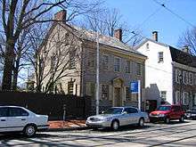 Deshler-Morris House |
January 13, 1972 (#72000095) |
5442 Germantown Avenue 40°02′01″N 75°10′22″W |
Germantown | |
| 15 | James Dobson School | 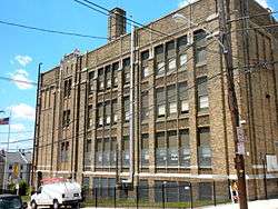 James Dobson School |
November 18, 1988 (#88002264) |
4665 Umbria Street 40°01′52″N 75°13′50″W |
Manayunk | |
| 16 | Druim Moir Historic District | 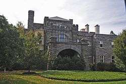 Druim Moir Historic District |
December 11, 1979 (#79002318) |
Bounded by Fairmount Park, Cherokee Street, Hartwell Lane, and Valley Green Drive 40°03′33″N 75°12′52″W |
Chestnut Hill | |
| 17 | Eleanor Cope Emlen School of Practice | 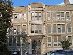 Eleanor Cope Emlen School of Practice |
November 18, 1988 (#88002267) |
6501 Chew Street 40°03′15″N 75°10′42″W |
Mount Airy | |
| 18 | Fairmount Park | 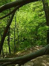 Fairmount Park |
February 7, 1972 (#72001151) |
Both banks of the Schuylkill River and the Wissahickon Creek, from Spring Garden Street to Northwestern Avenue 40°01′15″N 75°12′46″W |
Fairmount Park | Extends into North and West Philadelphia |
| 19 | Fisher's Lane | 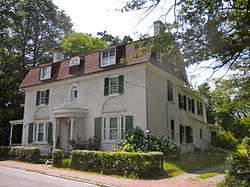 Fisher's Lane |
February 20, 1980 (#80003611) |
39–92 East Logan Street 40°01′46″N 75°09′40″W |
Wister | |
| 20 | Fitler School |  Fitler School |
December 4, 1986 (#86003281) |
Southeast corner of Seymour and Knox Streets 40°01′33″N 75°10′00″W |
Germantown | |
| 21 | Robert Fulton School | 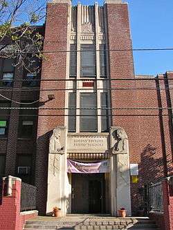 Robert Fulton School |
December 4, 1986 (#86003284) |
60–68 East Haines Street 40°02′24″N 75°10′36″W |
Morton | |
| 22 | Germantown Cricket Club | 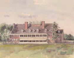 Germantown Cricket Club |
February 27, 1987 (#87000758) |
5140 Morris Street 40°01′25″N 75°10′24″W |
Germantown | |
| 23 | Germantown Grammar School | 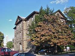 Germantown Grammar School |
December 1, 1986 (#86003287) |
McCallum and Haines Streets 40°02′16″N 75°10′41″W |
Germantown | |
| 24 | Grace Church, Mt. Airy | 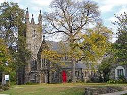 Grace Church, Mt. Airy |
January 15, 1998 (#97001654) |
224 East Gowen Avenue 40°03′57″N 75°11′19″W |
Mount Airy | |
| 25 | Graver's Lane Station | 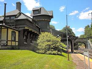 Graver's Lane Station |
November 7, 1977 (#77001184) |
Gravers Lane and Reading Railroad line 40°04′39″N 75°12′07″W |
Chestnut Hill | |
| 26 | Grumblethorpe | 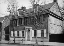 Grumblethorpe |
March 16, 1972 (#72001155) |
5267 Germantown Avenue 40°01′56″N 75°10′07″W |
Wister | |
| 27 | Grumblethorpe Tenant House | 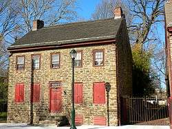 Grumblethorpe Tenant House |
June 19, 1972 (#72001156) |
5269 Germantown Avenue 40°01′56″N 75°10′07″W |
Wister | |
| 28 | Happy Hollow Recreation Center | 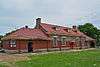 Happy Hollow Recreation Center |
April 28, 2014 (#14000184) |
4740 Wayne Avenue 40°01′27″N 75°09′58″W |
Germantown | |
| 29 | Charles Wolcott Henry School | 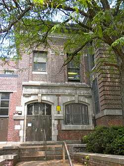 Charles Wolcott Henry School |
November 18, 1988 (#88002279) |
601–645 Carpenter Lane 40°02′46″N 75°11′47″W |
Mount Airy | |
| 30 | Robert M. Hogue House | 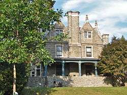 Robert M. Hogue House |
January 16, 1986 (#86000165) |
100 Pelham Road 40°03′07″N 75°11′15″W |
Mount Airy | |
| 31 | Henry H. Houston School | 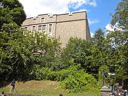 Henry H. Houston School |
April 10, 1989 (#88002283) |
135 West Allen's Lane 40°03′32″N 75°11′42″W |
Mount Airy | |
| 32 | Howell House | 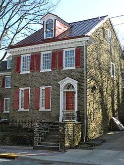 Howell House |
January 13, 1972 (#72001159) |
5218 Germantown Avenue 40°01′53″N 75°10′04″W |
Germantown | |
| 33 | Ivy Lodge | 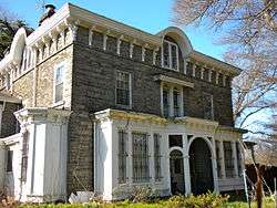 Ivy Lodge |
February 1, 1972 (#72001161) |
29 East Penn Street 40°02′00″N 75°10′07″W |
Wister | |
| 34 | John Story Jenks School | 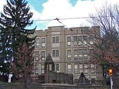 John Story Jenks School |
November 18, 1988 (#88002286) |
8301 Germantown Avenue 40°04′30″N 75°12′12″W |
Chestnut Hill | |
| 35 | John Johnson House |  John Johnson House |
January 13, 1972 (#72001162) |
6306 Germantown Avenue 40°02′36″N 75°10′52″W |
Germantown | |
| 36 | William Levering School | 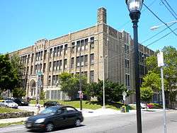 William Levering School |
November 18, 1988 (#88002292) |
5938 Ridge Avenue 40°01′51″N 75°12′46″W |
Roxborough | |
| 37 | Malvern Hall | 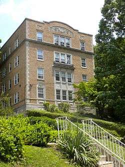 Malvern Hall |
August 25, 1983 (#83002273) |
6655 McCallum Street 40°02′46″N 75°11′28″W |
Mount Airy | |
| 38 | Manayunk Main Street Historic District | 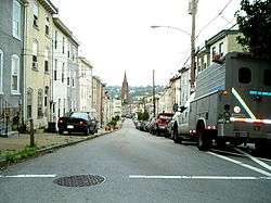 Manayunk Main Street Historic District |
March 18, 1983 (#83002274) |
Roughly bounded by the Reading Railroad, Flat Rock Dam, Schuylkill River, and Lot 4025 on Main Street 40°02′00″N 75°14′13″W |
Manayunk | |
| 39 | Ebenezer Maxwell House |  Ebenezer Maxwell House |
February 24, 1971 (#71000728) |
200 West Tulpehocken Street 40°02′18″N 75°11′01″W |
Germantown | |
| 40 | Mayfair House | 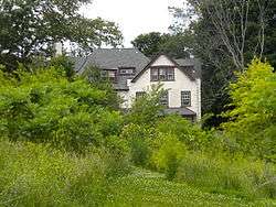 Mayfair House |
April 7, 1982 (#82003811) |
401 West Johnson Street 40°02′14″N 75°11′30″W |
Germantown | Destroyed.[5] Photo shows empty lot with Connie Mack's house in background. |
| 41 | McCallum Manor | 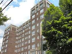 McCallum Manor |
May 9, 1985 (#85001000) |
6653 McCallum Avenue 40°02′43″N 75°11′29″W |
Mount Airy | |
| 42 | Thomas Meehan School |  Thomas Meehan School |
November 18, 1988 (#88002312) |
5347–5353 Pulaski Street 40°01′39″N 75°10′30″W |
Germantown | |
| 43 | Mennonite Meetinghouse |  Mennonite Meetinghouse |
July 23, 1973 (#73001663) |
6119 Germantown Avenue 40°02′28″N 75°10′45″W |
Morton | |
| 44 | Thomas Mifflin School | 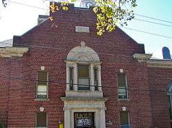 Thomas Mifflin School |
November 18, 1988 (#88002301) |
3500 Midvale Avenue 40°00′49″N 75°11′29″W |
East Falls | |
| 45 | The Monastery | 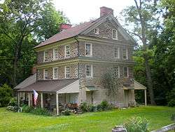 The Monastery |
March 16, 1972 (#72001164) |
Kitchen's Lane at Wissahickon Creek 40°02′10″N 75°12′13″W |
Fairmount Park | |
| 46 | Mt. Airy Station |  Mt. Airy Station |
September 22, 1977 (#77001186) |
119 East Gowen Avenue 40°03′55″N 75°11′28″W |
Mount Airy | |
| 47 | Nugent Home for Baptists | 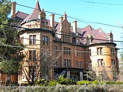 Nugent Home for Baptists |
August 30, 2006 (#06000746) |
221 West Johnson Street 40°02′33″N 75°11′11″W |
Mount Airy | |
| 48 | Violet Oakley Studio | 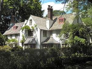 Violet Oakley Studio |
September 13, 1977 (#77001188) |
627 St. George's Road 40°03′12″N 75°12′19″W |
Mount Airy | |
| 49 | Oaks Cloister | 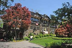 Oaks Cloister |
April 22, 2019 (#100003636) |
5829 Wissahickon Ave & 3 Lehman Ln. 40°02′00″N 75°10′29″W |
Germantown | |
| 50 | Old Germantown Academy and Headmasters' Houses | 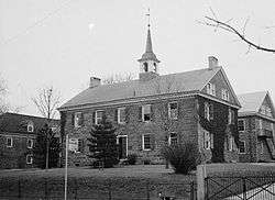 Old Germantown Academy and Headmasters' Houses |
January 13, 1972 (#72001168) |
Schoolhouse Lane and Greene Street 40°02′00″N 75°10′29″W |
Germantown | |
| 51 | Pennsylvania Institute for the Deaf and Dumb | 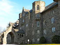 Pennsylvania Institute for the Deaf and Dumb |
May 9, 1985 (#85000999) |
7500 Germantown Ave. 40°03′49″N 75°11′47″W |
Mount Airy | |
| 52 | Presser Home for Retired Music Teachers | 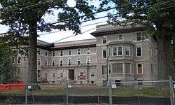 Presser Home for Retired Music Teachers |
November 8, 2006 (#06001006) |
101–121 W. Johnson St. 40°02′37″N 75°11′06″W |
Mount Airy | |
| 53 | Ridge Avenue Bridge in Philadelphia | 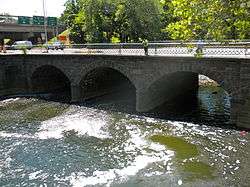 Ridge Avenue Bridge in Philadelphia |
June 22, 1988 (#88000852) |
Ridge Avenue over the Wissahickon Creek 40°00′54″N 75°12′24″W |
Wissahickon | |
| 54 | RittenhouseTown Historic District | .jpg) RittenhouseTown Historic District |
April 27, 1992 (#92001878) |
206–210 Lincoln Drive 40°01′43″N 75°11′28″W |
Fairmount Park | |
| 55 | Theodore Roosevelt Junior High School | 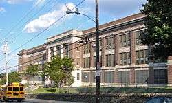 Theodore Roosevelt Junior High School |
November 18, 1988 (#88002317) |
430 East Washington Lane 40°02′54″N 75°10′31″W |
Morton | |
| 56 | St. Peter's Episcopal Church of Germantown | 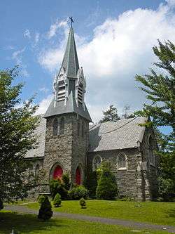 St. Peter's Episcopal Church of Germantown |
September 5, 1985 (#85001960) |
6000 Wayne Avenue 40°02′23″N 75°11′01″W |
Germantown | |
| 57 | Charles Schaeffer School | 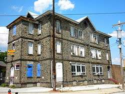 Charles Schaeffer School |
December 4, 1986 (#86003327) |
Germantown Avenue and Abbottsford Road 40°01′37″N 75°09′37″W |
Germantown | |
| 58 | Edward B. Seymour House | 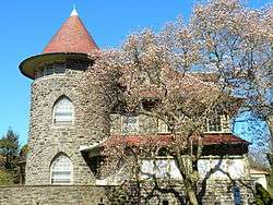 Edward B. Seymour House |
November 5, 1987 (#87001945) |
260 West Johnson Street 40°02′28″N 75°11′13″W |
Mount Airy | |
| 59 | William C. Sharpless House | 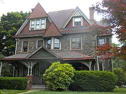 William C. Sharpless House |
December 29, 1983 (#83004249) |
5446 Wayne Avenue 40°01′47″N 75°10′34″W |
Germantown | |
| 60 | Smyser and English Pharmacy |  Smyser and English Pharmacy |
February 20, 2002 (#02000071) |
245–247 West Chelten Avenue 40°01′50″N 75°10′49″W |
Germantown | |
| 61 | Thomas Mill Covered Bridge | %2C_Philadelphia_(Philadelphia_County%2C_Pennsylvania).jpg) Thomas Mill Covered Bridge |
December 1, 1980 (#80003621) |
Thomas Mill Road 40°04′19″N 75°13′32″W |
Fairmount Park | |
| 62 | Tulpehocken Station Historic District | 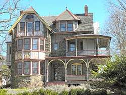 Tulpehocken Station Historic District |
November 26, 1985 (#85003564) |
Roughly bounded by McCallum Street, West Walnut Lane, Penn Central railroad tracks, and West Tulpehocken Street 40°02′17″N 75°10′58″W |
Germantown | |
| 63 | Upper Roxborough Historic District | 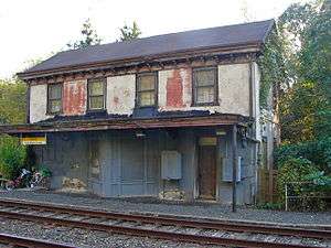 Upper Roxborough Historic District |
May 2, 2001 (#01000463) |
Roughly bounded by Shawmont Avenue, Hagy's Mill Road, and the Schuylkill River 40°03′24″N 75°14′44″W |
Roxborough | Extends into Montgomery County |
| 64 | Upsala | 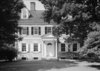 Upsala |
January 13, 1972 (#72001174) |
6430 Germantown Avenue 40°02′48″N 75°10′59″W |
Mount Airy | |
| 65 | Sally Watson House | 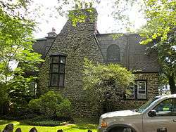 Sally Watson House |
March 10, 1982 (#82003818) |
5128 Wayne Avenue 40°01′35″N 75°10′12″W |
Germantown | |
| 66 | Wayne Junction Historic District | 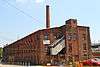 Wayne Junction Historic District |
April 16, 2012 (#12000223) |
Roughly bounded by W. Berkley St., Roberts, Germantown, & Wayne Aves. 40°01′19″N 75°09′45″W |
Germantown | Factory buildings surrounding the Wayne Junction station |
| 67 | John Wilde and Brother, Inc | 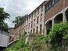 John Wilde and Brother, Inc |
April 30, 2013 (#13000258) |
3737 Main Street 40°01′00″N 75°12′43″W |
Manayunk | |
| 68 | Wissahickon |  Wissahickon |
November 25, 1983 (#83004257) |
Schuyler and Queen Streets 40°01′22″N 75°10′36″W |
East Falls | |
| 69 | Wissahickon Inn | 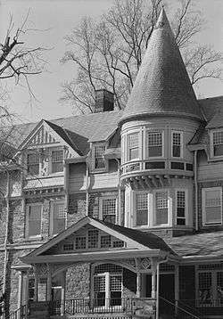 Wissahickon Inn |
December 6, 1979 (#79002333) |
500 West Willow Grove Avenue 40°03′44″N 75°12′31″W |
Chestnut Hill | |
| 70 | Wissahickon Memorial Bridge |  Wissahickon Memorial Bridge |
June 22, 1988 (#88000807) |
Henry Avenue over Wissahickon Drive 40°01′27″N 75°11′44″W |
Fairmount Park | |
| 71 | Woman's Medical College of Pennsylvania | 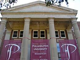 Woman's Medical College of Pennsylvania |
November 26, 2008 (#08000785) |
3300 Henry Ave. 40°00′42″N 75°11′03″W |
East Falls | |
| 72 | Wyck House | 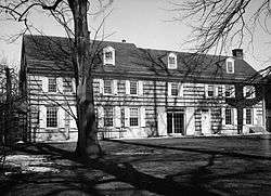 Wyck House |
October 26, 1971 (#71000736) |
6026 Germantown Avenue 40°02′24″N 75°10′43″W |
Germantown | |
| 73 | YMCA of Germantown | 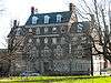 YMCA of Germantown |
November 14, 1991 (#91001709) |
5722 Greene Street 40°02′04″N 75°10′39″W |
Germantown |
See also
| Wikimedia Commons has media related to National Register of Historic Places in Northwest Philadelphia. |
- List of National Historic Landmarks in Philadelphia
- National Register of Historic Places listings in Philadelphia, Pennsylvania
References
- The latitude and longitude information provided in this table was derived originally from the National Register Information System, which has been found to be fairly accurate for about 99% of listings. Some locations in this table may have been corrected to current GPS standards.
- Numbers represent an ordering by significant words. Various colorings, defined here, differentiate National Historic Landmarks and historic districts from other NRHP buildings, structures, sites or objects.
- The eight-digit number below each date is the number assigned to each location in the National Register Information System database, which can be viewed by clicking the number.
- "The Political and Community Service Boundaries of Philadelphia" (PDF). Philadelphia City Planning Commission. June 2004. Retrieved June 22, 2013.
- Skyscraperpage.com
| Topics |  | |
|---|---|---|
| Lists by county |
| |
| Lists by city |
| |
| Other lists | ||
| ||