National Register of Historic Places listings in Crawford County, Pennsylvania
This is a list of the National Register of Historic Places listings in Crawford County, Pennsylvania.

Location of Crawford County in Pennsylvania
This is intended to be a complete list of the properties and districts on the National Register of Historic Places in Crawford County, Pennsylvania, United States. The locations of National Register properties and districts for which the latitude and longitude coordinates are included below, may be seen in a map.[1]
There are 19 properties and districts listed on the National Register in the county.
- This National Park Service list is complete through NPS recent listings posted August 14, 2020.[2]
Current listings
| [3] | Name on the Register | Image | Date listed[4] | Location | City or town | Description |
|---|---|---|---|---|---|---|
| 1 | Baldwin-Reynolds House | Baldwin-Reynolds House |
December 30, 1974 (#74001777) |
Terrace Street 41°38′52″N 80°09′07″W |
Meadville | |
| 2 | Bentley Hall | 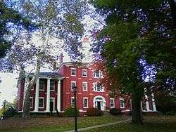 Bentley Hall |
May 6, 1977 (#77001156) |
Allegheny College campus 41°38′55″N 80°08′51″W |
Meadville | |
| 3 | Bridge in East Fallowfield Township |  Bridge in East Fallowfield Township |
June 22, 1988 (#88000825) |
Legislative Route 20012 over Unger Run 41°32′06″N 80°20′12″W |
East Fallowfield Township | Replaced |
| 4 | Bridge in Oil Creek Township |  Bridge in Oil Creek Township |
June 22, 1988 (#88000833) |
State Route 2020 over Oil Creek 41°37′45″N 79°42′10″W |
Oil Creek Township | Removed from site.[5] |
| 5 | Bridge in Rockdale Township |  Bridge in Rockdale Township |
June 22, 1988 (#88000829) |
Legislative Route 20076 over French Creek 41°48′38″N 79°59′02″W |
Rockdale Township | Replaced |
| 6 | Bridge in West Mead Township | 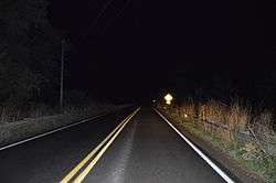 Bridge in West Mead Township |
June 22, 1988 (#88000827) |
Legislative Route 20027 over French Creek 41°35′21″N 80°09′02″W |
West Mead Township | Replaced |
| 7 | John Brown Tannery Site | 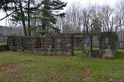 John Brown Tannery Site |
December 14, 1978 (#78002383) |
500 feet south of the junction of Pennsylvania Route 77 and John Brown Road[6] 41°43′09″N 79°57′04″W |
Richmond Township | Only the foundation remains after a fire in 1907 |
| 8 | Cambridge Springs Bridge | 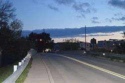 Cambridge Springs Bridge |
June 22, 1988 (#88000824) |
Legislative Route 84 spur B over French Creek 41°48′23″N 80°03′41″W |
Cambridge Springs | Replaced |
| 9 | Independent Congregational Church | 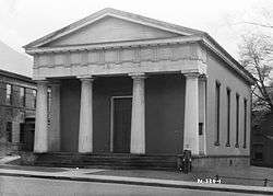 Independent Congregational Church |
March 8, 1978 (#78002381) |
346 Chestnut Street 41°38′14″N 80°09′01″W |
Meadville | |
| 10 | Amos Kelly House | 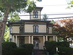 Amos Kelly House |
July 23, 1980 (#80003477) |
325 South Main Street 41°48′06″N 80°03′32″W |
Cambridge Springs | |
| 11 | Meadville Downtown Historic District | 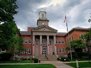 Meadville Downtown Historic District |
October 2, 1984 (#84000023) |
Roughly bounded by Chancery Lane, Mulberry, Walnut and Chestnut Streets 41°38′20″N 80°09′04″W |
Meadville | |
| 12 | Dr. J.R. Mosier Office | 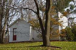 Dr. J.R. Mosier Office |
June 13, 1976 (#77001157) |
Terrace Street 41°38′47″N 80°09′08″W |
Meadville | |
| 13 | Riverside Hotel | 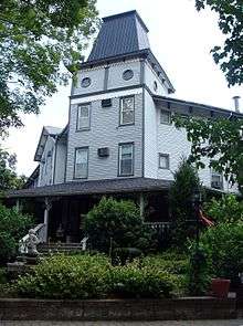 Riverside Hotel |
December 13, 1978 (#78002380) |
1 Fountain Street 41°48′21″N 80°03′12″W |
Cambridge Springs | Destroyed by fire, May 2nd, 2017 |
| 14 | Roueche House | 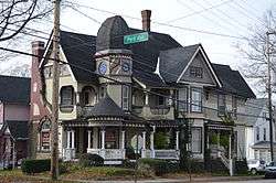 Roueche House |
March 4, 1982 (#82003784) |
762 Park Avenue 41°38′33″N 80°09′04″W |
Meadville | |
| 15 | Ruter Hall | 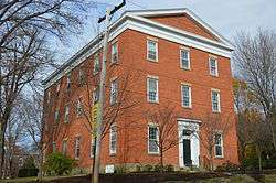 Ruter Hall |
September 18, 1978 (#78002382) |
North Main Street on Allegheny College campus 41°38′54″N 80°08′46″W |
Meadville | |
| 16 | Edward Saeger House | 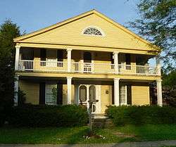 Edward Saeger House |
August 22, 1980 (#80003479) |
375 Main Street 41°43′07″N 80°08′53″W |
Saegertown | |
| 17 | Judge Henry Shippen House | 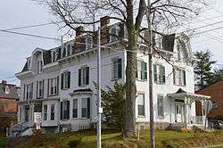 Judge Henry Shippen House |
June 6, 1984 (#84003339) |
403 Chestnut Street 41°38′14″N 80°08′52″W |
Meadville | |
| 18 | Titusville City Hall | 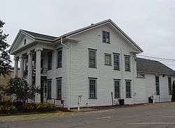 Titusville City Hall |
March 31, 1975 (#75001635) |
107 North Franklin Street 41°37′39″N 79°40′25″W |
Titusville | |
| 19 | Titusville Historic District | .jpg) Titusville Historic District |
January 31, 1985 (#85000178) |
Roughly bounded by Petroleum, Spruce, Franklin, Perry, Monroe, Main and Spring Streets 41°37′47″N 79°40′26″W |
Titusville |
Former listings
| [3] | Name on the Register | Image | Date listed | Date removed | Location | City or town | Summary |
|---|---|---|---|---|---|---|---|
| 1 | Shadeland | May 6, 1983 (#83002230) | August 7, 1992 | North of Springboro on Pennsylvania Route 18 |
Springboro | ||
| 2 | Dr. James White House | July 24, 1980 (#80003478) | July 21, 2004 | Junction of U.S. Route 322 and Pennsylvania Route 285 |
Hartstown |
gollark: It's not called a subway locally.
gollark: On the plus side, if exams are really cancelled, I won't have to do English Literature/Language exams, which I hate so very much.
gollark: Oh, and my city's subway system is running a reduced service, but for some reason the train network is running exactly the same as usual with probably a fifth of the usual passengers on my line.
gollark: My school is planning to try online learning or something, which I am sure will go badly.
gollark: ```What will happen about exams?In England and Wales, all exams in May and June have been cancelled, including GCSEs, A-levels and primary school national curriculum tests known as Sats.Mr Williamson told the Commons on Wednesday: "I can confirm we will not go ahead with assessments or exams and that we will not be publishing performance tables for this academic year."We will work with the sector and [the exams watchdog] Ofqual to ensure children get the qualifications that they need."```- from the BBC
See also
| Wikimedia Commons has media related to National Register of Historic Places in Crawford County, Pennsylvania. |
References
- The latitude and longitude information provided in this table was derived originally from the National Register Information System, which has been found to be fairly accurate for about 99% of listings. Some locations in this table may have been corrected to current GPS standards.
- "National Register of Historic Places: Weekly List Actions". National Park Service, United States Department of the Interior. Retrieved on August 14, 2020.
- Numbers represent an ordering by significant words. Various colorings, defined here, differentiate National Historic Landmarks and historic districts from other NRHP buildings, structures, sites or objects.
- The eight-digit number below each date is the number assigned to each location in the National Register Information System database, which can be viewed by clicking the number.
- Pennsylvania Bulletin, Doc. No. 98-1762.
- Location derived from its NRHP nomination form; the NRIS lists the site as "Address Restricted"
| Topics | 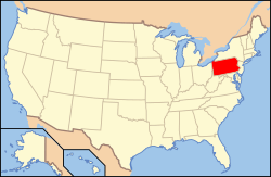 | |
|---|---|---|
| Lists by county |
| |
| Lists by city |
| |
| Other lists | ||
| ||
Municipalities and communities of Crawford County, Pennsylvania, United States | ||
|---|---|---|
| Cities | | |
| Boroughs | ||
| Townships |
| |
| CDPs | ||
| Unincorporated communities | ||
This article is issued from Wikipedia. The text is licensed under Creative Commons - Attribution - Sharealike. Additional terms may apply for the media files.