National Register of Historic Places listings in Southwest Philadelphia
This is a list of the National Register of Historic Places listings in Southwest Philadelphia.
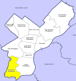
Location of Southwest Philadelphia in Philadelphia
This is intended to be a complete list of the properties and districts on the National Register of Historic Places in Southwest Philadelphia, Pennsylvania, United States. The locations of National Register properties and districts for which the latitude and longitude coordinates are included below may be seen in a Google map.[1]
There are 562 properties and districts listed on the National Register in Philadelphia, including 67 National Historic Landmarks. Southwest Philadelphia includes 12 of these properties and districts, including 2 National Historic Landmarks; the city's remaining properties and districts are listed elsewhere.
Current listings
| [2] | Name on the Register | Image | Date listed[3] | Location | Neighborhood | Description |
|---|---|---|---|---|---|---|
| 1 | John Bartram High School | 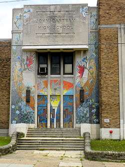 John Bartram High School |
December 4, 1986 (#86003263) |
67th and Elmwood Streets 39°55′16″N 75°13′58″W |
Middle Southwest | |
| 2 | John Bartram House | 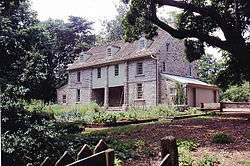 John Bartram House |
October 15, 1966 (#66000676) |
54th Street and Eastwick Avenue 39°55′54″N 75°12′43″W |
Bartram Village | |
| 3 | Joseph W. Catharine School | 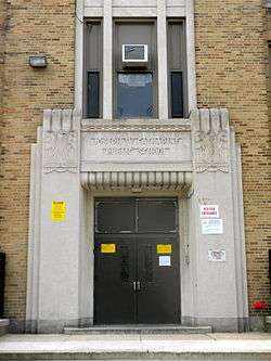 Joseph W. Catharine School |
November 18, 1988 (#88002253) |
6600 Chester Avenue 39°55′39″N 75°14′23″W |
Mount Moriah | |
| 4 | Fort Mifflin | 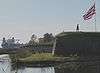 Fort Mifflin |
August 29, 1970 (#70000554) |
Fort Mifflin and Hog Island Roads[4] 39°52′31″N 75°12′47″W |
Philadelphia International Airport | |
| 5 | Fort Mifflin Hospital | 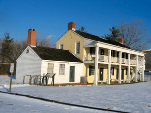 Fort Mifflin Hospital |
September 29, 1969 (#69000157) |
Fort Mifflin and Hog Island Road[4] 39°52′35″N 75°12′41″W |
Philadelphia International Airport | |
| 6 | S. Weir Mitchell School | 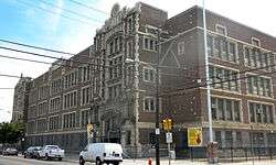 S. Weir Mitchell School |
December 4, 1986 (#86003309) |
56th and Kingsessing Street 39°56′12″N 75°13′25″W |
Kingsessing | |
| 7 | John M. Patterson School | 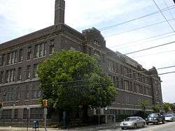 John M. Patterson School |
November 18, 1988 (#88002305) |
7001 Buist Avenue 39°54′58″N 75°14′12″W |
Penrose | |
| 8 | Thomas Buchanan Read School | 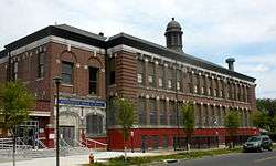 Thomas Buchanan Read School |
December 4, 1986 (#86003325) |
78th Street and Buist Avenue 39°54′23″N 75°14′52″W |
Elmwood Park | |
| 9 | Regent-Rennoc Court | 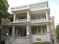 Regent-Rennoc Court |
September 12, 1985 (#85002292) |
5100 block of Regent Street and 1311–1327 South 52nd Street 39°56′29″N 75°13′09″W |
Southwest Schuylkill | |
| 10 | Anna Howard Shaw Junior High School | 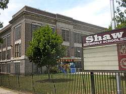 Anna Howard Shaw Junior High School |
November 18, 1988 (#88002321) |
5401 Warrington Street 39°56′30″N 75°13′35″W |
Southwest Schuylkill | |
| 11 | William J. Tilden Junior High School | 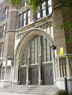 William J. Tilden Junior High School |
December 1, 1986 (#86003337) |
66th Street and Elmwood Avenue 39°55′18″N 75°13′56″W |
Paschall | |
| 12 | George Wolf School | 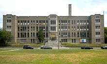 George Wolf School |
November 18, 1988 (#88002243) |
8100 Lyons Avenue 39°53′55″N 75°14′46″W |
Hedgerow |
gollark: Rude.
gollark: Do you count GTech™'s assassinational bees (they remain on standby, to clarify) as "people"?
gollark: It's fine if I just do one line, but if I have to move the "cursor" down a line it is liable to become misaligned and possibly overlap the previous line.
gollark: I can actually *write* without looking to some extent.
gollark: That may be our first non-demonstrational use of <:snub_dodecadodecahedron:800390497431715901>.
See also
| Wikimedia Commons has media related to National Register of Historic Places in Southwest Philadelphia. |
- List of National Historic Landmarks in Philadelphia
- National Register of Historic Places listings in Philadelphia, Pennsylvania
References
- The latitude and longitude information provided in this table was derived originally from the National Register Information System, which has been found to be fairly accurate for about 99% of listings. Some locations in this table may have been corrected to current GPS standards.
- Numbers represent an ordering by significant words. Various colorings, defined here, differentiate National Historic Landmarks and historic districts from other NRHP buildings, structures, sites or objects.
- The eight-digit number below each date is the number assigned to each location in the National Register Information System database, which can be viewed by clicking the number.
- Location is derived from Fort Mifflin website; the NRIS lists the property at the intersection of Penrose Ferry Rd. with the nonexistent Marina Rd.
| Topics | 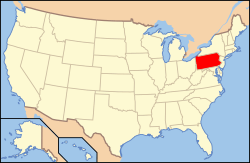 | |
|---|---|---|
| Lists by county |
| |
| Lists by city |
| |
| Other lists | ||
| ||
This article is issued from Wikipedia. The text is licensed under Creative Commons - Attribution - Sharealike. Additional terms may apply for the media files.